Katingan Regency
Katingan Regency (Indonesian: Kabupaten Katingan) is one of the thirteen regencies which comprise the Central Kalimantan Province on the island of Kalimantan (Borneo), Indonesia. It was created on 10 April 2002 from what were previously the eastern districts of East Kotawaringin Regency. The town of Kasongan is the capital of the Regency, which covers an area of 20,382.26 km2. The population of Katingan Regency was 146,439 at the 2010 Census[2] and 162,222 at the 2020 Census;[3] the official estimate as at mid 2023 was 169,355 (comprising 87,722 males and 81,633 females).[1]
Katingan Regency
Kabupaten Katingan | |
|---|---|
 Coat of arms | |
| Motto(s): "Penyang Hinje Simpei" Ngaju language: "Harmonious & Peaceful Living for Collective Prosperity" | |
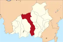 Location within Central Kalimantan | |
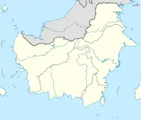 Katingan Regency Location in Kalimantan and Indonesia 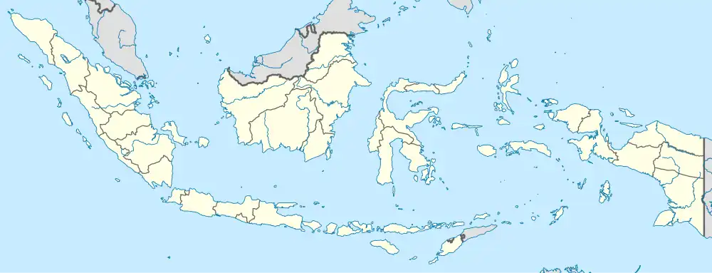 Katingan Regency Katingan Regency (Indonesia) | |
| Coordinates: 2.0667°S 113.4000°E | |
| Country | Indonesia |
| Region | Kalimantan |
| Province | Central Kalimantan |
| Capital | Kasongan |
| Government | |
| • Regent | Sakarias |
| • Vice Regent | vacant |
| Area | |
| • Total | 7,869.63 sq mi (20,382.26 km2) |
| Population (mid 2023 estimates) | |
| • Total | 169,355 |
| • Density | 22/sq mi (8.3/km2) |
| [1] | |
| Time zone | UTC+7 (Western Indonesia Time) |
| Area code | (+62) 536 |
| Website | katingankab |
Administrative Districts
Katingan Regency consists of thirteen districts (kecamatan), tabulated below with their areas and population totals from the 2010 Census[2] and the 2020 Census,[3] together with the official estimates as at mid 2023.[1] They are grouped below for convenience into a southern sector and a northern sector (without any administrative significance). The table also includes the locations of the district administrative centres, the number of administrative villages in each district (a total of 154 rural desa and 7 urban kelurahan), and its postal codes.
| Kode Wilayah | Name of District (kecamatan) | Area in km2 | Pop'n Census 2010 | Pop'n Census 2020 | Pop'n Estimate mid 2023 | Admin centre | No. of villages | Post codes |
|---|---|---|---|---|---|---|---|---|
| 62.06.10 | Katingan Kuala (a) | 1,440 | 19,488 | 18,654 | 18,740 | Pagatan | 16 (b) | 74463 |
| 62.06.09 | Mendawai (c) | 1,826 | 3,810 | 4,165 | 4,304 | Mendawai | 7 | 74464 |
| 62.06.01 | Kamipang | 2,793 | 6,269 | 7,192 | 7,520 | Baun Bango | 9 | 74462 |
| 62.06.11 | Tasik Payawan | 804 | 6,124 | 7,966 | 8,616 | Petak Bahandang | 8 | 74461 |
| 62.06.02 | Katingan Hilir (Lower Katingan) | 663 | 30,688 | 39,349 | 41,961 | Kasongan | 8 (d) | 74413 |
| Totals for southern sector | 7,526 | 66,379 | 77,326 | 81,141 | 48 | |||
| 62.06.03 | Tewang Sangalang Garing | 568 | 11,513 | 13,098 | 13,663 | Pendahara | 10 (e) | 74452 |
| 62.06.04 | Pulau Malan | 805 | 8,544 | 10,542 | 11,227 | Buntut Bali | 14 | 74453 |
| 62.06.05 | Katingan Tengah (Central Katingan) | 1,089 | 28,281 | 29,276 | 29,707 | Tumbang Samba | 16 (e) | 74454 |
| 62.06.06 | Sanaman Mantikei | 1,874 | 9,578 | 10,936 | 11,422 | Tumbang Kaman | 14 | 74451 |
| 62.06.12 | Petak Malai | 1,156 | 3,751 | 3,630 | 3,658 | Tumbang Baroi | 7 | 74455 |
| 62.06.07 | Marikit | 2,178 | 6,619 | 6,818 | 6,924 | Tumbang Hiran | 18 | 74456 |
| 62.06.08 | Katingan Hulu (Upper Katingan) | 1,775 | 8,050 | 8,247 | 8,362 | Tumbang Sanamang | 23 (e) | 74458 |
| 62.06.13 | Bukit Raya | 829 | 3,724 | 3,226 | 3,251 | Tumbang Kajamei | 11 | 74457 |
| Totals for northern sector | 10,274 | 80,060 | 85,773 | 88,214 | 113 | |||
| Totals for Regency | 20,382 | 146,439 | 162,222 | 169,355 | Kasongan | 161 |
Note: (a) including 9 small offshore or riverine islands. (b) including 2 kelurahan (Pagatan Hilir and Pagatan Hulu).
(c) including 10 small riverine islands. (d) including 2 kelurahan (Kasongan Baru and Kasongan Lama). (e) includes one kelurahan (the district admin centre).
References
- Badan Pusat Statistik, Jakarta, 28 February 2024, Kabupaten Katingan Dalam Angka 2024 (Katalog-BPS 1102001.6206)
- Biro Pusat Statistik, Jakarta, 2011.
- Badan Pusat Statistik, Jakarta, 2021.
Capital: Palangka Raya | ||
| Regencies |
| |
| Cities | ||