Kiefersfelden
Kiefersfelden is a municipality with about 7000 inhabitants located in the district of Rosenheim in Bavaria, Germany, on the border with Tyrol, Austria.
Kiefersfelden | |
|---|---|
 Church of the Holy Cross in Kiefersfelden with Kaiser Mountains in the background | |
 Coat of arms | |
Location of Kiefersfelden within Rosenheim district 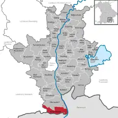 | |
 Kiefersfelden 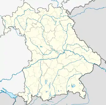 Kiefersfelden | |
| Coordinates: 47°37′N 12°11′E | |
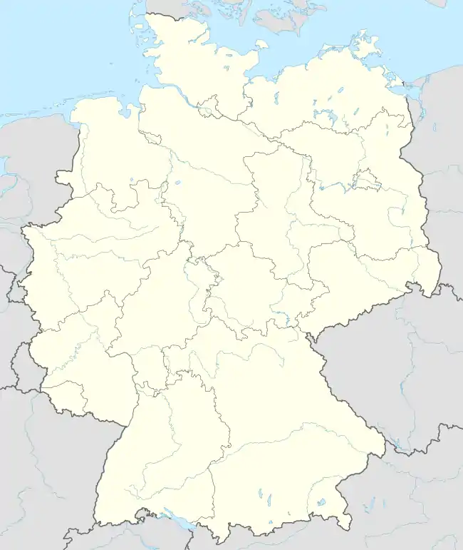
| Country | Germany |
| State | Bavaria |
| Admin. region | Oberbayern |
| District | Rosenheim |
| Government | |
| • Mayor (2020–26) | Hajo Gruber[1] |
| Area | |
| • Total | 36.72 km2 (14.18 sq mi) |
| Elevation | 490 m (1,610 ft) |
| Population (2022-12-31)[2] | |
| • Total | 6,854 |
| • Density | 190/km2 (480/sq mi) |
| Time zone | UTC+01:00 (CET) |
| • Summer (DST) | UTC+02:00 (CEST) |
| Postal codes | 83088 |
| Dialling codes | 08033 |
| Vehicle registration | RO |
| Website | www.kiefersfelden.de |
Geography
Geographical location
Kiefersfelden is located in the foothills of the Alps, in the Bavarian part of the Unterinntal, at an altitude of about 484 m (1,587.93 ft) ASL.
The local rivers are the Inn and the Kieferbach.
Communities[3]
- Althäusl (Einöde)
- Au (Weiler)
- Breitenau (Weiler)
- Gfallermühle (Dorf)
- Guggenau (Einöde)
- Hödenau (Weiler)
- Kiefersfelden (Pfarrdorf)
- Kohlstatt (Dorf)Köln (Weiler)
- Mühlau (Weiler)
- Mühlbach (Dorf)
- Nußlberg (Kirchdorf)
- Rechenau (Einöde)
- Ried (Weiler)
- Schöffau (Dorf)
- Troyer (Einöde)
- Wiesen (Weiler)
- Wildgrub (Einöde)
Nearby places
- Bayrischzell
- Ebbs in Tyrol
- Kufstein in Tyrol
- Oberaudorf
- Thiersee in Tyrol
Climate
A typical weather feature is the Föhn/Alpine foehn, which ensures periods of fine weather, which, in addition to sudden increases in temperature, is responsible for good visibility, but for headaches in sensitive people. The average duration of snow cover between 1951/52 and 1995/96 was 92 days (long-term behavior of snow cover in Baden-Württemberg and Bavaria, KLIWA, 2005).[4]
The current weather in Kiefersfelden is recorded at the Kiefersfelden-Gach weather station (part of the German Weather Service measuring network) at 518 m above sea level.[5]
References
- Liste der ersten Bürgermeister/Oberbürgermeister in kreisangehörigen Gemeinden, Bayerisches Landesamt für Statistik, 15 July 2021.
- Genesis Online-Datenbank des Bayerischen Landesamtes für Statistik Tabelle 12411-003r Fortschreibung des Bevölkerungsstandes: Gemeinden, Stichtag (Einwohnerzahlen auf Grundlage des Zensus 2011) (Hilfe dazu).
- "Ortsteile - Gemeinde Kiefersfelden, Landkreis Rosenheim - BayernPortal". www.bayernportal.de (in German). Retrieved 2024-04-17.
- "Wayback Machine" (PDF). web.archive.org. Retrieved 2024-04-17.
- "Wetter und Klima - Deutscher Wetterdienst - Startseite". www.dwd.de (in German). Retrieved 2024-04-17.
Towns and municipalities in Rosenheim district | ||
|---|---|---|
| ||