Láz (Třebíč District)
Láz is a municipality and village in Třebíč District in the Vysočina Region of the Czech Republic. It has about 300 inhabitants.
Láz | |
|---|---|
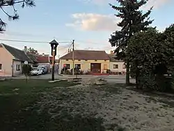 Centre of Láz | |
 Flag  Coat of arms | |
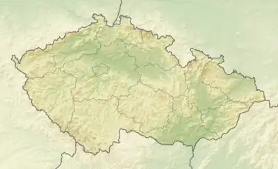 Láz Location in the Czech Republic | |
| Coordinates: 49°0′44″N 15°47′6″E | |
| Country | |
| Region | Vysočina |
| District | Třebíč |
| First mentioned | 1498 |
| Area | |
| • Total | 4.68 km2 (1.81 sq mi) |
| Elevation | 430 m (1,410 ft) |
| Population (2023-01-01)[1] | |
| • Total | 297 |
| • Density | 63/km2 (160/sq mi) |
| Time zone | UTC+1 (CET) |
| • Summer (DST) | UTC+2 (CEST) |
| Postal code | 675 41 |
| Website | www |
Etymology
The word láz originally meant a field or meadow created by felling or burning a forest, or a field next to a forest.[2]
Geography
Láz is located about 23 kilometres (14 mi) south of Třebíč and 45 km (28 mi) south of Jihlava. It lies in an agricultural landscape in the Jevišovice Uplands. Hájský Pond is situated in the eastern part of the municipality.
History
The first written mention of Láz is from 1498, when it was property of King Vladislaus II. In 1510, the village was annexed to the Bítov estate, later it became part of the Nové Syrovice estate.[2]
Demographics
|
|
| ||||||||||||||||||||||||||||||||||||||||||||||||||||||
| Source: Censuses[3][4] | ||||||||||||||||||||||||||||||||||||||||||||||||||||||||
Transport
There are no railways or major roads passing through the municipality.
Sights
The most valuable landmark is a wooden belfry from the early 19th century.[5]
References
- "Population of Municipalities – 1 January 2023". Czech Statistical Office. 2023-05-23.
- "O obci" (in Czech). Obec Láz. Retrieved 2023-06-17.
- "Historický lexikon obcí České republiky 1869–2011 – Okres Třebíč" (in Czech). Czech Statistical Office. 2015-12-21. pp. 7–8.
- "Population Census 2021: Population by sex". Public Database. Czech Statistical Office. 2021-03-27.
- "Zvonička" (in Czech). National Heritage Institute. Retrieved 2022-09-19.