La Souche
La Souche (French pronunciation: [la suʃ]; Occitan: La Socha) is a commune in the Ardèche department in southern France.
La Souche | |
|---|---|
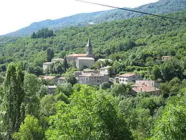 The church and surrounding buildings in La Souche | |
Location of La Souche | |
 La Souche  La Souche | |
| Coordinates: 44°37′48″N 4°11′53″E | |
| Country | France |
| Region | Auvergne-Rhône-Alpes |
| Department | Ardèche |
| Arrondissement | Largentière |
| Canton | Haute-Ardèche |
| Government | |
| • Mayor (2020–2026) | Jacques Geiguer[1] |
| Area 1 | 31.52 km2 (12.17 sq mi) |
| Population (2021)[2] | 380 |
| • Density | 12/km2 (31/sq mi) |
| Time zone | UTC+01:00 (CET) |
| • Summer (DST) | UTC+02:00 (CEST) |
| INSEE/Postal code | 07315 /07380 |
| Elevation | 463–1,498 m (1,519–4,915 ft) (avg. 530 m or 1,740 ft) |
| 1 French Land Register data, which excludes lakes, ponds, glaciers > 1 km2 (0.386 sq mi or 247 acres) and river estuaries. | |
Geography
The commune is located in the Parc naturel régional des Monts d'Ardèche 15 km (9.3 mi) east of Aubenas; its main hamlets are located on the right bank of the river Lignon, which rises in the commune's western part, then flows east through the commune.
Population
| Year | Pop. | ±% |
|---|---|---|
| 1962 | 346 | — |
| 1968 | 385 | +11.3% |
| 1975 | 334 | −13.2% |
| 1982 | 312 | −6.6% |
| 1990 | 288 | −7.7% |
| 1999 | 290 | +0.7% |
| 2006 | 335 | +15.5% |
| 2011 | 356 | +6.3% |
See also
- Communes of the Ardèche department
References
- "Répertoire national des élus: les maires". data.gouv.fr, Plateforme ouverte des données publiques françaises (in French). 9 August 2021.
- "Populations légales 2021". The National Institute of Statistics and Economic Studies. 28 December 2023.
Wikimedia Commons has media related to La Souche.
This article is issued from Wikipedia. The text is licensed under Creative Commons - Attribution - Sharealike. Additional terms may apply for the media files.