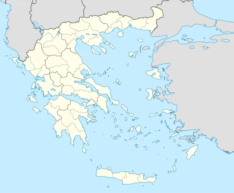
Livadi
Livadi or Leivadi (Greek: Λ[ε]ιβάδι) is a village and a former municipality in the Larissa regional unit, Thessaly, Greece. Since the 2011 local government reform it is part of the municipality Elassona, of which it is a municipal unit.[2]
Livadi
Λιβάδι | |
|---|---|
 | |
 Livadi Location within the regional unit 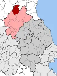 | |
| Coordinates: 40°7.6′N 22°9.45′E | |
| Country | Greece |
| Administrative region | Thessaly |
| Regional unit | Larissa |
| Municipality | Elassona |
| Area | |
| • Municipal unit | 158.273 km2 (61.110 sq mi) |
| • Community | 140.90 km2 (54.40 sq mi) |
| Elevation | 1,160 m (3,810 ft) |
| Population (2021)[1] | |
| • Municipal unit | 2,413 |
| • Municipal unit density | 15/km2 (39/sq mi) |
| • Community | 2,079 |
| • Community density | 15/km2 (38/sq mi) |
| Time zone | UTC+2 (EET) |
| • Summer (DST) | UTC+3 (EEST) |
| Postal code | 400 02 |
| Area code(s) | +30-2493 |
| Vehicle registration | ΡΙ |
| Website | www.livadi.gr |
In the Ottoman tahrir defteri of 1521, the settlement is recorded as a village with the name Livadi.[3] The village was founded by Aromanian agricultural and livestock farmers.[4] Before the 2011 local government reform it was an independent municipality.[2] The community of Livadi covers an area of 140.90 km2 while the respective municipal unit 158.273 km2.[5]
Subdivisions
The municipal unit Livadi is subdivided into the following communities:
- Dolichi
- Livadi
Geography
Livadi borders Pieria regional unit to the northeast, and Kozani regional unit to the northwest. Livadi is located west of Pythio and Katerini, NNW of Larissa, north of Elassona and southeast of Kozani.
Population
| Year | Village population | Municipal unit population |
|---|---|---|
| 1991 | 3,164 | - |
| 1991 | 2,882 | - |
| 2001[5] | 2,515 | 2,983 |
| 2011 | 2,244 | 2,674 |
| 2021[1] | 2,079 | 2,413 |
Notable people
- Giorgakis Olympios (1772–1821), fighter in the Greek War of Independence
References
- "Αποτελέσματα Απογραφής Πληθυσμού - Κατοικιών 2021, Μόνιμος Πληθυσμός κατά οικισμό" [Results of the 2021 Population - Housing Census, Permanent population by settlement] (in Greek). Hellenic Statistical Authority. 29 March 2024.
- "ΦΕΚ B 1292/2010, Kallikratis reform municipalities" (in Greek). Government Gazette.
- Ünal, Uğur; Budak, Mustafa; Bayram, Sabahattin; Yıldıztaş, Mümin (2013). Özkılınç, Ahmet; Coşkun, Ali; Sivridağ, Abdullah (eds.). Osmanlı Yer Adları I: Rumeli Eyaleti (1514–1550) (in Turkish). Ankara: Directorate of State Archives. pp. VII–VIII, 42, 540. ISBN 978-975-19-6238-6. p. 540:
Livadi k., Alasonya n., Alasonya kz., Tırhala l.: TD 101/20
- "Λιβάδι". www.elassona.com.gr. Retrieved 2023-02-12.
- "Population & housing census 2001 (incl. area and average elevation)" (PDF) (in Greek). National Statistical Service of Greece. Archived (PDF) from the original on 2015-09-21.