Lordegan
Lordegan (Luri and Persian: لردگان)[lower-alpha 1] is a city in the Central District of Lordegan County, Chaharmahal and Bakhtiari province, Iran, serving as capital of both the county and the district.[5] The city is populated by Lurs.[6]
Lordegan
Persian: لردگان | |
|---|---|
City | |
.JPG.webp) Cheshmeh-ye Beram | |
 Lordegan | |
| Coordinates: 31°30′29″N 50°49′55″E[1] | |
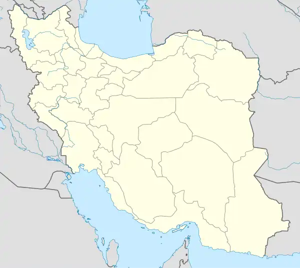
| Country | Iran |
| Province | Chaharmahal and Bakhtiari |
| County | Lordegan |
| District | Central |
| Elevation | 1,764 m (5,787 ft) |
| Population (2016)[3] | |
| • Total | 40,528 |
| Time zone | UTC+3:30 (IRST) |
At the 2006 census, its population was 22,728 in 4,459 households.[7] The following census in 2011 counted 35,276 people in 8,037 households.[8] The census in 2016 showed a population of 40,528 people in 10,482 households.[3]
Climate
| Climate data for Lordegan(1995-2010 normals) | |||||||||||||
|---|---|---|---|---|---|---|---|---|---|---|---|---|---|
| Month | Jan | Feb | Mar | Apr | May | Jun | Jul | Aug | Sep | Oct | Nov | Dec | Year |
| Mean daily maximum °C (°F) | 9.4 (48.9) |
12.7 (54.9) |
17.0 (62.6) |
21.9 (71.4) |
28.3 (82.9) |
34.3 (93.7) |
37.0 (98.6) |
36.8 (98.2) |
32.7 (90.9) |
26.6 (79.9) |
18.2 (64.8) |
12.4 (54.3) |
23.9 (75.1) |
| Daily mean °C (°F) | 3.2 (37.8) |
6.0 (42.8) |
9.6 (49.3) |
14.1 (57.4) |
19.1 (66.4) |
24.2 (75.6) |
27.5 (81.5) |
27.1 (80.8) |
22.7 (72.9) |
17.3 (63.1) |
10.3 (50.5) |
5.7 (42.3) |
15.6 (60.0) |
| Mean daily minimum °C (°F) | −2.9 (26.8) |
−0.8 (30.6) |
2.2 (36.0) |
6.2 (43.2) |
9.9 (49.8) |
14.2 (57.6) |
18.0 (64.4) |
17.5 (63.5) |
12.6 (54.7) |
8.0 (46.4) |
2.5 (36.5) |
−1.0 (30.2) |
7.2 (45.0) |
| Average precipitation mm (inches) | 127.1 (5.00) |
86.5 (3.41) |
86.1 (3.39) |
64.1 (2.52) |
8.1 (0.32) |
0.5 (0.02) |
1.0 (0.04) |
0.3 (0.01) |
1.2 (0.05) |
5.7 (0.22) |
51.6 (2.03) |
122.8 (4.83) |
555 (21.84) |
| Average relative humidity (%) | 66 | 57 | 50 | 49 | 35 | 25 | 24 | 23 | 26 | 33 | 51 | 63 | 42 |
| Average dew point °C (°F) | −3.3 (26.1) |
−3.4 (25.9) |
−1.2 (29.8) |
2.3 (36.1) |
3.0 (37.4) |
3.5 (38.3) |
5.9 (42.6) |
4.6 (40.3) |
1.8 (35.2) |
0.2 (32.4) |
−0.8 (30.6) |
−1.5 (29.3) |
0.9 (33.7) |
| Mean monthly sunshine hours | 194.9 | 202.2 | 235.2 | 244.5 | 316 | 351.8 | 343.3 | 342.9 | 320.5 | 290.4 | 226.5 | 201.4 | 3,269.6 |
| Source: IRIMO(Dew Point 1995-2005)[9] | |||||||||||||
Notes
References
- OpenStreetMap contributors (2 April 2023). "Lordegan, Lordegan County" (Map). OpenStreetMap. Retrieved 2 April 2023.
- "ايستگاه ها - اداره کل هواشناسي استان چهارمحال و بختياري". www.chaharmahalmet.ir.
- "Census of the Islamic Republic of Iran, 1395 (2016)". AMAR (in Persian). The Statistical Center of Iran. p. 14. Archived from the original (Excel) on 24 May 2019. Retrieved 19 December 2022.
- Lordegan can be found at GEOnet Names Server, at this link, by opening the Advanced Search box, entering "-3073209" in the "Unique Feature Id" form, and clicking on "Search Database".
- Habibi, Hassan (21 June 1369). "Approval of the organization and chain of citizenship of the elements and units of the national divisions of Chaharmahal and Bakhtiari province, centered in the city of Shahrekord". Islamic Parliament Research Center (in Persian). Ministry of Interior, Defense Political Commission of the Government Board. Archived from the original on 21 September 2016. Retrieved 2 December 2023.
- "Language distribution: Chahar Mahal va Bakhtiari Province". Iran Atlas. Retrieved 25 March 2021.
- "Census of the Islamic Republic of Iran, 1385 (2006)". AMAR (in Persian). The Statistical Center of Iran. p. 14. Archived from the original (Excel) on 20 September 2011. Retrieved 25 September 2022.
- "Census of the Islamic Republic of Iran, 1390 (2011)". Syracuse University (in Persian). The Statistical Center of Iran. p. 14. Archived from the original (Excel) on 16 January 2023. Retrieved 19 December 2022.
- Archived February 17, 2016, at the Wayback Machine
| Capital | 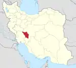 | ||||||||||||||||||||||
|---|---|---|---|---|---|---|---|---|---|---|---|---|---|---|---|---|---|---|---|---|---|---|---|
| Counties and cities |
| ||||||||||||||||||||||
| Landmarks |
| ||||||||||||||||||||||
| populated places |
| ||||||||||||||||||||||
| Capital | |||||||||||||||||||||||||||||||||||||||||||||
|---|---|---|---|---|---|---|---|---|---|---|---|---|---|---|---|---|---|---|---|---|---|---|---|---|---|---|---|---|---|---|---|---|---|---|---|---|---|---|---|---|---|---|---|---|---|
| Districts |
| ||||||||||||||||||||||||||||||||||||||||||||
This article is issued from Wikipedia. The text is licensed under Creative Commons - Attribution - Sharealike. Additional terms may apply for the media files.