Mane, Alpes-de-Haute-Provence
Mane (French pronunciation: [man] ⓘ; Occitan: Mana) is a commune in Alpes-de-Haute-Provence department in southeastern France.
Mane | |
|---|---|
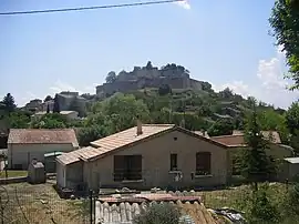 A general view of the village of Mane | |
 Coat of arms | |
Location of Mane | |
 Mane 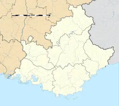 Mane | |
| Coordinates: 43°56′21″N 5°46′06″E | |
| Country | France |
| Region | Provence-Alpes-Côte d'Azur |
| Department | Alpes-de-Haute-Provence |
| Arrondissement | Forcalquier |
| Canton | Reillanne |
| Government | |
| • Mayor (2020–2026) | Jacques Depieds[1] |
| Area 1 | 22 km2 (8 sq mi) |
| Population (2021)[2] | 1,369 |
| • Density | 62/km2 (160/sq mi) |
| Time zone | UTC+01:00 (CET) |
| • Summer (DST) | UTC+02:00 (CEST) |
| INSEE/Postal code | 04111 /04300 |
| Elevation | 386–868 m (1,266–2,848 ft) (avg. 500 m or 1,600 ft) |
| 1 French Land Register data, which excludes lakes, ponds, glaciers > 1 km2 (0.386 sq mi or 247 acres) and river estuaries. | |
It lies near Forcalquier. It was the birthplace of Louis Feuillée and the 18th-century botanist Jean-Paul de Rome d'Ardène. A Minim convent was situated here. The ancient Pont sur Laye is close by the town.
Population
| Year | Pop. | ±% p.a. |
|---|---|---|
| 1968 | 852 | — |
| 1975 | 834 | −0.30% |
| 1982 | 943 | +1.77% |
| 1990 | 1,135 | +2.34% |
| 1999 | 1,169 | +0.33% |
| 2009 | 1,367 | +1.58% |
| 2014 | 1,376 | +0.13% |
| 2020 | 1,349 | −0.33% |
| Source: INSEE[3] | ||
References
- "Répertoire national des élus: les maires". data.gouv.fr, Plateforme ouverte des données publiques françaises (in French). 2 December 2020.
- "Populations légales 2021". The National Institute of Statistics and Economic Studies. 28 December 2023.
- Population en historique depuis 1968, INSEE
Wikimedia Commons has media related to Mane, Alpes-de-Haute-Provence.
This article is issued from Wikipedia. The text is licensed under Creative Commons - Attribution - Sharealike. Additional terms may apply for the media files.