Montmorency-Beaufort
Montmorency-Beaufort (French pronunciation: [mɔ̃mɔʁɑ̃si bofɔʁ]) is a commune in the Aube department in north-central France.
Montmorency-Beaufort | |
|---|---|
.jpg.webp) The church in Montmorency-Beaufort | |
 Coat of arms | |
Location of Montmorency-Beaufort | |
 Montmorency-Beaufort 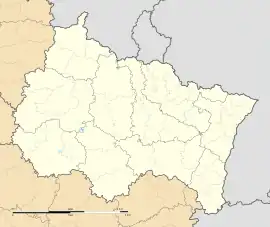 Montmorency-Beaufort | |
| Coordinates: 48°29′14″N 4°33′49″E | |
| Country | France |
| Region | Grand Est |
| Department | Aube |
| Arrondissement | Bar-sur-Aube |
| Canton | Brienne-le-Château |
| Government | |
| • Mayor (2020–2026) | Michel Burr[1] |
| Area 1 | 9.38 km2 (3.62 sq mi) |
| Population (2021)[2] | 148 |
| • Density | 16/km2 (41/sq mi) |
| Time zone | UTC+01:00 (CET) |
| • Summer (DST) | UTC+02:00 (CEST) |
| INSEE/Postal code | 10253 /10330 |
| Elevation | 112–182 m (367–597 ft) (avg. 124 m or 407 ft) |
| 1 French Land Register data, which excludes lakes, ponds, glaciers > 1 km2 (0.386 sq mi or 247 acres) and river estuaries. | |
Through the English noble House of Beaufort and the later peerage of Beaufort, both named after the local castle, it is the ultimate origin of most Beaufort toponyms in the English-speaking world.
Population
| Year | Pop. | ±% |
|---|---|---|
| 1962 | 158 | — |
| 1968 | 167 | +5.7% |
| 1975 | 128 | −23.4% |
| 1982 | 114 | −10.9% |
| 1990 | 111 | −2.6% |
| 1999 | 121 | +9.0% |
| 2008 | 123 | +1.7% |
| 2012 | 122 | −0.8% |
References
- "Répertoire national des élus: les maires" (in French). data.gouv.fr, Plateforme ouverte des données publiques françaises. 13 September 2022.
- "Populations légales 2021". The National Institute of Statistics and Economic Studies. 28 December 2023.
Wikimedia Commons has media related to Montmorency-Beaufort.
This article is issued from Wikipedia. The text is licensed under Creative Commons - Attribution - Sharealike. Additional terms may apply for the media files.