Prince County, Prince Edward Island
Prince County is located in western Prince Edward Island, Canada. The county's defining geographic feature is Malpeque Bay, a sub-basin of the Gulf of St. Lawrence, which creates the narrowest portion of Prince Edward Island's landmass, an isthmus upon which the city of Summerside is located.
Prince County Comté de Prince (French) | |
|---|---|
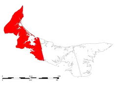 Location of Prince County in Prince Edward Island. | |
| Incorporated Towns & Municipalities | Summerside (city), Alberton (town), Borden-Carleton (town), Kensington (town), O'Leary (town) |
| Parishes | North Parish, Egmont Parish, Halifax Parish, Richmond Parish, St. David's Parish |
| Townships and royalties | List
|
| Area | |
| • Total | 1,979.21 km2 (764.18 sq mi) |
| Population (2021)[1] | |
| • Total | 46,234 |
| • Density | 23/km2 (61/sq mi) |
| Median income/capita | $30,609 |
The geographic division created by Malpeque Bay is informally augmented by a socio-economic division between the more urban East Prince and rural West Prince, although the line of division generally varies. Much of Prince Edward Island's industrial base is concentrated in the eastern part of the county, with three large frozen French fry manufacturing plants, a potato chip manufacturing plant, and an aerospace industry located at a former air force base. Industrial farming for root crops such as potatoes accounts for the majority of rural economic activity, followed by fishing for shellfish such as lobster and crab.
The county was named by Capt. Samuel Holland in 1765 for George, Prince of Wales, who would later become King George IV (1762–1830). As such, Prince County's shire town was designated as Princetown, but the inferior harbour for Prince Royalty saw the settlement pattern change to give this honour to Summerside.
Demographics
As a census division in the 2021 Census of Population conducted by Statistics Canada, Prince County had a population of 46,234 living in 19,660 of its 22,776 total private dwellings, a change of 5.3% from its 2016 population of 43,910. With a land area of 2,006.27 km2 (774.63 sq mi), it had a population density of 23.0/km2 (59.7/sq mi) in 2021.[7]
Transportation
Major highways
 Route 1 (TCH)
 Route 1A
 Route 2
 Route 6
 Route 8
 Route 10
Places
- Cities
- Towns
- Municipalities
- Abrams Village
- Bedeque and Area
- Central Prince
- Elmsdale
- Greenmount-Montrose
- Kinkora
- Linkletter
- Lot 11 and Area
- Malpeque Bay
- Miminegash
- Miscouche
- Sherbrooke
- St. Felix
- St. Louis
- Tignish Shore
- Tyne Valley
- Wellington
- Unincorporated communities
- Albany
- Augustine Cove
- Belmont
- Port Hill
- Days Corner
- Richmond
- Union Corner
- Indian reserves
- Lennox Island 1
See also
- Lady Slipper Drive
- Royal eponyms in Canada
References
- "Census Profile, 2016 Census: Prince, County [Census division], Prince Edward Island". Statistics Canada. Retrieved October 10, 2019.
- "Census Profile - Prince, CTY, Prince Edward Island (Census division)". Canada 2011 Census. Statistics Canada. 2011. Retrieved 24 June 2014.
- "Census Profile - Prince County, Prince Edward Island (Census Division)". Canada 2006 Census. Statistics Canada. 2006. Retrieved 24 June 2014.
- "Community profile - Prince County, Prince Edward Island (County)". Canada 2001 Census. Statistics Canada. 2001. Retrieved 24 June 2014.
- "Electronic Area Profiles - Prince County Prince Edward Island". Canada 1996 Census. Statistics Canada. 1996. Retrieved 24 June 2014.
- Dominion Bureau of Statistics (1944). Cudmore, S. A. (ed.). Eighth Census of Canada 1941 (Report). Vol. II: Population by Local Subdivisions. Edmond Cloutier, Printer to the King's Most Excellent Majesty. p. 55.
- "Population and dwelling counts: Canada and census divisions". Statistics Canada. February 9, 2022. Retrieved April 2, 2022.
Places adjacent to Prince County, Prince Edward Island | |
|---|---|
Subdivisions of Prince Edward Island | |||||||
|---|---|---|---|---|---|---|---|
| Counties | |||||||
| Subdivisions |
| ||||||
| Cities | |||||||
| Towns | |||||||
| Rural municipalities |
| ||||||
| Resort municipalities | |||||||
| Former municipalities |
| ||||||
| Unincorporated communities |
| ||||||
| |||||||