Qaleh Ganj
Qaleh Ganj (Persian: قلعه گنج)[lower-alpha 1] is a city in the Central District of Qaleh Ganj County, Kerman province, Iran, serving as capital of both the county and the district.[4] It is also the administrative center for Qaleh Ganj Rural District.[5]
Qaleh Ganj
Persian: قلعه گنج | |
|---|---|
City | |
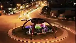 Azadegan Blvd., Vali-ye Asr Square | |
 Qaleh Ganj | |
| Coordinates: 27°31′30″N 57°52′48″E[1] | |
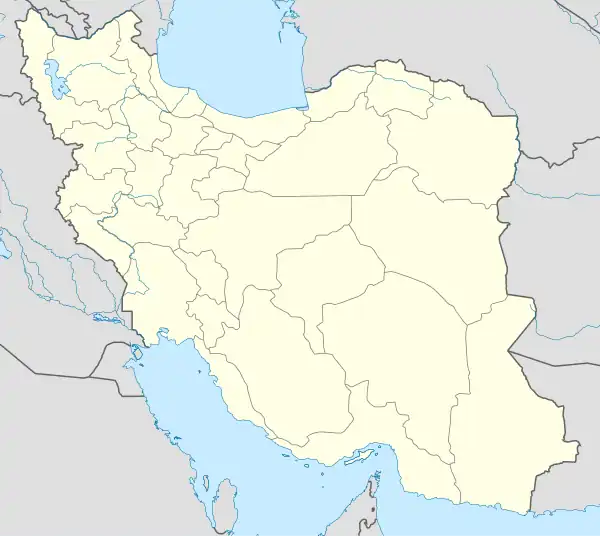
| Country | Iran |
| Province | Kerman |
| County | Qaleh Ganj |
| District | Central |
| Government | |
| • Shahrdar | Jasem Ahmadi |
| Area | |
| • Total | 14,200 km2 (5,500 sq mi) |
| Population (2016)[2] | |
| • Total | 13,169 |
| • Density | 0.93/km2 (2.4/sq mi) |
| Time zone | UTC+3:30 (IRST) |
| Area code | +34 |
At the 2006 National Census, its population was 11,560 in 2,443 households.[6] The following census in 2011 counted 12,663 people in 3,034 households.[7] The latest census in 2016 showed a population of 13,169 people in 3,638 households.[2]
History
Investigation on the history of this city is very difficult and dramatic. It Belongs to the pre-Islamic and Nativity which shows relatives who have been living everywhere in this city. Remains from this civilization show the city is over 5,000 years old. Now people who live in this city are Persians, Balouch, Arabs, Bakhtiari and Afro-Iranians.
Language
The local language of Qale Ganj is Balochi, and a small minority speak Bashkardi which is closely related to the Garmsiri group.[8]
Notes
References
- OpenStreetMap contributors (2 July 2023). "Qaleh Ganj, Qaleh Ganj County" (Map). OpenStreetMap. Retrieved 2 July 2023.
- "Census of the Islamic Republic of Iran, 1395 (2016)". AMAR (in Persian). The Statistical Center of Iran. p. 08. Archived from the original (Excel) on 20 October 2020. Retrieved 19 December 2022.
- Qaleh Ganj can be found at GEOnet Names Server, at this link, by opening the Advanced Search box, entering "-3079165" in the "Unique Feature Id" form, and clicking on "Search Database".
- Aref, Mohammad Reza (11 May 1384). "Divisional changes and reforms in Kerman province". Laws and Regulations Portal of the Islamic Republic of Iran (in Persian). Ministry of Interior, Defense Political Commission of the Government Board. Archived from the original on 5 May 2023. Retrieved 9 July 2023.
- "Creation and formation of 15 rural districts including villages, fields and places in Kahnuj County under Kerman province". Islamic Parliament Research Center of the Islamic Republic of Iran (in Persian). Ministry of Interior, Council of Ministers. 18 May 1365. Archived from the original on 26 October 2019. Retrieved 31 January 2024.
- "Census of the Islamic Republic of Iran, 1385 (2006)". AMAR (in Persian). The Statistical Center of Iran. p. 08. Archived from the original (Excel) on 20 September 2011. Retrieved 25 September 2022.
- "Census of the Islamic Republic of Iran, 1390 (2011)". Syracuse University (in Persian). The Statistical Center of Iran. p. 08. Archived from the original (Excel) on 29 March 2023. Retrieved 19 December 2022.
- “KERMAN xvi. LANGUAGES,” Encyclopædia Iranica, XVI/3, pp. 301-315
Kerman province, Iran | |||||||||||||||||||||||||||||||||||||||||||||||
|---|---|---|---|---|---|---|---|---|---|---|---|---|---|---|---|---|---|---|---|---|---|---|---|---|---|---|---|---|---|---|---|---|---|---|---|---|---|---|---|---|---|---|---|---|---|---|---|
| Capital | 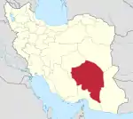 | ||||||||||||||||||||||||||||||||||||||||||||||
| Counties and cities |
| ||||||||||||||||||||||||||||||||||||||||||||||
| Sights |
| ||||||||||||||||||||||||||||||||||||||||||||||
| Places |
| ||||||||||||||||||||||||||||||||||||||||||||||
| Capital | |||||||||||||||||||||||
|---|---|---|---|---|---|---|---|---|---|---|---|---|---|---|---|---|---|---|---|---|---|---|---|
| Districts |
| ||||||||||||||||||||||