Quins, Aveyron
Quins (French pronunciation: [kɛ̃s]) is a commune in the Aveyron department in southern France.
Quins | |
|---|---|
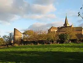 A general view of Quins | |
Location of Quins | |
 Quins 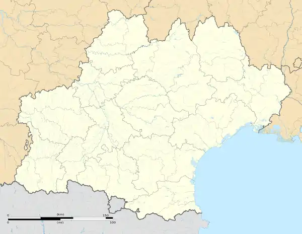 Quins | |
| Coordinates: 44°14′00″N 2°22′25″E | |
| Country | France |
| Region | Occitania |
| Department | Aveyron |
| Arrondissement | Villefranche-de-Rouergue |
| Canton | Ceor-Ségala |
| Government | |
| • Mayor (2020–2026) | Jean-Pierre Mazars[1] |
| Area 1 | 38.46 km2 (14.85 sq mi) |
| Population (2021)[2] | 862 |
| • Density | 22/km2 (58/sq mi) |
| Time zone | UTC+01:00 (CET) |
| • Summer (DST) | UTC+02:00 (CEST) |
| INSEE/Postal code | 12194 /12800 |
| Elevation | 343–724 m (1,125–2,375 ft) (avg. 608 m or 1,995 ft) |
| 1 French Land Register data, which excludes lakes, ponds, glaciers > 1 km2 (0.386 sq mi or 247 acres) and river estuaries. | |
Geography
Location
Quins borders Route Nationale 88, which crosses the commune at La Mothe. It lies between Naucelle and Baraqueville, in the Ségala region.
Villages and hamlets
Verdun, Jalenques, Salan, La Mothe Démies, Courtalesque, La Tournarie, Pradials, La Couliche, Cadars, Truels
Population
| Year | Pop. | ±% |
|---|---|---|
| 1962 | 942 | — |
| 1968 | 1,053 | +11.8% |
| 1975 | 886 | −15.9% |
| 1982 | 715 | −19.3% |
| 1990 | 717 | +0.3% |
| 1999 | 648 | −9.6% |
| 2008 | 798 | +23.1% |
See also
References
- "Répertoire national des élus: les maires". data.gouv.fr, Plateforme ouverte des données publiques françaises (in French). 2 December 2020.
- "Populations légales 2021". The National Institute of Statistics and Economic Studies. 28 December 2023.
Wikimedia Commons has media related to Quins.
This article is issued from Wikipedia. The text is licensed under Creative Commons - Attribution - Sharealike. Additional terms may apply for the media files.