Saint-Fraimbault
Saint-Fraimbault (French pronunciation: [sɛ̃ fʁɛ̃bo] ⓘ) is a commune in the Orne department in north-western France.[3] The town is named after the 6th-century AD Saint Fraimbault de Lassay (also known as Fraimbaud, Fraimbourg, Frambaud, Frambourg, Frambour, Frambaldus, etc.).
Saint-Fraimbault | |
|---|---|
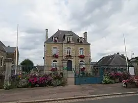 The town hall in Saint-Fraimbault | |
Location of Saint-Fraimbault | |
 Saint-Fraimbault 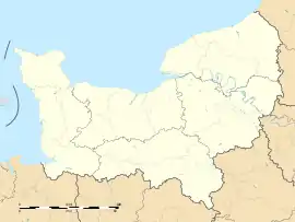 Saint-Fraimbault | |
| Coordinates: 48°29′14″N 0°41′54″W | |
| Country | France |
| Region | Normandy |
| Department | Orne |
| Arrondissement | Alençon |
| Canton | Bagnoles de l'Orne Normandie |
| Government | |
| • Mayor (2020–2026) | Éric Leroux[1] |
| Area 1 | 28.59 km2 (11.04 sq mi) |
| Population (2021)[2] | 540 |
| • Density | 19/km2 (49/sq mi) |
| Time zone | UTC+01:00 (CET) |
| • Summer (DST) | UTC+02:00 (CEST) |
| INSEE/Postal code | 61387 /61350 |
| Elevation | 107–196 m (351–643 ft) (avg. 150 m or 490 ft) |
| 1 French Land Register data, which excludes lakes, ponds, glaciers > 1 km2 (0.386 sq mi or 247 acres) and river estuaries. | |
Points of Interest
Notable People
References
- "Répertoire national des élus: les maires" (in French). data.gouv.fr, Plateforme ouverte des données publiques françaises. 13 September 2022.
- "Populations légales 2021". The National Institute of Statistics and Economic Studies. 28 December 2023.
- "Commune de Saint-Fraimbault (61387) − COG | Insee". www.insee.fr.
- "Plan d'eau de Saint-Fraimbault in SAINT-FRAIMBAULT". Normandy Tourism, France.
- "Activités et Loisirs - ACTIVITES PLAN D'EAU ET AUTOUR - La Mairie de Saint Fraimbault". www.saint-fraimbault.com.
- "Olympedia – Marie-Chantal Depetris-Demaille". www.olympedia.org.
Wikimedia Commons has media related to Saint-Fraimbault (Orne).
| |
|
This article is issued from Wikipedia. The text is licensed under Creative Commons - Attribution - Sharealike. Additional terms may apply for the media files.