Saint-Pierre-des-Champs
Saint-Pierre-des-Champs (French pronunciation: [sɛ̃ pjɛʁ de ʃɑ̃] ⓘ; Languedocien: Sant Pèire dels Camps) is a commune in the Aude department in southern France.
Saint-Pierre-des-Champs | |
|---|---|
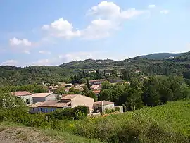 A general view of Saint-Pierre-des-Champs | |
.svg.png.webp) Coat of arms | |
Location of Saint-Pierre-des-Champs | |
 Saint-Pierre-des-Champs 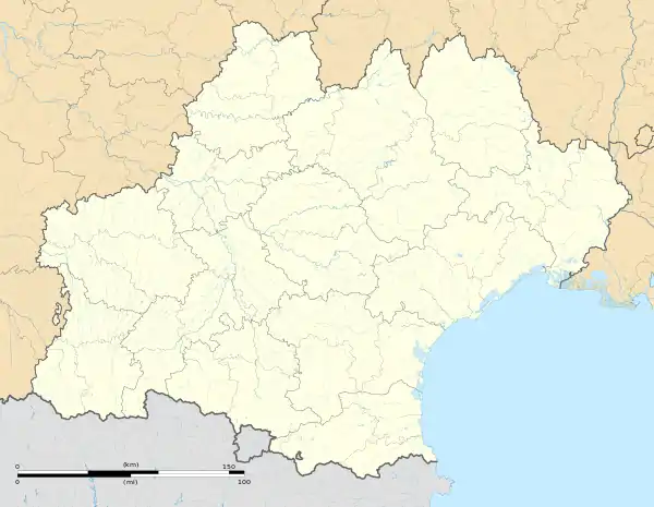 Saint-Pierre-des-Champs | |
| Coordinates: 43°03′34″N 2°36′20″E | |
| Country | France |
| Region | Occitania |
| Department | Aude |
| Arrondissement | Narbonne |
| Canton | Les Corbières |
| Intercommunality | Région Lézignanaise, Corbières et Minervois |
| Government | |
| • Mayor (2020–2026) | Roland Quincey[1] |
| Area 1 | 15.89 km2 (6.14 sq mi) |
| Population (2021)[2] | 191 |
| • Density | 12/km2 (31/sq mi) |
| Demonym | Saint-Pierrois |
| Time zone | UTC+01:00 (CET) |
| • Summer (DST) | UTC+02:00 (CEST) |
| INSEE/Postal code | 11363 /11220 |
| Elevation | 133–520 m (436–1,706 ft) (avg. 146 m or 479 ft) |
| 1 French Land Register data, which excludes lakes, ponds, glaciers > 1 km2 (0.386 sq mi or 247 acres) and river estuaries. | |
Population
| Year | Pop. | ±% |
|---|---|---|
| 1962 | 121 | — |
| 1968 | 155 | +28.1% |
| 1975 | 152 | −1.9% |
| 1982 | 121 | −20.4% |
| 1990 | 134 | +10.7% |
| 1999 | 127 | −5.2% |
| 2008 | 164 | +29.1% |
Geography
The commune is located in the Corbières Massif.
The village lies on the right bank of the Orbieu, which flows northeast through the western part of the commune.
See also
- Corbières AOC
- Communes of the Aude department
References
- "Répertoire national des élus: les maires". data.gouv.fr, Plateforme ouverte des données publiques françaises (in French). 9 August 2021.
- "Populations légales 2021". The National Institute of Statistics and Economic Studies. 28 December 2023.
Wikimedia Commons has media related to Saint-Pierre-des-Champs.
This article is issued from Wikipedia. The text is licensed under Creative Commons - Attribution - Sharealike. Additional terms may apply for the media files.