Staffelfelden
Staffelfelden (French pronunciation: [stafəlfɛldən]) is a commune in the Haut-Rhin department in Grand Est in north-eastern France. It forms part of the Mulhouse Alsace Agglomération, the inter-communal local government body for the Mulhouse conurbation.[3]
Staffelfelden | |
|---|---|
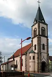 The church in Staffelfelden | |
.svg.png.webp) Coat of arms | |
Location of Staffelfelden | |
 Staffelfelden 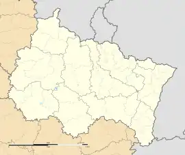 Staffelfelden | |
| Coordinates: 47°49′38″N 7°15′14″E | |
| Country | France |
| Region | Grand Est |
| Department | Haut-Rhin |
| Arrondissement | Mulhouse |
| Canton | Wittenheim |
| Intercommunality | Mulhouse Alsace Agglomération |
| Government | |
| • Mayor (2020–2026) | Thierry Belloni[1] |
| Area 1 | 7.42 km2 (2.86 sq mi) |
| Population (2021)[2] | 4,061 |
| • Density | 550/km2 (1,400/sq mi) |
| Time zone | UTC+01:00 (CET) |
| • Summer (DST) | UTC+02:00 (CEST) |
| INSEE/Postal code | 68321 /68850 |
| Elevation | 238–270 m (781–886 ft) (avg. 255 m or 837 ft) |
| 1 French Land Register data, which excludes lakes, ponds, glaciers > 1 km2 (0.386 sq mi or 247 acres) and river estuaries. | |
Population
| Year | Pop. | ±% p.a. |
|---|---|---|
| 1968 | 3,234 | — |
| 1975 | 3,513 | +1.19% |
| 1982 | 3,465 | −0.20% |
| 1990 | 3,331 | −0.49% |
| 1999 | 3,553 | +0.72% |
| 2007 | 3,600 | +0.16% |
| 2012 | 3,727 | +0.70% |
| 2017 | 3,959 | +1.22% |
| Source: INSEE[4] | ||
See also
References
- "Répertoire national des élus: les maires" (in French). data.gouv.fr, Plateforme ouverte des données publiques françaises. 13 September 2022.
- "Populations légales 2021". The National Institute of Statistics and Economic Studies. 28 December 2023.
- "Mulhouse Alsace Agglomération". Mulhouse Alsace Agglomération. Retrieved 2011-04-07.
- Population en historique depuis 1968, INSEE
Wikimedia Commons has media related to Staffelfelden.
This article is issued from Wikipedia. The text is licensed under Creative Commons - Attribution - Sharealike. Additional terms may apply for the media files.