Stará Voda (Cheb District)
Stará Voda (German: Altwasser) is a municipality and village in Cheb District in the Karlovy Vary Region of the Czech Republic. It has about 500 inhabitants.
Stará Voda | |
|---|---|
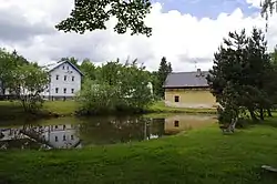 A pond in the centre | |
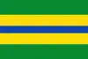 Flag 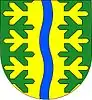 Coat of arms | |
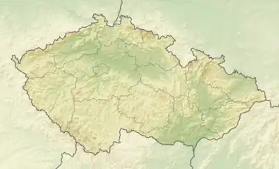 Stará Voda Location in the Czech Republic | |
| Coordinates: 49°59′30″N 12°35′45″E | |
| Country | |
| Region | Karlovy Vary |
| District | Cheb |
| First mentioned | 1380 |
| Area | |
| • Total | 54.01 km2 (20.85 sq mi) |
| Elevation | 605 m (1,985 ft) |
| Population (2023-01-01)[1] | |
| • Total | 501 |
| • Density | 9.3/km2 (24/sq mi) |
| Time zone | UTC+1 (CET) |
| • Summer (DST) | UTC+2 (CEST) |
| Postal codes | 350 02, 353 01 |
| Website | www |
Administrative parts
The villages of Sekerské Chalupy and Vysoká are administrative parts of Stará Voda.
Etymology
The name means 'old water'.
Geography
Stará Voda is located about 17 kilometres (11 mi) southeast of Cheb and 32 km (20 mi) southwest of Karlovy Vary, on the border with Germany. The eastern part of the municipal territory with the village of Stará Voda lies in the Upper Palatine Forest Foothills, but most of the municipality lies in the Upper Palatine Forest. The highest point is the second highest peak of the entire Upper Palatine Forest, Dyleň at 940 m (3,080 ft) above sea level.
History
The first written mention of Stará Voda is from 1380.[2]
Demographics
|
|
| ||||||||||||||||||||||||||||||||||||||||||||||||||||||
| Source: Censuses[3][4] | ||||||||||||||||||||||||||||||||||||||||||||||||||||||||
Transport
The I/21 road, which connects the D5 and D6 motorways, passes through the municipality.
The main railway line Prague–Cheb via Plzeň runs through the municipal territory. The train station named Lázně Kynžvart, which serves mainly the neighbouring town of Lázně Kynžvart, is located in the territory of Stará Voda.[5]
Sights
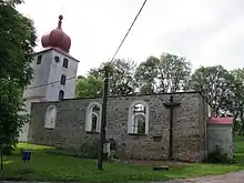
The main landmark of the municipality is the Church of Saint John the Baptist in Vysoká. It was originally a Romanesque-Gothic building from the mid-13th century. It was gradually rebuilt and modified until 1847. In 1982, the roof was taken off and only the tower was preserved.[6]
References
- "Population of Municipalities – 1 January 2023". Czech Statistical Office. 2023-05-23.
- "Program obnovy venkova Stará Voda" (in Czech). Obec Stará Voda. 2009-01-29. Retrieved 2024-02-13.
- "Historický lexikon obcí České republiky 1869–2011 – Okres Cheb" (in Czech). Czech Statistical Office. 2015-12-21. pp. 13–14.
- "Population Census 2021: Population by sex". Public Database. Czech Statistical Office. 2021-03-27.
- "Detail stanice Lázně Kynžvart" (in Czech). České dráhy. Retrieved 2023-11-03.
- "Kostel sv. Jana Křtitele" (in Czech). National Heritage Institute. Retrieved 2024-02-13.