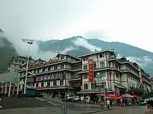
Luding County
Luding County (simplified Chinese: 泸定县; traditional Chinese: 瀘定縣; pinyin: Lúdìng Xiàn), also known via its Tibetan name as Chagsam or Jagsam (Tibetan: ལྕགས་ཟམ་རྫོང་།, Wylie: lcags zam rdzong, ZYPY: Jagsam Zong), is a county located in the southeast of the Garzê Tibetan Autonomous Prefecture in Sichuan province, China.[1] Luding County covers an area of 2,165.35 km2 (836.05 sq mi), and has a population of 86,234 as of 2022.[1]
Luding County
泸定县 · ལྕགས་ཟམ་རྫོང་། | |
|---|---|
 Luding Bridge crossing the Dadu River | |
.png.webp) Location of Luding County (red) within Garzê Prefecture (yellow) and Sichuan | |
| Coordinates: 29°54′50″N 102°14′02″E | |
| Country | People's Republic of China |
| Province | Sichuan |
| Prefecture-level city | Garzê |
| County seat | Luqiao (泸桥镇) |
| Area | |
| • Total | 2,165.35 km2 (836.05 sq mi) |
| Population (2022) | |
| • Total | 86,234 |
| • Density | 40/km2 (100/sq mi) |
| • Major nationalities | Han - 78.2% Tibetan - 16.0% Yi - 4.8% |
| Time zone | UTC+8 (China Standard) |
| Postal code | 626100 |
| Area code | 0836 |
| Website | www |
History
Geography
Luding County is bordered by Tianquan County, Yingjing County, and Hanyuan County to the east, Shimian County to the south, and Kangding to the west and north.[1]
The county is located within the Hengduan Mountains, within the southeastern edge of the Tibetan Plateau.[1] The town of Luqiao, the county seat, sits at an elevation of 1,321 metres (4,334 ft) above sea level.[1] The highest point in the county is Mount Gongga, along the southwestern border with Kangding.[1] Mount Erlang is also located on the county's edge.[1]
Climate
| Climate data for Luding (1981−2010 normals) | |||||||||||||
|---|---|---|---|---|---|---|---|---|---|---|---|---|---|
| Month | Jan | Feb | Mar | Apr | May | Jun | Jul | Aug | Sep | Oct | Nov | Dec | Year |
| Record high °C (°F) | 23.4 (74.1) |
29.4 (84.9) |
36.3 (97.3) |
35.5 (95.9) |
36.3 (97.3) |
36.3 (97.3) |
37.8 (100.0) |
36.1 (97.0) |
34.9 (94.8) |
30.6 (87.1) |
26.3 (79.3) |
22.0 (71.6) |
37.8 (100.0) |
| Average high °C (°F) | 12.2 (54.0) |
14.5 (58.1) |
18.7 (65.7) |
23.3 (73.9) |
25.8 (78.4) |
26.7 (80.1) |
28.5 (83.3) |
28.1 (82.6) |
25.0 (77.0) |
21.1 (70.0) |
17.5 (63.5) |
13.3 (55.9) |
21.2 (70.2) |
| Daily mean °C (°F) | 6.7 (44.1) |
8.9 (48.0) |
12.4 (54.3) |
16.5 (61.7) |
19.4 (66.9) |
21.1 (70.0) |
22.7 (72.9) |
22.4 (72.3) |
19.8 (67.6) |
16.2 (61.2) |
12.2 (54.0) |
7.8 (46.0) |
15.5 (59.9) |
| Average low °C (°F) | 2.8 (37.0) |
4.9 (40.8) |
8.0 (46.4) |
12.0 (53.6) |
15.1 (59.2) |
17.2 (63.0) |
18.8 (65.8) |
18.7 (65.7) |
16.4 (61.5) |
12.9 (55.2) |
8.6 (47.5) |
3.9 (39.0) |
11.6 (52.9) |
| Record low °C (°F) | −4.2 (24.4) |
−3.5 (25.7) |
−2.4 (27.7) |
3.4 (38.1) |
6.0 (42.8) |
10.6 (51.1) |
13.2 (55.8) |
11.7 (53.1) |
9.9 (49.8) |
5.3 (41.5) |
0.2 (32.4) |
−3.2 (26.2) |
−4.2 (24.4) |
| Average precipitation mm (inches) | 0.8 (0.03) |
2.4 (0.09) |
18.2 (0.72) |
42.7 (1.68) |
72.4 (2.85) |
116.7 (4.59) |
140.3 (5.52) |
148.0 (5.83) |
86.4 (3.40) |
34.4 (1.35) |
7.6 (0.30) |
1.0 (0.04) |
670.9 (26.4) |
| Average precipitation days (≥ 0.1 mm) | 1.0 | 2.3 | 9.0 | 14.2 | 16.8 | 20.8 | 20.4 | 19.8 | 17.3 | 11.3 | 4.5 | 1.4 | 138.8 |
| Average snowy days | 1.4 | 1.0 | 0.3 | 0 | 0 | 0 | 0 | 0 | 0 | 0 | 0.1 | 0.5 | 3.3 |
| Average relative humidity (%) | 54 | 53 | 56 | 60 | 66 | 74 | 78 | 78 | 77 | 73 | 65 | 59 | 66 |
| Mean monthly sunshine hours | 113.9 | 108.3 | 114.2 | 126.1 | 116.8 | 91.1 | 110.1 | 115.7 | 88.0 | 91.4 | 106.9 | 108.5 | 1,291 |
| Percent possible sunshine | 35 | 34 | 31 | 33 | 28 | 22 | 26 | 29 | 24 | 26 | 34 | 34 | 30 |
| Source: China Meteorological Administration (precipitation days, snow days, sunshine 1991–2015)[2][3] | |||||||||||||
Administrative divisions
As of 2022, Luding County contains the following eight towns and one township:[4]
| English name | Hanzi | 2019 population[5] | Notes |
|---|---|---|---|
| Luqiao | 泸桥镇 | 23,903 | Seat of the county government |
| Lengqi | 冷碛镇 | 7,897 | |
| Xinglong | 兴隆镇 | 9,255 | |
| Moxi | 磨西镇 | 7,243 | |
| Pengba | 烹坝镇 | 4,656 | |
| Yanzigou | 燕子沟镇 | 5,400 | |
| Detuo | 得妥镇 | 8,114 | |
| Dewei | 德威镇 | 4,528 | |
| Lan'an Township | 岚安乡 | 2,789 |
Former administrative divisions
| English name | Hanzi | Population |
|---|---|---|
| Tianba Township | 田坝乡 | 5,117 (2019)[5] |
| Chuni Township | 杵坭乡 | 3,117 (2019)[5] |
| Jiajun Township | 加郡乡 | 4,223 (2019)[5] |
| Xinxing Township | 新兴乡 |
Demographics
Luding County has a total population of 86,234 as of 2022,[1] up from approximately 80,000 at the end of 2004, and the 77,855 recorded in the 2000 Chinese Census.
Ethnic groups
Luding County has a supermajority Han Chinese population, but is home to a number of ethnic minorities, who constitute about 22% of the county's population.[1] The county's ethnic minorities include Tibetans, Yi, Qiang, Miao, Hui, Mongols, Tujia, Lisu, Manchus, Yao, Kam, Nakhi, Bouyei, Bai, Zhuang, and the Dai.[1]
The following table shows the ethnic composition of Luding County:
| 2000 | 2022[1] | ||||
|---|---|---|---|---|---|
| Ethnic Group | Population | Percentage | Ethnic Group | Population | Percentage |
| Han | 66,066 | 84.86% | Han | ~67,435 | 78.2% |
| Tibetan | 7,834 | 10.06% | Tibetan | ~13,797 | 16.0% |
| Yi | 3,424 | 4.4% | Yi | ~4,139 | 4.8% |
| Mongols | 253 | 0.32% | Mongols | N/A | N/A |
| Others | 278 | 0.36% | Others | 863 | 1.0% |
Transport
References
- 泸定简介 [Luding Introduction]. luding.gov.cn (in Chinese). Luding County People's Government. Archived from the original on 2022-09-05. Retrieved 2022-09-05.
- 中国气象数据网 – WeatherBk Data (in Simplified Chinese). China Meteorological Administration. Retrieved 14 April 2023.
- 中国气象数据网 (in Simplified Chinese). China Meteorological Administration. Retrieved 14 April 2023.
- 2021年统计用区划代码(泸定县). 2021 Statistical Division Codes (Luding County) (in Chinese). National Bureau of Statistics of China. Archived from the original on 2022-07-14. Retrieved 2022-09-05.
- 泸定县历史沿革 [Luding County Administrative History]. luding.gov.cn (in Chinese). Luding County People's Government. 2020-12-10. Archived from the original on 2022-09-11. Retrieved 2022-09-11.
External links
| County-level divisions |   | |
|---|---|---|
| Towns and villages |
| |
| Geography | ||
| Landmarks | ||