Liberal, Kansas
Liberal is a city in southwest Kansas, close to the Oklahoma state border. In 2010, 20,525 people lived there. The city was founded in 1888 and incorporated in the same year.
Liberal, Kansas | |
|---|---|
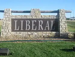
 Welcome sign on U.S. Route 83 | |
 Location of Liberal, Kansas | |
| Coordinates: 37°2′36″N 100°55′41″W | |
| Country | United States |
| State | Kansas |
| County | Seward |
| Founded | 1888 |
| Incorporated | 1888 |
| Government | |
| • Mayor | Tim Long |
| Area | |
| • Total | 11.75 sq mi (30.43 km2) |
| • Land | 11.61 sq mi (30.07 km2) |
| • Water | 0.14 sq mi (0.36 km2) |
| Elevation | 2,835 ft (864 m) |
| Population | |
| • Total | 20,525 |
| • Estimate (2012[2]) | 21,084 |
| • Density | 1,767.9/sq mi (682.6/km2) |
| • µSA | 23,547 |
| Time zone | UTC-6 (Central (CST)) |
| • Summer (DST) | UTC-5 (CDT) |
| ZIP codes | 67901, 67905 |
| Area code(s) | 620 |
| FIPS code | 20-39825[3] |
| GNIS feature ID | 0470667[4] |
| Website | CityOfLiberal.org |
Sources
- "American FactFinder". United States Census Bureau. Retrieved 2012-07-06.
- "Population Estimates". United States Census Bureau. Retrieved 2013-05-29.
- "American FactFinder". United States Census Bureau. Retrieved 2008-01-31.
- "US Board on Geographic Names". United States Geological Survey. 2007-10-25. Retrieved 2008-01-31.
This article is issued from Wikipedia. The text is licensed under Creative Commons - Attribution - Sharealike. Additional terms may apply for the media files.

