Meade County, Kansas
Meade County (standard abbreviation: ME) is a county in the U.S. state of Kansas. In 2010, 4,575 people lived there.[1] The county seat is Meade. Meade is also the biggest city in Meade County.[2] The county was created in 1873. It was named after General George G. Meade.[3]
Meade County | |
|---|---|
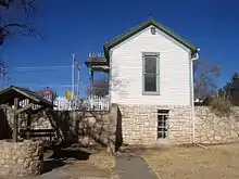 Dalton Gang Hideout and Museum in Meade | |
 Location within the U.S. state of Kansas | |
 Kansas's location within the U.S. | |
| Coordinates: 37°14′00″N 100°22′01″W | |
| Country | |
| State | |
| Founded | March 20, 1873 |
| Named for | George G. Meade |
| Seat | Meade |
| Largest city | Meade |
| Area | |
| • Total | 979 sq mi (2,540 km2) |
| • Land | 978 sq mi (2,530 km2) |
| • Water | 1.3 sq mi (3 km2) 0.1%% |
| Population | |
| • Estimate (2016) | 4,216 |
| • Density | 4.7/sq mi (1.8/km2) |
| Time zone | UTC−6 (Central) |
| • Summer (DST) | UTC−5 (CDT) |
| Congressional district | 1st |
| Website | MeadeCo.org |
Geography
The U.S. Census Bureau says that the county has a total area of 979 square miles (2,540 km2). Of that, 978 square miles (2,530 km2) is land and 1.3 square miles (3.4 km2) (0.1%) is water.[4]
People
| Historical population | |||
|---|---|---|---|
| Census | Pop. | %± | |
| 1880 | 296 | — | |
| 1890 | 2,542 | 758.8% | |
| 1900 | 1,581 | −37.8% | |
| 1910 | 5,055 | 219.7% | |
| 1920 | 5,542 | 9.6% | |
| 1930 | 6,858 | 23.7% | |
| 1940 | 5,522 | −19.5% | |
| 1950 | 5,710 | 3.4% | |
| 1960 | 5,505 | −3.6% | |
| 1970 | 4,912 | −10.8% | |
| 1980 | 4,788 | −2.5% | |
| 1990 | 4,247 | −11.3% | |
| 2000 | 4,631 | 9.0% | |
| 2010 | 4,575 | −1.2% | |
| 2016 (est.) | 4,216 | [5] | −7.8% |
| U.S. Decennial Census[6] 1790-1960[7] 1900-1990[8] 1990-2000[9] 2010-2016[1] | |||

Age pyramid
Government
Meade County is often won by Republican Candidates. The last time a democratic candidate has won this county was in 1936 by Franklin D. Roosevelt.
Presidential elections
Presidential Elections Results
| Year | Republican | Democratic | Third Parties |
|---|---|---|---|
| 2016 | 81.7% 1,415 | 12.1% 210 | 6.2% 107 |
| 2012 | 83.6% 1,428 | 15.1% 258 | 1.4% 23 |
| 2008 | 79.8% 1,540 | 18.5% 357 | 1.8% 34 |
| 2004 | 82.4% 1,748 | 16.8% 356 | 0.8% 17 |
| 2000 | 78.1% 1,604 | 19.5% 400 | 2.4% 49 |
| 1996 | 70.1% 1,443 | 20.7% 426 | 9.2% 190 |
| 1992 | 52.5% 1,135 | 19.9% 430 | 27.7% 599 |
| 1988 | 65.2% 1,322 | 32.7% 664 | 2.1% 42 |
| 1984 | 77.2% 1,804 | 21.0% 491 | 1.8% 43 |
| 1980 | 71.7% 1,618 | 21.4% 482 | 7.0% 158 |
| 1976 | 51.5% 1,109 | 45.7% 983 | 2.8% 60 |
| 1972 | 74.6% 1,712 | 22.9% 526 | 2.5% 58 |
| 1968 | 66.2% 1,511 | 25.1% 572 | 8.7% 198 |
| 1964 | 51.8% 1,290 | 47.3% 1,179 | 0.9% 23 |
| 1960 | 70.5% 1,826 | 29.1% 754 | 0.4% 11 |
| 1956 | 74.3% 1,720 | 24.8% 575 | 0.9% 20 |
| 1952 | 76.9% 2,061 | 21.2% 568 | 1.9% 51 |
| 1948 | 60.2% 1,406 | 35.7% 834 | 4.1% 96 |
| 1944 | 68.2% 1,424 | 30.2% 631 | 1.5% 32 |
| 1940 | 61.1% 1,618 | 36.7% 970 | 2.2% 59 |
| 1936 | 46.6% 1,218 | 53.3% 1,394 | 0.1% 3 |
| 1932 | 49.5% 1,248 | 48.8% 1,231 | 1.7% 42 |
| 1928 | 73.2% 1,709 | 26.5% 618 | 0.4% 9 |
| 1924 | 66.9% 1,290 | 24.5% 472 | 8.6% 165 |
| 1920 | 71.0% 1,236 | 27.7% 483 | 1.3% 23 |
| 1916 | 45.0% 973 | 45.2% 977 | 9.9% 214 |
| 1912 | 18.3% 204 | 34.3% 383 | 47.5% 530[lower-alpha 1] |
| 1908 | 56.2% 560 | 38.8% 386 | 5.0% 50 |
| 1904 | 66.4% 383 | 28.8% 166 | 4.9% 28 |
| 1900 | 53.2% 238 | 46.8% 209 | 0.0% 0 |
| 1896 | 50.5% 203 | 48.5% 195 | 1.0% 4 |
| 1892 | 54.8% 261 | 45.2% 215 | |
| 1888 | 56.8% 578 | 33.6% 342 | 9.6% 98 |
Education
Unified school districts

References
- "State & County QuickFacts". United States Census Bureau. Archived from the original on August 6, 2011. Retrieved July 27, 2014.
- "Find a County". National Association of Counties. Retrieved 2011-06-07.
- Blackmar, Frank Wilson (1912). Kansas: A Cyclopedia of State History, Volume 2. Standard Publishing Company. p. 249.
- "US Gazetteer files: 2010, 2000, and 1990". United States Census Bureau. 2011-02-12. Retrieved 2011-04-23.
- "Population and Housing Unit Estimates". Retrieved June 9, 2017.
- "U.S. Decennial Census". United States Census Bureau. Retrieved July 27, 2014.
- "Historical Census Browser". University of Virginia Library. Retrieved July 27, 2014.
- "Population of Counties by Decennial Census: 1900 to 1990". United States Census Bureau. Retrieved July 27, 2014.
- "Census 2000 PHC-T-4. Ranking Tables for Counties: 1990 and 2000" (PDF). United States Census Bureau. Retrieved July 27, 2014.
- "Dave Leip's Atlas of U.S. Presidential Elections".
- Notes
- This total comprises 418 votes (37.42 percent) for Progressive Theodore Roosevelt (who carried the county), 110 votes (10.03 percent) for Socialist Eugene V. Debs, and 2 votes for write-in candidates.
More reading
- Plat Book of Meade County, Kansas; R. P. Ice Co; 43 pages; 1909.
Other websites
Wikimedia Commons has media related to Meade County, Kansas.
- County
- General county information
- Maps
- Meade County Maps: Current, Historic, KDOT
- Kansas Highway Maps: Current, Historic, KDOT
- Kansas Railroad Maps: Current, 1996, 1915, KDOT and Kansas Historical Society

Authority control | |
|---|---|
| General | |
| National libraries | |
This article is issued from Wikipedia. The text is licensed under Creative Commons - Attribution - Sharealike. Additional terms may apply for the media files.