Snyder, Oklahoma
Snyder is a city in Oklahoma in the United States with territory in the shape of a butcher's knife.
Snyder, Oklahoma | |
|---|---|
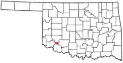 Location of Snyder, Oklahoma | |
| Coordinates: | |
| Country | United States |
| State | Oklahoma |
| County | Kiowa |
| Area | |
| • Total | 1.3 sq mi (3.3 km2) |
| • Land | 1.3 sq mi (3.3 km2) |
| • Water | 0.0 sq mi (0.0 km2) |
| Elevation | 1,355 ft (413 m) |
| Population (2000) | |
| • Total | 1,509 |
| • Density | 1,190.6/sq mi (459.7/km2) |
| Time zone | UTC-6 (Central (CST)) |
| • Summer (DST) | UTC-5 (CDT) |
| ZIP code | 73566 |
| Area code(s) | 580 |
| FIPS code | 40-68400[1] |
| GNIS feature ID | 1098175[2] |
References
- "American FactFinder". United States Census Bureau. Retrieved 2008-01-31.
- "US Board on Geographic Names". United States Geological Survey. 2007-10-25. Retrieved 2008-01-31.

This article is issued from Wikipedia. The text is licensed under Creative Commons - Attribution - Sharealike. Additional terms may apply for the media files.