Antichan-de-Frontignes
Antichan-de-Frontignes (French pronunciation: [ɑ̃tiʃɑ̃ də fʁɔ̃tiɲ]; Occitan: Antishan de Frontinhas) is a commune in the Haute-Garonne department in the Occitanie region of south-western France.
Antichan-de-Frontignes | |
|---|---|
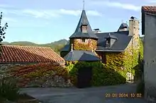
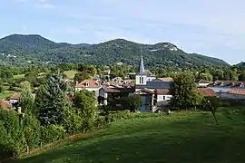 A general view of Antichan-de-Frontignes | |
Location of Antichan-de-Frontignes | |
 Antichan-de-Frontignes 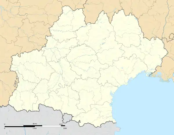 Antichan-de-Frontignes | |
| Coordinates: 42°58′27″N 0°39′58″E | |
| Country | France |
| Region | Occitania |
| Department | Haute-Garonne |
| Arrondissement | Saint-Gaudens |
| Canton | Bagnères-de-Luchon |
| Intercommunality | Pyrénées Haut Garonnaises |
| Government | |
| • Mayor (2020–2026) | Bernard Dumail[1] |
| Area 1 | 4.27 km2 (1.65 sq mi) |
| Population (2021)[2] | 188 |
| • Density | 44/km2 (110/sq mi) |
| Time zone | UTC+01:00 (CET) |
| • Summer (DST) | UTC+02:00 (CEST) |
| INSEE/Postal code | 31009 /31510 |
| Elevation | 533–1,655 m (1,749–5,430 ft) (avg. 600 m or 2,000 ft) |
| 1 French Land Register data, which excludes lakes, ponds, glaciers > 1 km2 (0.386 sq mi or 247 acres) and river estuaries. | |
Geography
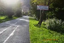
Antichan-de-Frontignes is located at the foot of the Pyrenees in the Comminges region some 40 km east by south-east of Bagnères-de-Bigorre and 19 km south by south-west of Saint-Gaudens. Access to the commune is by the D618 road which branches from the D331 east of Ore and goes to the village then continues north-east by a roundabout route to Juzet-d'Izaut. There is also a local road going from the D618 north of the village to Saint-Pé-d'Ardet. Most of the commune is heavily forested however there is some farmland near the village.[3]
Neighbouring communes and villages
Places adjacent to Antichan-de-Frontignes | ||||||||||||||||
|---|---|---|---|---|---|---|---|---|---|---|---|---|---|---|---|---|
| ||||||||||||||||
Demography
The inhabitants of the commune are known as Antichanais or Antichanaises in French.[5]
|
| ||||||||||||||||||||||||||||||||||||||||||||||||||||||||||||||||||||||||||||||||||||||||||||||||||||||||||||||||||
| Source: EHESS[6] and INSEE[7] | |||||||||||||||||||||||||||||||||||||||||||||||||||||||||||||||||||||||||||||||||||||||||||||||||||||||||||||||||||
Sites and monuments
- The village is the point of departure for a hiking trail which crosses the Col des Ares 4.5 km from the village then continues to the summits of the Pic du Gar and the Saillant Peak.
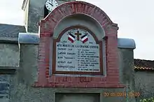
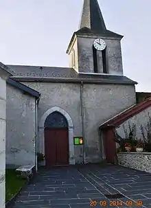
- The Church of Notre-Dame of the Assumption
References
- "Répertoire national des élus: les maires" (in French). data.gouv.fr, Plateforme ouverte des données publiques françaises. 13 September 2022.
- "Populations légales 2021". The National Institute of Statistics and Economic Studies. 28 December 2023.
- Google Maps
- List of Mayors of France (in French)
- Le nom des habitants du 31 - Haute-Garonne, habitants.fr
- Des villages de Cassini aux communes d'aujourd'hui: Commune data sheet Antichan-de-Frontignes, EHESS (in French).
- Population en historique depuis 1968, INSEE
External links
- Antichan-de-Frontignes on the old IGN website (in French)
- Antichan-de-Frontignes on Géoportail, National Geographic Institute (IGN) website (in French)
- Antichan-de-Frontignes on the 1750 Cassini Map