Apach
Apach (French pronunciation: [apak]; German: Apach; Luxembourgish: Opech [ˈoːpəɕ]) is a commune in the Moselle department in Grand Est in northeastern France.
Apach | |
|---|---|
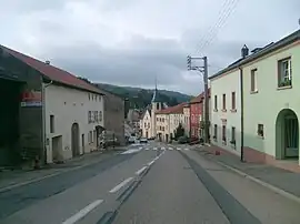 A view within Apach | |
 Coat of arms | |
Location of Apach | |
 Apach 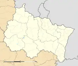 Apach | |
| Coordinates: 49°27′34″N 6°22′32″E | |
| Country | France |
| Region | Grand Est |
| Department | Moselle |
| Arrondissement | Thionville |
| Canton | Bouzonville |
| Government | |
| • Mayor (2020–2026) | Emilie Feltz-Villain[1] |
| Area 1 | 3.35 km2 (1.29 sq mi) |
| Population (2021)[2] | 1,071 |
| • Density | 320/km2 (830/sq mi) |
| Time zone | UTC+01:00 (CET) |
| • Summer (DST) | UTC+02:00 (CEST) |
| INSEE/Postal code | 57026 /57480 |
| Elevation | 145–365 m (476–1,198 ft) (avg. 115 m or 377 ft) |
| 1 French Land Register data, which excludes lakes, ponds, glaciers > 1 km2 (0.386 sq mi or 247 acres) and river estuaries. | |
Apach is 2 km (1.2 mi) from Sierck-les-Bains, 25 km (16 mi) from Thionville, and 50 km (31 mi) from Metz. It is on the right bank of the river Moselle, on the border of Germany and Luxembourg, the municipalities just across the border being Perl in Germany and Schengen in Luxembourg. It has a station on the Thionville–Trier railway, served by regional trains.
Apach was the scene of a skirmish between the French and German armies during the Saar Offensive of 1939.[3]
A natural reserve for orchids is located along the limestone hillsides, of which there are many in this town.
Population
| Year | Pop. | ±% p.a. |
|---|---|---|
| 1968 | 841 | — |
| 1975 | 848 | +0.12% |
| 1982 | 864 | +0.27% |
| 1990 | 798 | −0.99% |
| 1999 | 813 | +0.21% |
| 2009 | 963 | +1.71% |
| 2014 | 1,013 | +1.02% |
| 2020 | 1,071 | +0.93% |
| Source: INSEE[4] | ||
See also
References
- "Répertoire national des élus: les maires". data.gouv.fr, Plateforme ouverte des données publiques françaises (in French). 2 December 2020.
- "Populations légales 2021". The National Institute of Statistics and Economic Studies. 28 December 2023.
- "What was the Saar Offensive (1939)? - Boot Camp & Military Fitness Institute". 11 November 2020.
- Population en historique depuis 1968, INSEE
External links
 Media related to Apach at Wikimedia Commons
This article is issued from Wikipedia. The text is licensed under Creative Commons - Attribution - Sharealike. Additional terms may apply for the media files.