Lagamas
Lagamas (Occitan: L'Agamàs) is a commune in the Hérault département in the Occitanie region in southern France.
Lagamas | |
|---|---|
.jpg.webp) The town hall | |
.svg.png.webp) Coat of arms | |
Location of Lagamas | |
 Lagamas 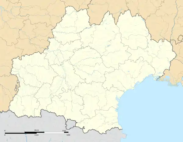 Lagamas | |
| Coordinates: 43°40′29″N 3°31′26″E | |
| Country | France |
| Region | Occitania |
| Department | Hérault |
| Arrondissement | Lodève |
| Canton | Gignac |
| Intercommunality | Vallée de l'Hérault |
| Government | |
| • Mayor (2020–2026) | Christian Viloing[1] |
| Area 1 | 4.52 km2 (1.75 sq mi) |
| Population (2021)[2] | 110 |
| • Density | 24/km2 (63/sq mi) |
| Time zone | UTC+01:00 (CET) |
| • Summer (DST) | UTC+02:00 (CEST) |
| INSEE/Postal code | 34125 /34150 |
| Elevation | 33–142 m (108–466 ft) (avg. 40 m or 130 ft) |
| 1 French Land Register data, which excludes lakes, ponds, glaciers > 1 km2 (0.386 sq mi or 247 acres) and river estuaries. | |
Geography
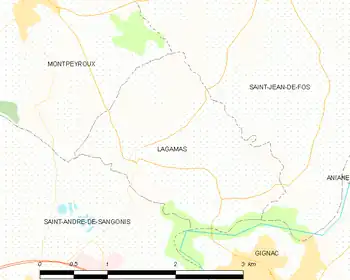
This commune is located in the Languedoc-Roussillon region, in the Hérault département, in the canton of Gignac. The village is part of the 4th constituency of Hérault.
Climate
In 2020, Météo-France published a typology of climates in mainland France in which the commune is exposed to a Mediterranean climate and is in the Provence, Languedoc-Roussillon climatic region, characterised by low rainfall in summer, very good sunshine (2,600 h/year), a hot summer 21.5 °C (71 °F), very dry air in summer, dry in all seasons, strong winds (frequency of 40 to 50% of winds > 5 m/s) and little fog.[3]
For the period 1971-2000, the average annual temperature was 14.3 °C (58 °F) with an annual temperature range of 16.5 °C (62 °F). The average annual total rainfall is 849 mm, with 6.8 days of precipitation in January and 3.1 days in July. For the period 1991-2020, the average annual temperature observed at the nearest weather station, located in the commune of Saint-André-de-Sangonis, 3 km away as the crow flies,[4] is 15.5 °C (60 °F) and the average annual total rainfall is 652.4 mm.[5][6] For the future, climate parameters for the municipality estimated for 2050 according to different greenhouse gas emission scenarios can be consulted on a dedicated website published by Météo-France in November 2022.[Map 1]
Urbanism
Land use
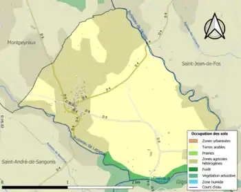
The commune's land use, as revealed by the European biophysical land cover database Corine Land Cover (CLC), is characterised by the importance of agricultural land (96.9% in 2018), an increase compared to 1990 (77%). The detailed breakdown in 2018 is as follows: permanent crops (56.5%), heterogeneous agricultural areas (40.4%), forests (3%).[7] Changes in land use in the municipality and its infrastructure can be seen on various maps of the area: the Cassini map (eighteenth century), the carte d'état-major (1820-1866) and IGN maps or aerial photos for the current period (1950 to the present).
Population
Changes in the number of inhabitants are known from population censuses carried out in the commune since 1793. For communes with fewer than 10,000 inhabitants, a census of the entire population is carried out every five years, with the legal populations for the intervening years estimated by interpolation or extrapolation.[8] For the commune, the first exhaustive census under the new system was carried out in 2005.[9]
In 2021, the commune had a population of 110,[lower-alpha 1] unchanged from 2015 (Hérault: +7.29%, France excluding Mayotte: +1.84%).
|
| |||||||||||||||||||||||||||||||||||||||||||||||||||||||||||||||||||||||||||||||||||||||||||||||||||||||||||||||||||||||||||
| Source: EHESS[10] and INSEE (1968–2017)[11] | ||||||||||||||||||||||||||||||||||||||||||||||||||||||||||||||||||||||||||||||||||||||||||||||||||||||||||||||||||||||||||||
Architecture
The church, Notre-Dame de la Garrigue, was built by Élodie Martin, the widow of the textile magnate Jean-Pierre Balsan as a homage to her husband. The Balsan family is known to have inhabited Lagamas since at least 1576. The church, with its unusual gothic style, is a miniature inspired by the Châteauroux cathedral, a city where the Balsan family had acquired the Manufacture Royale de Drap de Châteauroux in 1856.
The church was completed in around 1874.[12] An extensive renovation was finalised in 2007.
The same widow built the large mansion facing the church, known locally as the château. It hosts an annual multi-disciplinary artist residency organised by the Cornelius Arts Foundation.
See also
Notes
- Legal municipal population in effect as of January 1, 2024, dated 2021, defined within the territorial boundaries in effect as of January 1, 2023, statistical reference date: January 1, 2021.
References
- "Répertoire national des élus: les maires". data.gouv.fr, Plateforme ouverte des données publiques françaises (in French). 2 December 2020.
- "Populations légales 2021". The National Institute of Statistics and Economic Studies. 28 December 2023.
- "Zonages climatiques en France métropolitaine". pluiesextremes.meteo.fr. Retrieved 3 March 2024..
- "Orthodromie entre Lagamas et Saint-André-de-Sangonis". fr.distance.to. Retrieved 3 March 2024..
- "Station Météo-France « St Andre De Sangonis » (commune de Saint-André-de-Sangonis) - fiche climatologique - période 1991-2020" (PDF). donneespubliques.meteofrance.fr. Retrieved 3 March 2024..
- "Station Météo-France « St Andre De Sangonis » (commune de Saint-André-de-Sangonis) - fiche de métadonnées" (PDF). donneespubliques.meteofrance.fr. Retrieved 3 March 2024.
- "CORINE Land Cover (CLC) - Répartition des superficies en 15 postes d'occupation des sols (métropole)". the site des données et études statistiques (Statistical data and studies site) from the Ministry of Ecological Transition. Retrieved 3 March 2024.
{{cite web}}: External link in|website= - "L'organisation du recensement". insee.fr.
- "Calendrier départemental des recensements". insee.fr.
- Des villages de Cassini aux communes d'aujourd'hui: Commune data sheet Lagamas, EHESS (in French).
- Population en historique depuis 1968, INSEE
- Base Mérimée: Eglise paroissiale Notre-Dame-de-la-Garrigue, Ministère français de la Culture. (in French)