Lambton, Quebec
Lambton is a municipality of about 1600 people in Le Granit Regional County Municipality in the Estrie region of Quebec, Canada.
Lambton | |
|---|---|
 | |
| Motto(s): Le jour viendra (French) "The day will come" | |
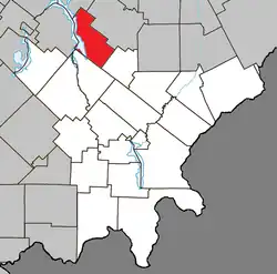 Location within Le Granit RCM | |
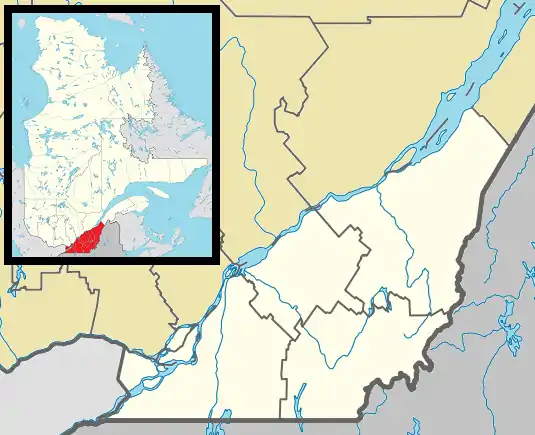 Lambton Location in southern Quebec | |
| Coordinates: 45°50′N 71°05′W[1] | |
| Country | |
| Province | |
| Region | Estrie |
| RCM | Le Granit |
| Constituted | December 23, 1976 |
| Government | |
| • Mayor | Ghislain Bolduc |
| • Federal riding | Mégantic—L'Érable |
| • Prov. riding | Mégantic |
| Area | |
| • Total | 124.70 km2 (48.15 sq mi) |
| • Land | 108.45 km2 (41.87 sq mi) |
| Population | |
| • Total | 1,630 |
| • Density | 15/km2 (40/sq mi) |
| • Pop 2016-2021 | |
| • Dwellings | 1,143 |
| Time zone | UTC−5 (EST) |
| • Summer (DST) | UTC−4 (EDT) |
| Postal code(s) | G0M 1H0 |
| Area code(s) | 418 and 581 |
| Highways | |
| Website | www |
Lambton is mostly rural and agricultural area with some business on the two main roads in town.
Infrastructure
The main roads connecting Lambton are Route 108 and Route 263.
References
- "Banque de noms de lieux du Québec: Reference number 80867". toponymie.gouv.qc.ca (in French). Commission de toponymie du Québec.
- "Répertoire des municipalités: Geographic code 30095". www.mamh.gouv.qc.ca (in French). Ministère des Affaires municipales et de l'Habitation.
- https://www12.statcan.gc.ca/census-recensement/2021/dp-pd/prof/details/page.cfm?LANG=E&GENDERlist=1&STATISTIClist=1,4&DGUIDlist=2021A00052430095&HEADERlist=0&SearchText=Lambton
External links
 Media related to Lambton, Quebec at Wikimedia Commons
Places adjacent to Lambton, Quebec | ||||||||||||||||
|---|---|---|---|---|---|---|---|---|---|---|---|---|---|---|---|---|
| ||||||||||||||||
| Cities | |
|---|---|
| Municipalities |
|
| Parishes | |
| Townships | |
| |
This article is issued from Wikipedia. The text is licensed under Creative Commons - Attribution - Sharealike. Additional terms may apply for the media files.