Ouricuri
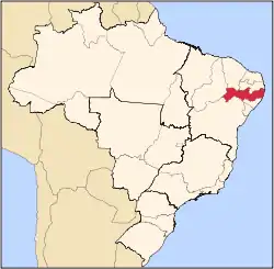
Ouricuri is a city in the state of Pernambuco, Brazil. It is located in the mesoregion of Sertão Pernambucano. Ouricuri has a total area of 2,423 square kilometers and had an estimated population of 66,978 inhabitants [1] in 2009 according to the IBGE.

Ouricuri | |
|---|---|
City | |
| Country | Brazil |
| State | Pernambuco |
Geography
- State - Pernambuco
- Region - Sertão Pernambucano
- Boundaries - Araripina, Trindade and Ipubi (N), Santa Cruz and Santa Filomena (S), Parnamirim and Bodocó (E), Piaui state (W)
- Area - 2,423 km2
- Elevation - 451 m
- Hydrography - Brigida River
- Vegetation - Caatinga
- Climate - Semi-arid (Sertao) hot and dry
- Annual average temperature - 25.5 c
- Main road - BR 232 and BR 316
- Distance to Recife - 621 km
Climate
| Climate data for Ouricuri (1991–2020) | |||||||||||||
|---|---|---|---|---|---|---|---|---|---|---|---|---|---|
| Month | Jan | Feb | Mar | Apr | May | Jun | Jul | Aug | Sep | Oct | Nov | Dec | Year |
| Mean daily maximum °C (°F) | 32.5 (90.5) |
31.7 (89.1) |
31.6 (88.9) |
30.9 (87.6) |
30.7 (87.3) |
29.8 (85.6) |
29.7 (85.5) |
31.0 (87.8) |
32.9 (91.2) |
34.4 (93.9) |
34.5 (94.1) |
33.7 (92.7) |
32.0 (89.6) |
| Daily mean °C (°F) | — | 26.3 (79.3) |
26.1 (79.0) |
25.6 (78.1) |
25.3 (77.5) |
24.3 (75.7) |
23.8 (74.8) |
24.7 (76.5) |
26.4 (79.5) |
28.0 (82.4) |
28.4 (83.1) |
27.9 (82.2) |
— |
| Mean daily minimum °C (°F) | — | 22.1 (71.8) |
22.2 (72.0) |
21.7 (71.1) |
21.1 (70.0) |
20.0 (68.0) |
19.3 (66.7) |
19.5 (67.1) |
20.7 (69.3) |
22.2 (72.0) |
23.0 (73.4) |
23.0 (73.4) |
— |
| Average precipitation mm (inches) | 95.1 (3.74) |
103.4 (4.07) |
135.6 (5.34) |
83.3 (3.28) |
41.3 (1.63) |
8.6 (0.34) |
11.8 (0.46) |
3.9 (0.15) |
2.6 (0.10) |
14.1 (0.56) |
31.5 (1.24) |
76.8 (3.02) |
608.0 (23.94) |
| Average precipitation days (≥ 1.0 mm) | 6.5 | 6.5 | 9.3 | 6.8 | 4.4 | 2.5 | 3.0 | 1.0 | 0.4 | 0.9 | 2.8 | 4.7 | 48.8 |
| Average dew point °C (°F) | 19.7 (67.5) |
20.4 (68.7) |
21.0 (69.8) |
20.8 (69.4) |
19.7 (67.5) |
18.0 (64.4) |
16.8 (62.2) |
16.0 (60.8) |
15.8 (60.4) |
16.8 (62.2) |
17.8 (64.0) |
18.8 (65.8) |
18.5 (65.3) |
| Mean monthly sunshine hours | 215.3 | 183.7 | 208.6 | 204.8 | 199.4 | 191.4 | 204.9 | 255.3 | 264.7 | 286.8 | 258.2 | 249.0 | 2,722.1 |
| Source: NOAA[2] | |||||||||||||
Economy
The main economic activities in Ouricuri are based in extraction of gypsum and no metallic minerals, and primary sector especially creation of goats, donkeys, pigs and farms with beans, manioc and corn. Ouricuri is located in the micro region of Araripina which contains 95% of the Brazilian reserves of Gypsum.
Economic Indicators
| Population | GDP x(1000 R$).[3] | GDP pc (R$) | PE |
|---|---|---|---|
| 66.978 | 200.880 | 3.186 | 0.33% |
Economy by Sector 2006
| Primary sector | Secondary sector | Service sector |
|---|---|---|
| 6.51% | 17.42% | 76.07% |
Health Indicators
| HDI (2000) | Hospitals (2007) | Hospitals beds (2007) | Children's Mortality every 1000 (2005) |
|---|---|---|---|
| 0.614 | 2 | 165 | 27.4 |
The institutions that is responsible for public healthcare in Ouricuri and region of the Araripe are; Municipal Health Secretary of Ouricuri (SMSO), Intermunicipal Health Consortium of Pernambuco (CIAPE)
References
- http://www.ibge.gov.br/home/estatistica/populacao/estimativa2009/POP2009_DOU.pdf IBGE Population 2009 Ouricuri, page 34
- "World Meteorological Organization Climate Normals for 1991-2020 — Ouricuri". National Oceanic and Atmospheric Administration. Retrieved January 31, 2024.
- Ouricuri 2007 GDP IBGE page 31 Archived 2016-03-04 at the Wayback Machine
- PE State site - City by city profile
Capital: Recife | ||||||||||||||
| Mesoregion Agreste Pernambucano |
|  | ||||||||||||
| Mesoregion Mata Pernambucana |
| |||||||||||||
| Mesoregion Metropolitana de Recife |
| |||||||||||||
| Mesoregion Sao Francisco Pernambucano |
| |||||||||||||
| Mesoregion Sertão Pernambucano |
| |||||||||||||