Whichello, Queensland
Whichello is a rural locality in the Toowoomba Region, Queensland, Australia.[3] In the 2021 census, Whichello had a population of 31 people.[4]
| Whichello Queensland | |||||||||||||||
|---|---|---|---|---|---|---|---|---|---|---|---|---|---|---|---|
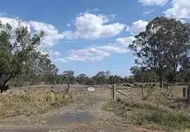 Paddock along Pechey Maclagan Road, 2014 | |||||||||||||||
 Whichello | |||||||||||||||
| Coordinates | 27.2941°S 151.9980°E | ||||||||||||||
| Population | 31 (SAL 2016)[1][2] | ||||||||||||||
| Postcode(s) | 4352 | ||||||||||||||
| Area | 11.7 km2 (4.5 sq mi) | ||||||||||||||
| Time zone | AEST (UTC+10:00) | ||||||||||||||
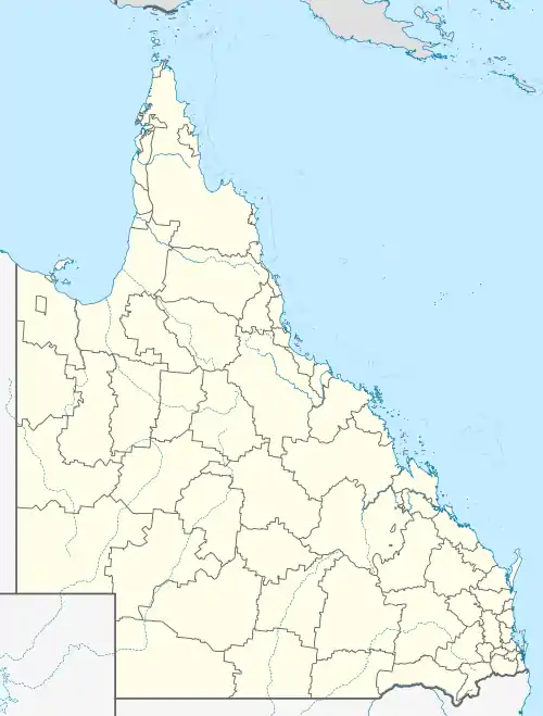
| Location |
| ||||||||||||||
| LGA(s) | Toowoomba Region | ||||||||||||||
| State electorate(s) | Condamine | ||||||||||||||
| Federal division(s) | Maranoa | ||||||||||||||
| |||||||||||||||
Geography

Whichello is on the Darling Downs in southern Queensland. It is bounded to the north-east by the Great Dividing Range.[5]
The terrain ranges from 560 to 75 metres (1,837 to 246 ft) above sea level. The land use is predominantly grazing on native vegetation with some crop growing.[6]
The Pechey-Maclagan Road runs through from east (Pechey) to south (Groomsville).[7]
History

Whichello Provisional School opened on 18 April 1894. On 1 January 1909, it became Whichello State School. It closed on 22 January 1942.[8][9] It was on a 5-acre (2.0 ha) site on the northern side of Whichello School Road (27.29223°S 152.01097°E).[10][11] The site is now a park.[12]
Whichello Methodist Church opened in March 1907.[13] It was on a 1-acre (0.40 ha) on the northern side of Whichello School Road (27.29296°S 152.01425°E), appox 325 metres (1,066 ft) east of the school.[10][11] The timber church could seat 50 people. In 1952, the church building was relocated to Wilsonton.[14]
Demographics
In the 2016 census, Whichello had a population of 31 people.[15]
In the 2021 census, Whichello had a population of 31 people.[4]
Education
There are no schools in Whichello. The nearest government primary schools are Crows Nest State School in neighbouring Crows Nest to the north-east and Goombungee State School in Goombungee to the south-west. The nearest government secondary schools are Crows Nest State School (to Year 10) and Highfields State Secondary College (to Year 12) in Highfields to the south.[16]
References
- Australian Bureau of Statistics (27 June 2017). "Whichello (suburb and locality)". Australian Census 2016.
- Australian Bureau of Statistics (27 June 2017). "Whichello (suburb and locality)". Australian Census 2016 QuickStats. Retrieved 28 June 2022.
- "Whichello – locality in Toowoomba Region (entry 48094)". Queensland Place Names. Queensland Government. Retrieved 17 November 2019.
- Australian Bureau of Statistics (28 June 2022). "Whichello (SAL)". 2021 Census QuickStats. Retrieved 28 February 2023.
- "Layers: Locality; Mountains and ranges; Contours; Watercourses". Queensland Globe. Queensland Government. Archived from the original on 19 December 2017. Retrieved 13 March 2024.
- "Layers: Locality; Protected areas and forests; Land use". Queensland Globe. Queensland Government. Archived from the original on 19 December 2017. Retrieved 13 March 2024.
- Whichello, Queensland (Map). OpenStreetMap. Archived from the original on 28 March 2022. Retrieved 28 March 2022.
- Queensland Family History Society (2010), Queensland schools past and present (Version 1.01 ed.), Queensland Family History Society, ISBN 978-1-921171-26-0
- "Agency ID 9273, Whichello State School". Queensland State Archives. Retrieved 24 September 2023.
- "Crows Nest" (Map). Queensland Government. 1945. Archived from the original on 23 September 2023. Retrieved 24 September 2023.
- "Parish of Douglas" (Map). Queensland Government. 1951. Archived from the original on 23 September 2023. Retrieved 24 September 2023.
- "Queensland Globe". State of Queensland. Retrieved 24 September 2023.
- "DOWNS NEWS". Darling Downs Gazette. Vol. XLIX, no. 7, 969. Queensland, Australia. 23 March 1907. p. 7. Archived from the original on 13 March 2024. Retrieved 24 September 2023 – via National Library of Australia.
- "Whichello Methodist Church | Whichello". Queensland Religious Places Database. Archived from the original on 13 March 2024. Retrieved 13 March 2024.
- Australian Bureau of Statistics (27 June 2017). "Whichello (SSC)". 2016 Census QuickStats. Retrieved 20 October 2018.
- "Layers: Locality; Schools and school catchments". Queensland Globe. Queensland Government. Archived from the original on 19 December 2017. Retrieved 13 March 2024.