Klatovy District
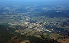
Klatovy District (Czech: Okres Klatovy) is a district in the Plzeň Region of the Czech Republic. Its capital is the town of Klatovy. With its area of 1,946 km2 (751 sq mi) it is the largest district in the Czech Republic.
Klatovy District
Okres Klatovy | |
|---|---|
 Location in the Plzeň Region within the Czech Republic | |
| Coordinates: 49°16′N 13°25′E | |
| Country | |
| Region | Plzeň |
| Capital | Klatovy |
| Area | |
| • Total | 1,945.72 km2 (751.25 sq mi) |
| Population (2022)[2] | |
| • Total | 84,614 |
| • Density | 43/km2 (110/sq mi) |
| Time zone | UTC+1 (CET) |
| • Summer (DST) | UTC+2 (CEST) |
| Municipalities | 94 |
| * Towns | 15 |
| * Market towns | 4 |
Administrative division
Klatovy District is divided into three administrative districts of municipalities with extended competence: Klatovy, Horažďovice and Sušice.
List of municipalities
Towns are marked in bold and market towns in italics:
Běhařov - Běšiny - Bezděkov - Biřkov - Bolešiny - Břežany - Budětice - Bukovník - Čachrov - Černíkov - Červené Poříčí - Chanovice - Chlistov - Chudenice - Chudenín - Číhaň - Čímice - Dešenice - Dlažov - Dlouhá Ves - Dobršín - Dolany - Domoraz - Dražovice - Frymburk - Hamry - Hartmanice - Hejná - Hlavňovice - Hnačov - Horažďovice - Horská Kvilda - Hrádek - Hradešice - Janovice nad Úhlavou - Javor - Ježovy - Kašperské Hory - Kejnice - Klatovy - Klenová - Kolinec - Kovčín - Křenice - Kvášňovice - Lomec - Malý Bor - Maňovice - Měčín - Mezihoří - Mlýnské Struhadlo - Modrava - Mochtín - Mokrosuky - Myslív - Myslovice - Nalžovské Hory - Nehodiv - Nezamyslice - Nezdice na Šumavě - Nýrsko - Obytce - Olšany - Ostřetice - Pačejov - Petrovice u Sušice - Plánice - Podmokly - Poleň - Prášily - Předslav - Rabí - Rejštejn - Slatina - Soběšice - Srní - Strašín - Strážov - Sušice - Svéradice - Švihov - Tužice - Týnec - Újezd u Plánice - Velhartice - Velké Hydčice - Velký Bor - Vrhaveč - Vřeskovice - Zavlekov - Zborovy - Železná Ruda - Žichovice - Žihobce
Geography
Klatovy District is the largest Czech district with an area of 1,946 km2 (751 sq mi). It borders Germany in the southwest. The landscape is very rugged. Most of the territory has a foothill character, but along the state border, the landscape is mountainous, and in the northeast, the terrain is only slightly undulating. The territory extends into five geomorphological mesoregions: Bohemian Forest Foothills (centre and east), Bohemian Forest (south and southwest), Blatná Uplands (northeast), Švihov Highlands (northwest) and Cham-Furth Depression (small part in the west). The highest point of the district and of the entire Plzeň Region is the mountain Velká Mokrůvka in Modrava with an elevation of 1,370 m (4,490 ft). The lowest point is the river bed of the Úhlava in Červené Poříčí at 362 m (1,188 ft).
The area is rich in rivers. Both sources of the Otava River, Křemelná and Vydra, originate here. The Otava then continues to flow across the eastern part of the district. Similarly important is the Úhlava, which also springs here and flows through the western part of the district. The other important rives that springs here are Regen and Úslava.
The largest bodies of water are the Nýrsko Reservoir with an area of 148 ha (370 acres)[3] and Kovčínský Pond with an area of 106 ha (260 acres).[4] Two of the few natural lakes in the country, Černé and Čertovo, lie within the district.
In the south is located a large part of the Šumava National Park. The territory in the southwest falls under the protection of the Šumava Protected Landscape Area.
Most populated municipalities
| Name | Population[2] | Area (km2) |
|---|---|---|
| Klatovy | 21,587 | 81 |
| Sušice | 10,662 | 46 |
| Horažďovice | 5,113 | 43 |
| Nýrsko | 4,806 | 32 |
| Janovice nad Úhlavou | 2,307 | 28 |
| Švihov | 1,644 | 35 |
| Plánice | 1,631 | 56 |
| Železná Ruda | 1,573 | 80 |
| Kolinec | 1,437 | 49 |
| Kašperské Hory | 1,375 | 44 |
Economy
The largest employers with its headquarters in Klatovy District and at least 500 employers are:[5]
| Economic entity | Location | Number of employees | Activity |
|---|---|---|---|
| Klatovy Hospital | Klatovy | 1,000–1,499 | Health care |
| Rodenstock ČR | Klatovy | 1,000–1,499 | Manufacture of spectacle lenses |
| Pfeifer Holz | Chanovice | 500–999 | Manufacture of wooden products |
Transport
There are no motorways passing through the district. The most important road is the I/27 (part of European route E53) from Plzeň to the Czech-German border via Klatovy.
Sights
_2.JPG.webp)
The most important monuments in the district, protected as national cultural monuments, are:[6]
- Rabí Castle
- Švihov Castle
- Velhartice Castle
- Červené Poříčí Castle
- Týnec Castle
The best-preserved settlements and landscapes, protected as monument reservations and monument zones, are:[7]
- Dobršín (monument reservation)
- Horažďovice
- Kašperské Hory
- Klatovy
- Rabí
- Strážov
- Sušice
- Velhartice
- Břežany
- Hradešice
- Chanovice
- Ostřetice
- Poleň
- Velké Hydčice
- Chudenicko landscape
Five of the ten most visited tourist destinations of the Plzeň Region are located in Klatovy District. The most visited tourist destinations are the Rabí Castle, Velhartice Castle, Klenová Castle, Kašperk Castle and Švihov Castle.[8]
References
- "Small Lexicon of Municipalities of the Czech Republic – 2022". Czech Statistical Office. 2022-12-15.
- "Population of Municipalities – 1 January 2022". Czech Statistical Office. 2022-04-29.
- "VD Nýrsko" (PDF) (in Czech). Povodí Vltavy. Retrieved 2023-02-16.
- "Klatovští rybáři loví svůj největší rybník Kovčín na Klatovsku". Naše voda (in Czech). 2020-11-25. Retrieved 2023-02-16.
- "Registr ekonomických subjektů". Business Register (in Czech). Czech Statistical Office. Retrieved 2023-02-16.
- "Výsledky vyhledávání: Národní kulturní památky, okres Klatovy". Ústřední seznam kulturních památek (in Czech). National Heritage Institute. Retrieved 2023-02-16.
- "Výsledky vyhledávání: Památkové rezervace, Památkové zóny, okres Klatovy". Ústřední seznam kulturních památek (in Czech). National Heritage Institute. Retrieved 2023-02-16.
- "Turisté mají v České republice nejraději zoologické zahrady, technické památky, koupání a Pražský hrad" (in Czech). CzechTourism. 2022-06-24. Retrieved 2023-02-16.
External links
- Klatovy District profile on the Czech Statistical Office's website