Morris County, New Jersey
Morris County is a county in the U.S. state of New Jersey, close to New York City. As of 2017, there was 499,693 people living in the county. This made it the 10th-most populous county in New Jersey.[2][3][4] The county seat is Morristown.[5] The place where most people live at is Parsippany-Troy Hills Township, with 53,238 people, while the largest place is Rockaway Township, at 45.55 square miles (118.0 km2).
Morris County | |
|---|---|
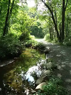 A horse path along a stream in Morris County | |
 Flag | |
 Location within the U.S. state of New Jersey | |
 New Jersey's location within the U.S. | |
| Coordinates: 40.87°N 74.55°W | |
| Country | |
| State | |
| Founded | March 15, 1739[1] |
| Named for | Colonial governor Lewis Morris |
| Seat | Morristown |
| Largest city | Parsippany-Troy Hills Township (population) Rockaway Township (area) |
| Area | |
| • Total | 481.62 sq mi (1,247.4 km2) |
| • Land | 460.18 sq mi (1,191.9 km2) |
| • Water | 21.45 sq mi (55.6 km2) 4.45%% |
| Population | |
| • Estimate (2018) | 494,228 |
| • Density | 1,085/sq mi (419.1/km2) |
| Congressional districts | 7th, 11th |
| Website | www |
History
Lenape Native Americans used to live in New Jersey. They lived near rivers and hunted, fished, and got plants and nuts.
Henry Hudson explored New Jersey in the 1600s. After he did, the Dutch came and made small towns and cities. They traded tools with the Native Americans for food and fur.
Then, the British took over the land that the Dutch owned. They built the first towns and mines in what is now Morris County.[6][7] But by 1750, there were no more Native Americans in New Jersey, because the Native Americans lost their land, grew less food, and got very sick. They all went to the Ohio Valley or Eastern Canada instead.
Morris County was made for real in 1739, from parts of Hunterdon County.[8] It was named after a governor named Lewis Morris.[9]
During the battles of Trenton and Princeton during the American Revolution, George Washington and his men camped here. You can still see the place where they camped today; it's called Jockey Hollow.[10]
Geography
This county is 481.62 square miles, according to the 2010 Census.[11][12]

References
- Snyder, John P. The Story of New Jersey's Civil Boundaries: 1606–1968, Bureau of Geology and Topography; Trenton, New Jersey; 1969. p. 191. Accessed January 21, 2013.
- QuickFacts – Morris County, New Jersey; New Jersey; United States, United States Census Bureau. Accessed March 25, 2018.
- Annual Estimates of the Resident Population: April 1, 2010 to July 1, 2017 - 2017 Population Estimates Archived February 13, 2020, at Archive.today, United States Census Bureau. Accessed March 24, 2018.
- GCT-PEPANNCHG: Estimates of Resident Population Change and Rankings: July 1, 2016 to July 1, 2017 - State -- County / County Equivalent from the 2017 Population Estimates for New Jersey Archived February 13, 2020, at Archive.today, United States Census Bureau. Accessed March 24, 2018.
- New Jersey County Map, New Jersey Department of State. Accessed July 10, 2017.
- "Third Anglo-Dutch War, 1672-1674". www.historyofwar.org. Retrieved 2019-03-23.
- Morris County profile[permanent dead link], Choose: New Jersey. Accessed October 6, 2013.
- Snyder, John P. The Story of New Jersey's Civil Boundaries: 1606–1968, Bureau of Geology and Topography; Trenton, New Jersey; 1969. p. 191. Accessed January 21, 2013.
- "Morris County Web Site – History – The Land Past and Present". Co.morris.nj.us. Archived from the original on August 22, 2009. Retrieved August 9, 2011.
- Adams, III, Charles J. "Jockey Hollow Was Refuge For Continental Army", Reading Eagle, July 20, 2006. Accessed October 6, 2013.
- New Jersey: 2010 – Population and Housing Unit Counts; 2010 Census of Population and Housing, p. 6, CPH-2-32. United States Census Bureau, August 2012. Accessed August 29, 2016.
- "Census 2010 U.S. Gazetteer Files: New Jersey Counties". Archived from the original on 2012-06-11., United States Census Bureau, Backed up by the Internet Archive as of June 11, 2012. Accessed October 6, 2013.

Municipalities and communities of Morris County, New Jersey, United States | ||
|---|---|---|
| Boroughs |
| Map of New Jersey highlighting Morris County |
| Towns |
| |
| Townships |
| |
| CDPs |
| |
| Other communities |
| |