Santa Clarita, California
Santa Clarita, officially the City of Santa Clarita, is the fourth largest city in Los Angeles County, California. It is the 24th largest city in the state of California. The city has annexed unincorporated areas, which has made the population higher. Santa Clarita is about 35 miles (56 km) northwest of downtown Los Angeles. It takes up most of Santa Clarita Valley. It is a good example of a U.S. edge city or boomburb. Santa Clarita was ranked by Money magazine in 2006 as 18th of the top 100 places to live.[7] There are four smaller communities in Santa Clarita. They are called Valencia, Saugus, Newhall, and Canyon Country. Santa Clarita is well known for the amusement park Six Flags Magic Mountain as well as the TV program Santa Clarita Diet.
Santa Clarita, California | |
|---|---|
| City of Santa Clarita | |
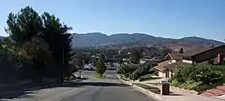 Santa Clarita's Canyon Country in September 2008. | |
 Flag  Seal | |
 Location of Santa Clarita in California and Los Angeles County | |
 Santa Clarita Location in the United States  Santa Clarita Santa Clarita (the United States) | |
| Coordinates: 34°25′00″N 118°30′23″W | |
| Country | |
| State | |
| County | |
| Incorporated | December 15, 1987[1] |
| Named for | Santa Clara, California |
| Government | |
| • Type | Council-Manager |
| • Mayor | Laurene Weste |
| • Mayor Pro-Tem | Marsha McLean |
| • City council | Bob Kellar Bill Miranda Cameron Smyth |
| • City manager | Ken Striplin[2] |
| Area | |
| • City | 52.81 sq mi (136.78 km2) |
| • Land | 52.76 sq mi (136.65 km2) |
| • Water | 0.05 sq mi (0.13 km2) 0.099% |
| Elevation | 1,207 ft (368 m) |
| Population | |
| • City | 176,320 |
| • Estimate (2016) | 181,972 |
| • Rank | 4th in Los Angeles County 24th in California |
| • Density | 3,449.12/sq mi (1,331.71/km2) |
| • Metro | 13,155,788 |
| Demonym(s) | Santa Claritan |
| Time zone | UTC−08:00 (Pacific) |
| • Summer (DST) | UTC−07:00 (PDT) |
| ZIP codes[6] | 91310, 91321–91322, 91350–91351, 91354–91355, 91380–91387, 91390 |
| Area code | 661 |
| FIPS code | 06-69088 |
| GNIS feature IDs | 1662338, 2411819 |
| Website | www |
History
Santa Clarita became a city in December 1987, but its history stretches back many hundreds of years. In the year 450, a group of Native Americans called the Tataviam arrived in the valley, and as many as 2,000 lived there at their height.
In 1842, Francisco Lopez found gold in the area. It was the first recorded gold in the state.[8] It is marked in an area called Placerita Canyon, which was also the original "back lot" area for Hollywood movie makers.
The town of Newhall is named after Henry Mayo Newhall, a businessman who became rich during the California Gold Rush. At first, he founded H.M. Newhall & Company, an auction house in San Francisco. Then, he got into the railroad business. He put money into companies that would join San Francisco to other cities and was in charge of the San Francisco and San Jose Railroad. He sold the business to the Southern Pacific Railroad in 1870, and was one of the people in charge of it.
After railroads, Newhall started focusing on real estate and ranching. He bought 143,000 acres of land between Los Angeles and Monterey counties. The largest piece of land was the 46,460 acres of land in northern Los Angeles County which was called the Rancho San Francisco, later called Newhall Ranch. He sold some of his property to the Southern Pacific Railroad which built a train line through the present-day Newhall Pass. They also built a town and named it after Newhall. The first station North on the new line was named Saugus by Newhall, after his hometown of Saugus, Massachusetts. His children created the Newhall Land and Farming Company that helped build the rest of Santa Clarita.
On September 5, 1876, Charles Crocker and Leland Stanford (en) joined their railroads together in Canyon Country, linking Los Angeles with the rest of the country for the first time.
A couple of weeks later, on September 26, Charles Alexander Mentry built California's first useful oil well in Mentryville, helping kickstart the Southern California oil industry. The oil was cleaned in Newhall, in what is now the oldest existing oil cleaner in the world. It was open between 1874 and 1888.
The Saugus Cafe on Railroad Avenue in Saugus was opened in 1887. It is far and away the oldest open restaurant in Los Angeles County and the 16th oldest open restaurant in the state.[9][10]
Filming in Santa Clarita began at the turn of the century and featured actors including William S. Hart and John Wayne. Hart and actor Harry Carey both have parks named after them in the county.
The Santa Clarita Valley was the scene of the second most deadly disaster in Californian history, behind the 1906 San Francisco earthquake. It was known as the "worst civil engineering failure of the 20th century". Before midnight on March 12, 1928, the St. Francis Dam collapsed. It caused a flood to rush all the way West to the Pacific Ocean near Ventura. An estimated 431 people were killed, and the site of the present-day Westfield Valencia Town Center was buried in muck. The disaster resulted in the end of the career of engineer William Mulholland.
After many attempts to form a city or a county, the four communities of Canyon Country, Newhall, Saugus, and Valencia finally joined to become the City of Santa Clarita at 4:30 PM on December 15, 1987.
Geography
Santa Clarita is located in the Santa Clarita Valley, a valley in northern Los Angeles County, just north of the San Fernando Valley and southwest of the Antelope Valley. The Santa Clara River runs east–west through the valley. Freeways Interstate 5 and State Route 14 also run across the valley. Six Flags Magic Mountain is located just west of Interstate 5, in Stevenson Ranch. Smaller hills also cross the valley.[11] Hiking trails are common in the hills, including Central Park, Quigley Canyon, East Canyon, Rice Canyon, and Towsley Canyon.
Climate
Santa Clarita has a Mediterranean climate with warm and dry days throughout the year. This, along with the Chaparral ecosystem in the area, makes wildfires common in the summer.
| Climate data for Santa Clarita, California | |||||||||||||
|---|---|---|---|---|---|---|---|---|---|---|---|---|---|
| Month | Jan | Feb | Mar | Apr | May | Jun | Jul | Aug | Sep | Oct | Nov | Dec | Year |
| Average high °F (°C) | 64 (18) |
66 (19) |
68 (20) |
74 (23) |
79 (26) |
88 (31) |
94 (34) |
95 (35) |
91 (33) |
82 (28) |
72 (22) |
65 (18) |
78 (26) |
| Average low °F (°C) | 36 (2) |
37 (3) |
38 (3) |
41 (5) |
45 (7) |
50 (10) |
54 (12) |
55 (13) |
52 (11) |
46 (8) |
39 (4) |
36 (2) |
44 (7) |
| Average precipitation inches (mm) | 2.99 (76) |
3.50 (89) |
3.03 (77) |
.63 (16) |
.22 (5.6) |
.01 (0.25) |
.01 (0.25) |
.11 (2.8) |
.27 (6.9) |
.36 (9.1) |
1.22 (31) |
1.61 (41) |
13.96 (355) |
| Source: [12] | |||||||||||||
References
- "California Cities by Incorporation Date". California Association of Local Agency Formation Commissions. Archived from the original (Word) on November 3, 2014. Retrieved August 25, 2014.
- "City Manager's Office". City of Santa Clarita. Retrieved January 30, 2015.
- "2016 U.S. Gazetteer Files". United States Census Bureau. Retrieved June 28, 2017.
- "Santa Clarita". Geographic Names Information System. United States Geological Survey. Retrieved November 5, 2014.
- California Department of Finance Press Release Archived June 4, 2016, at the Wayback Machine
- "ZIP Code(tm) Lookup". United States Postal Service. Retrieved December 6, 2014.
- MONEY Magazine: Best places to live 2006
- "California's REAL First Gold". scvhistory.com. Retrieved July 13, 2018.
- "LA's oldest restaurant keeps a 130-year diner tradition alive". Eater LA. Retrieved July 13, 2018.
- "Oldest Restaurants in California". www.oldestrestaurants.com. Retrieved July 13, 2018.
- "Google Maps". Google Maps. Retrieved September 20, 2018.
- "Average weather for Santa Clarita". Weather.com. Retrieved March 28, 2008.
Municipalities and communities of Los Angeles County, California, United States | ||
|---|---|---|
| Cities |
|  Los Angeles County map |
| CDPs |
| |
| Unincorporated communities |
| |
| Former settlements |
| |
| Main city |  | |
|---|---|---|
| Counties | ||
| Satellite cities | ||
| Cities >200k | ||
| Cities and towns 100k–200k |
| |
| Area regions | ||
| Landforms | ||
| Bodies of water | ||