Chalais, Indre
Chalais (French pronunciation: [ʃalɛ]) is a commune in the Indre department in central France.
Chalais | |
|---|---|
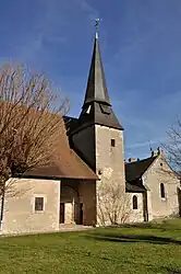 The church of Saint-Léobon, in Chalais | |
Location of Chalais | |
 Chalais 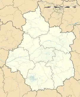 Chalais | |
| Coordinates: 46°32′15″N 1°11′52″E | |
| Country | France |
| Region | Centre-Val de Loire |
| Department | Indre |
| Arrondissement | Le Blanc |
| Canton | Saint-Gaultier |
| Government | |
| • Mayor (2020–2026) | Frédérique Vrignat[1] |
| Area 1 | 39.65 km2 (15.31 sq mi) |
| Population (2021)[2] | 152 |
| • Density | 3.8/km2 (9.9/sq mi) |
| Time zone | UTC+01:00 (CET) |
| • Summer (DST) | UTC+02:00 (CEST) |
| INSEE/Postal code | 36036 /36370 |
| Elevation | 95–161 m (312–528 ft) (avg. 144 m or 472 ft) |
| 1 French Land Register data, which excludes lakes, ponds, glaciers > 1 km2 (0.386 sq mi or 247 acres) and river estuaries. | |
Geography
The commune is located in the parc naturel régional de la Brenne.
The river Anglin flows northwest through the southwestern part of the commune.
Population
| Year | Pop. | ±% p.a. |
|---|---|---|
| 1968 | 325 | — |
| 1975 | 257 | −3.30% |
| 1982 | 198 | −3.66% |
| 1990 | 186 | −0.78% |
| 1999 | 165 | −1.32% |
| 2009 | 168 | +0.18% |
| 2014 | 152 | −1.98% |
| 2020 | 153 | +0.11% |
| Source: INSEE[3] | ||
See also
References
- "Répertoire national des élus: les maires" (in French). data.gouv.fr, Plateforme ouverte des données publiques françaises. 13 September 2022.
- "Populations légales 2021". The National Institute of Statistics and Economic Studies. 28 December 2023.
- Population en historique depuis 1968, INSEE
Wikimedia Commons has media related to Chalais (Indre).
This article is issued from Wikipedia. The text is licensed under Creative Commons - Attribution - Sharealike. Additional terms may apply for the media files.