Rosnay, Indre
Rosnay (French pronunciation: [ʁonɛ]) is a commune in the Indre department in central France.
Rosnay | |
|---|---|
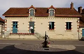 The town hall in Rosnay | |
Location of Rosnay | |
 Rosnay 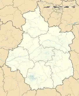 Rosnay | |
| Coordinates: 46°42′06″N 1°12′55″E | |
| Country | France |
| Region | Centre-Val de Loire |
| Department | Indre |
| Arrondissement | Le Blanc |
| Canton | Le Blanc |
| Intercommunality | Brenne Val de Creuse |
| Government | |
| • Mayor (2022–2026) | Serge Bergeat[1] |
| Area 1 | 59.03 km2 (22.79 sq mi) |
| Population (2021)[2] | 520 |
| • Density | 8.8/km2 (23/sq mi) |
| Time zone | UTC+01:00 (CET) |
| • Summer (DST) | UTC+02:00 (CEST) |
| INSEE/Postal code | 36173 /36300 |
| Elevation | 87–133 m (285–436 ft) (avg. 115 m or 377 ft) |
| 1 French Land Register data, which excludes lakes, ponds, glaciers > 1 km2 (0.386 sq mi or 247 acres) and river estuaries. | |
Geography
The commune is located in the parc naturel régional de la Brenne.
Population
| Year | Pop. | ±% p.a. |
|---|---|---|
| 1968 | 686 | — |
| 1975 | 622 | −1.39% |
| 1982 | 529 | −2.29% |
| 1990 | 537 | +0.19% |
| 1999 | 526 | −0.23% |
| 2009 | 615 | +1.58% |
| 2014 | 500 | −4.06% |
| 2020 | 519 | +0.62% |
| Source: INSEE[3] | ||
See also
- Communes of the Indre department
- HWU transmitter
References
- "Répertoire national des élus: les maires" (in French). data.gouv.fr, Plateforme ouverte des données publiques françaises. 4 May 2022.
- "Populations légales 2021". The National Institute of Statistics and Economic Studies. 28 December 2023.
- Population en historique depuis 1968, INSEE
Wikimedia Commons has media related to Rosnay (Indre).
This article is issued from Wikipedia. The text is licensed under Creative Commons - Attribution - Sharealike. Additional terms may apply for the media files.