Chazelet
Chazelet (French pronunciation: [ʃazlɛ]) is a commune in the Indre department in central France.
Chazelet | |
|---|---|
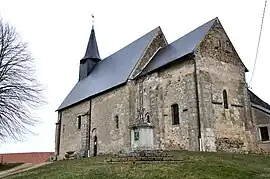 The Church of Saint-Jean-Baptiste, in Chazelet | |
Location of Chazelet | |
 Chazelet 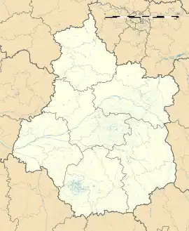 Chazelet | |
| Coordinates: 46°30′33″N 1°26′34″E | |
| Country | France |
| Region | Centre-Val de Loire |
| Department | Indre |
| Arrondissement | Le Blanc |
| Canton | Saint-Gaultier |
| Intercommunality | Brenne Val de Creuse |
| Government | |
| • Mayor (2020–2026) | Dominique Delaigue-Billaud[1] |
| Area 1 | 11.73 km2 (4.53 sq mi) |
| Population (2021)[2] | 125 |
| • Density | 11/km2 (28/sq mi) |
| Time zone | UTC+01:00 (CET) |
| • Summer (DST) | UTC+02:00 (CEST) |
| INSEE/Postal code | 36049 /36170 |
| Elevation | 141–237 m (463–778 ft) (avg. 215 m or 705 ft) |
| 1 French Land Register data, which excludes lakes, ponds, glaciers > 1 km2 (0.386 sq mi or 247 acres) and river estuaries. | |
Geography
The commune is located in the parc naturel régional de la Brenne.
The river Abloux flows west through the southern part of the commune.
Population
| Year | Pop. | ±% p.a. |
|---|---|---|
| 1968 | 189 | — |
| 1975 | 196 | +0.52% |
| 1982 | 150 | −3.75% |
| 1990 | 132 | −1.59% |
| 1999 | 146 | +1.13% |
| 2009 | 118 | −2.11% |
| 2014 | 117 | −0.17% |
| 2020 | 124 | +0.97% |
| Source: INSEE[3] | ||
See also
References
- "Répertoire national des élus: les maires". data.gouv.fr, Plateforme ouverte des données publiques françaises (in French). 9 August 2021.
- "Populations légales 2021". The National Institute of Statistics and Economic Studies. 28 December 2023.
- Population en historique depuis 1968, INSEE
Wikimedia Commons has media related to Chazelet.
This article is issued from Wikipedia. The text is licensed under Creative Commons - Attribution - Sharealike. Additional terms may apply for the media files.