Cholonge
Cholonge (French pronunciation: [ʃɔlɔ̃ʒ]) is a commune in the Isère department in southeastern France.
Cholonge | |
|---|---|
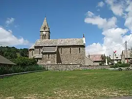 The church of Cholonge | |
Location of Cholonge | |
 Cholonge  Cholonge | |
| Coordinates: 45°00′18″N 5°47′51″E | |
| Country | France |
| Region | Auvergne-Rhône-Alpes |
| Department | Isère |
| Arrondissement | Grenoble |
| Canton | Matheysine-Trièves |
| Intercommunality | La Matheysine |
| Government | |
| • Mayor (2020–2026) | Bruno Kramarczewski[1] |
| Area 1 | 9 km2 (3 sq mi) |
| Population (2021)[2] | 347 |
| • Density | 39/km2 (100/sq mi) |
| Time zone | UTC+01:00 (CET) |
| • Summer (DST) | UTC+02:00 (CEST) |
| INSEE/Postal code | 38106 /38220 |
| Elevation | 905–2,140 m (2,969–7,021 ft) |
| 1 French Land Register data, which excludes lakes, ponds, glaciers > 1 km2 (0.386 sq mi or 247 acres) and river estuaries. | |
Population
| Year | Pop. | ±% p.a. |
|---|---|---|
| 1968 | 124 | — |
| 1975 | 128 | +0.45% |
| 1982 | 139 | +1.18% |
| 1990 | 161 | +1.85% |
| 1999 | 229 | +3.99% |
| 2007 | 305 | +3.65% |
| 2012 | 332 | +1.71% |
| 2017 | 329 | −0.18% |
| Source: INSEE[3] | ||
See also
References
- "Répertoire national des élus: les maires" (in French). data.gouv.fr, Plateforme ouverte des données publiques françaises. 13 September 2022.
- "Populations légales 2021". The National Institute of Statistics and Economic Studies. 28 December 2023.
- Population en historique depuis 1968, INSEE
Wikimedia Commons has media related to Cholonge.
This article is issued from Wikipedia. The text is licensed under Creative Commons - Attribution - Sharealike. Additional terms may apply for the media files.