Saint-Théoffrey
Saint-Théoffrey (French pronunciation: [sɛ̃ teɔfʁɛ]) is a commune in the Isère department in southeastern France.[3]
Saint-Théoffrey | |
|---|---|
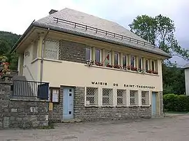 Town hall | |
Location of Saint-Théoffrey | |
 Saint-Théoffrey  Saint-Théoffrey | |
| Coordinates: 44°59′59″N 5°46′25″E | |
| Country | France |
| Region | Auvergne-Rhône-Alpes |
| Department | Isère |
| Arrondissement | Grenoble |
| Canton | Matheysine-Trièves |
| Intercommunality | Matheysine |
| Government | |
| • Mayor (2020–2026) | Alain Mendez[1] |
| Area 1 | 6 km2 (2 sq mi) |
| Population (2021)[2] | 586 |
| • Density | 98/km2 (250/sq mi) |
| Time zone | UTC+01:00 (CET) |
| • Summer (DST) | UTC+02:00 (CEST) |
| INSEE/Postal code | 38462 /38119 |
| Elevation | 905–1,240 m (2,969–4,068 ft) (avg. 940 m or 3,080 ft) |
| 1 French Land Register data, which excludes lakes, ponds, glaciers > 1 km2 (0.386 sq mi or 247 acres) and river estuaries. | |
Population
| Year | Pop. | ±% p.a. |
|---|---|---|
| 1968 | 171 | — |
| 1975 | 115 | −5.51% |
| 1982 | 210 | +8.98% |
| 1990 | 279 | +3.62% |
| 1999 | 342 | +2.29% |
| 2009 | 444 | +2.64% |
| 2014 | 471 | +1.19% |
| 2020 | 563 | +3.02% |
| Source: INSEE[4] | ||
See also
References
- "Répertoire national des élus: les maires". data.gouv.fr, Plateforme ouverte des données publiques françaises (in French). 9 August 2021.
- "Populations légales 2021". The National Institute of Statistics and Economic Studies. 28 December 2023.
- INSEE commune file
- Population en historique depuis 1968, INSEE
Wikimedia Commons has media related to Saint-Théoffrey.
This article is issued from Wikipedia. The text is licensed under Creative Commons - Attribution - Sharealike. Additional terms may apply for the media files.