Le Champ-près-Froges
Le Champ-près-Froges (French pronunciation: [lə ʃɑ̃ pʁɛ fʁɔʒ], literally Le Champ near Froges) is a commune in the Isère department in southeastern France. It is part of the Grenoble urban unit (agglomeration).[3]
Le Champ-près-Froges | |
|---|---|
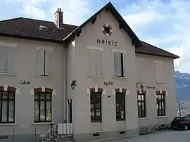 Town hall | |
Location of Le Champ-près-Froges | |
 Le Champ-près-Froges  Le Champ-près-Froges | |
| Coordinates: 45°16′54″N 5°56′22″E | |
| Country | France |
| Region | Auvergne-Rhône-Alpes |
| Department | Isère |
| Arrondissement | Grenoble |
| Canton | Le Haut-Grésivaudan |
| Intercommunality | CC Le Grésivaudan |
| Government | |
| • Mayor (2020–2026) | Mylène Jacquin[1] |
| Area 1 | 5 km2 (2 sq mi) |
| Population (2021)[2] | 1,346 |
| • Density | 270/km2 (700/sq mi) |
| Time zone | UTC+01:00 (CET) |
| • Summer (DST) | UTC+02:00 (CEST) |
| INSEE/Postal code | 38070 /38190 |
| Elevation | 220–826 m (722–2,710 ft) (avg. 320 m or 1,050 ft) |
| 1 French Land Register data, which excludes lakes, ponds, glaciers > 1 km2 (0.386 sq mi or 247 acres) and river estuaries. | |
Population
| Year | Pop. | ±% p.a. |
|---|---|---|
| 1968 | 556 | — |
| 1975 | 701 | +3.37% |
| 1982 | 924 | +4.02% |
| 1990 | 1,008 | +1.09% |
| 1999 | 1,158 | +1.55% |
| 2007 | 1,207 | +0.52% |
| 2012 | 1,229 | +0.36% |
| 2017 | 1,197 | −0.53% |
| Source: INSEE[4] | ||
See also
References
- "Répertoire national des élus: les maires". data.gouv.fr, Plateforme ouverte des données publiques françaises (in French). 9 August 2021.
- "Populations légales 2021". The National Institute of Statistics and Economic Studies. 28 December 2023.
- Unité urbaine 2020 de Grenoble (38701), INSEE
- Population en historique depuis 1968, INSEE
Wikimedia Commons has media related to Le Champ-près-Froges.
This article is issued from Wikipedia. The text is licensed under Creative Commons - Attribution - Sharealike. Additional terms may apply for the media files.