Fremont Peak (Arizona)
Fremont Peak is a peak in the San Francisco Peaks, a mountain range that takes up a part of the Coconino National Forest in northern Arizona. It is the third highest point in the state of Arizona,[1] and named in honor John C. Frémont (1813–1890), an explorer and civil war general, who served as the governor of Arizona Territory from 1878 to 1882.[3] The peak is in the Kachina Peaks Wilderness on the Coconino National Forest.
| Fremont Peak | |
|---|---|
 Doyle Peak and Fremont Peak (right) from the eastern side of Agassiz Peak | |
| Highest point | |
| Elevation | 11,973 ft (3,649 m) NAVD 88[1] |
| Prominence | 615 ft (187 m)[1] |
| Parent peak | Agassiz Peak[1] |
| Coordinates | 35°19′23″N 111°39′40″W[2] |
| Geography | |
 Fremont Peak | |
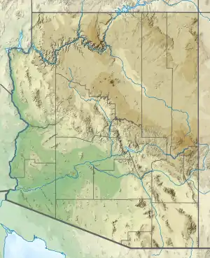
| Location | Coconino County, Arizona, U.S. |
| Parent range | San Francisco Peaks |
| Topo map | USGS Humphreys Peak |
| Geology | |
| Volcanic field | San Francisco volcanic field |
| Climbing | |
| Easiest route | From Doyle Saddle |
Fremont offers year-round views of the south. It can be seen from Flagstaff, Arizona as the pointy peak on the right.
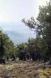
View through a grove of Rocky Mountain Bristlecone Pine growing on the south slope of Fremont Peak, Flagstaff is visible in the background
See also
- List of mountains and hills of Arizona by height
References
- "Fremont Peak, Arizona". Peakbagger.com. Retrieved 2009-01-10.
- "Fremont Peak". Geographic Names Information System. United States Geological Survey, United States Department of the Interior. Retrieved 2009-01-10.
- "History of the San Francisco Peaks and how they got their names". US Forest Service. Archived from the original on 24 February 2023. Retrieved 16 November 2023.
This article is issued from Wikipedia. The text is licensed under Creative Commons - Attribution - Sharealike. Additional terms may apply for the media files.