Mount Turnbull (Arizona)
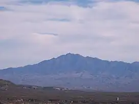
Mount Turnbull (Western Apache: Dził Dlaazhe) is the highest point in the Santa Teresa Mountains in western Graham County, Arizona. The summit has an elevation of 8,284 feet (2,525 m) and a prominence of 3,562 feet (1,086 m). It is the highest point in the Santa Teresa Mountains and the San Carlos Apache Indian Reservation.[1] A recreational permit is required for access to reservation land.[3][4]
| Mount. Turnbull | |
|---|---|
 | |
| Highest point | |
| Elevation | 8,284 ft (2,525 m) NAVD 88[1] |
| Prominence | 3,562 ft (1,086 m)[1] |
| Coordinates | 33°04′26″N 110°15′39″W[2] |
| Geography | |
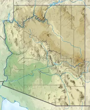 Mount Turnbull Location in Arizona | |
| Location | |
| Parent range | Santa Teresa Mountains |
| Topo map | USGS Mount Turnbull |
References
- "Mount Turnbull, Arizona". Peakbagger.com. Retrieved 2016-08-21.
- "Mount. Turnbull". Geographic Names Information System. United States Geological Survey, United States Department of the Interior. Retrieved 2021-11-13.
- "Information for Permits and Access". San Carlos Apache Reservation. Retrieved 2016-08-21.
- "Mount Turnbull". SummitPost.org. Retrieved 2016-08-21.
This article is issued from Wikipedia. The text is licensed under Creative Commons - Attribution - Sharealike. Additional terms may apply for the media files.