Autrepierre
Autrepierre (French pronunciation: [otʁəpjɛʁ]) is a commune in the Meurthe-et-Moselle department in northeastern France.
Autrepierre | |
|---|---|
_mairie_-_%C3%A9cole.jpg.webp) The town hall and school in Autrepierre | |
 Coat of arms | |
Location of Autrepierre | |
 Autrepierre 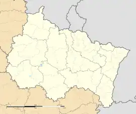 Autrepierre | |
| Coordinates: 48°36′45″N 6°48′07″E | |
| Country | France |
| Region | Grand Est |
| Department | Meurthe-et-Moselle |
| Arrondissement | Lunéville |
| Canton | Baccarat |
| Intercommunality | CC Vezouze Piémont |
| Government | |
| • Mayor (2020–2026) | Yves Grelot[1] |
| Area 1 | 7.75 km2 (2.99 sq mi) |
| Population (2021)[2] | 80 |
| • Density | 10/km2 (27/sq mi) |
| Time zone | UTC+01:00 (CET) |
| • Summer (DST) | UTC+02:00 (CEST) |
| INSEE/Postal code | 54030 /54450 |
| Elevation | 254–346 m (833–1,135 ft) (avg. 290 m or 950 ft) |
| 1 French Land Register data, which excludes lakes, ponds, glaciers > 1 km2 (0.386 sq mi or 247 acres) and river estuaries. | |
Population
| Year | Pop. | ±% p.a. |
|---|---|---|
| 1968 | 157 | — |
| 1975 | 161 | +0.36% |
| 1982 | 133 | −2.69% |
| 1990 | 113 | −2.02% |
| 1999 | 108 | −0.50% |
| 2009 | 120 | +1.06% |
| 2014 | 85 | −6.66% |
| 2020 | 81 | −0.80% |
| Source: INSEE[3] | ||
References
- "Répertoire national des élus: les maires" (in French). data.gouv.fr, Plateforme ouverte des données publiques françaises. 13 September 2022.
- "Populations légales 2021". The National Institute of Statistics and Economic Studies. 28 December 2023.
- Population en historique depuis 1968, INSEE
Wikimedia Commons has media related to Autrepierre.
This article is issued from Wikipedia. The text is licensed under Creative Commons - Attribution - Sharealike. Additional terms may apply for the media files.