Varangéville
Varangéville (French pronunciation: [vaʁɑ̃ʒevil]) is a commune in the Meurthe-et-Moselle département in north-eastern France.
Varangéville | |
|---|---|
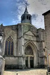 The church in Varangéville | |
 Coat of arms | |
Location of Varangéville | |
 Varangéville 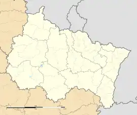 Varangéville | |
| Coordinates: 48°38′02″N 6°18′49″E | |
| Country | France |
| Region | Grand Est |
| Department | Meurthe-et-Moselle |
| Arrondissement | Nancy |
| Canton | Lunéville-1 |
| Intercommunality | CC Pays du Sel et du Vermois |
| Government | |
| • Mayor (2020–2026) | Christopher Varin[1] |
| Area 1 | 12.04 km2 (4.65 sq mi) |
| Population (2021)[2] | 3,578 |
| • Density | 300/km2 (770/sq mi) |
| Time zone | UTC+01:00 (CET) |
| • Summer (DST) | UTC+02:00 (CEST) |
| INSEE/Postal code | 54549 /54110 |
| Elevation | 197–323 m (646–1,060 ft) (avg. 207 m or 679 ft) |
| 1 French Land Register data, which excludes lakes, ponds, glaciers > 1 km2 (0.386 sq mi or 247 acres) and river estuaries. | |
Population
| Year | Pop. | ±% p.a. |
|---|---|---|
| 1968 | 4,385 | — |
| 1975 | 4,301 | −0.28% |
| 1982 | 4,126 | −0.59% |
| 1990 | 4,001 | −0.38% |
| 1999 | 4,241 | +0.65% |
| 2007 | 4,103 | −0.41% |
| 2012 | 3,861 | −1.21% |
| 2017 | 3,652 | −1.11% |
| Source: INSEE[3] | ||
Inhabitants of Varangéville are known as Varangévillois(e)s in French.
References
- "Répertoire national des élus: les maires". data.gouv.fr, Plateforme ouverte des données publiques françaises (in French). 9 August 2021.
- "Populations légales 2021". The National Institute of Statistics and Economic Studies. 28 December 2023.
- Population en historique depuis 1968, INSEE
Wikimedia Commons has media related to Varangéville.
This article is issued from Wikipedia. The text is licensed under Creative Commons - Attribution - Sharealike. Additional terms may apply for the media files.