Cormolain
Cormolain (French pronunciation: [kɔʁmɔlɛ̃] ⓘ) is a commune in the Calvados department in the Normandy region in northwestern France.
Cormolain | |
|---|---|
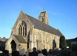 The church in Cormolain | |
Location of Cormolain | |
 Cormolain 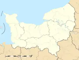 Cormolain | |
| Coordinates: 49°07′51″N 0°51′16″W | |
| Country | France |
| Region | Normandy |
| Department | Calvados |
| Arrondissement | Bayeux |
| Canton | Trévières |
| Intercommunality | CC Isigny-Omaha Intercom |
| Government | |
| • Mayor (2020–2026) | Cédric Poisson[1] |
| Area 1 | 11.04 km2 (4.26 sq mi) |
| Population (2021)[2] | 395 |
| • Density | 36/km2 (93/sq mi) |
| Time zone | UTC+01:00 (CET) |
| • Summer (DST) | UTC+02:00 (CEST) |
| INSEE/Postal code | 14182 /14240 |
| Elevation | 68–180 m (223–591 ft) (avg. 130 m or 430 ft) |
| 1 French Land Register data, which excludes lakes, ponds, glaciers > 1 km2 (0.386 sq mi or 247 acres) and river estuaries. | |
Edward III camped with his army in Cormolain overnight on 23 July 1346 on the way to the battle of Crécy.
Population
| Year | Pop. | ±% |
|---|---|---|
| 1962 | 560 | — |
| 1968 | 544 | −2.9% |
| 1975 | 436 | −19.9% |
| 1982 | 451 | +3.4% |
| 1990 | 397 | −12.0% |
| 1999 | 356 | −10.3% |
| 2008 | 402 | +12.9% |
See also
References
- "Répertoire national des élus: les maires". data.gouv.fr, Plateforme ouverte des données publiques françaises (in French). 9 August 2021.
- "Populations légales 2021". The National Institute of Statistics and Economic Studies. 28 December 2023.
Wikimedia Commons has media related to Cormolain.
This article is issued from Wikipedia. The text is licensed under Creative Commons - Attribution - Sharealike. Additional terms may apply for the media files.