Saint-Omer, Calvados
Saint-Omer (French pronunciation: [sɛ̃.t‿ɔmɛʁ] ⓘ) is a commune in the Calvados department in the Normandy region in northwestern France.
Saint-Omer | |
|---|---|
 A hillside view of Saint-Omer | |
Location of Saint-Omer | |
 Saint-Omer 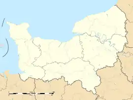 Saint-Omer | |
| Coordinates: 48°55′36″N 0°27′07″W | |
| Country | France |
| Region | Normandy |
| Department | Calvados |
| Arrondissement | Caen |
| Canton | Le Hom |
| Intercommunality | Cingal-Suisse Normande |
| Government | |
| • Mayor (2020–2026) | Claudine Courval[1] |
| Area 1 | 8.07 km2 (3.12 sq mi) |
| Population (2021)[2] | 189 |
| • Density | 23/km2 (61/sq mi) |
| Time zone | UTC+01:00 (CET) |
| • Summer (DST) | UTC+02:00 (CEST) |
| INSEE/Postal code | 14635 /14220 |
| Elevation | 90–306 m (295–1,004 ft) (avg. 306 m or 1,004 ft) |
| 1 French Land Register data, which excludes lakes, ponds, glaciers > 1 km2 (0.386 sq mi or 247 acres) and river estuaries. | |
Geography
The commune is part of the area known as Suisse Normande.[3]
The commune is made up of the following collection of villages and hamlets, Le Mesnil, L'Abbaye du Val, Le Moncel, La Fortinière, Les Hautes Planches, Courteil and Saint-Omer.[4]
The two streams of La Vallee des Vaux and The Orival are the only watercourses running through the commune.
Neighbouring communes[4] | ||||||||||||||||
|---|---|---|---|---|---|---|---|---|---|---|---|---|---|---|---|---|
| ||||||||||||||||
Population
| Year | Pop. | ±% |
|---|---|---|
| 1962 | 188 | — |
| 1968 | 182 | −3.2% |
| 1975 | 184 | +1.1% |
| 1982 | 162 | −12.0% |
| 1990 | 142 | −12.3% |
| 1999 | 157 | +10.6% |
| 2008 | 163 | +3.8% |
Points of Interest
Les Rochers de La Houle is the remains of an ancient mountain range, the Armorican Massif that was gradually eroded by the sea, the remaining 240 metre high fragment is a popular destination for tourists.[5][6]
National heritage sites
Mégalithe du Pré-du-Vivret is a Neolithic Megalith that was classed as a Monument historique in 1954[7][8]
See also
References
- "Répertoire national des élus: les maires". data.gouv.fr, Plateforme ouverte des données publiques françaises (in French). 2 December 2020.
- "Populations légales 2021". The National Institute of Statistics and Economic Studies. 28 December 2023.
- "Map of Suiss Normande" (PDF).
- "Saint-Omer · 14220, France". Saint-Omer · 14220, France.
- "Calvados. Une balade sportive sur les hauteurs de la Suisse Normande". tendanceouest.com.
- "Les rochers de la Houle SAINT-OMER". Normandie Tourisme.
- "Mégalithe à Saint-Omer - PA00111705 - Monumentum". monumentum.fr.
- "Mégalithe du Pré-du-Vivret - Burial Chamber or Dolmen in France in Normandie:Calvados (14)". The Megalithic Portal.