Saint-Rémy, Calvados
Saint Rémy (French pronunciation: [sɛ̃ ʁemi] ⓘ) is a commune in the Calvados department in the Normandy region in northwestern France. Until 1968 an iron mine was exploited in the village.[3]
Saint-Rémy | |
|---|---|
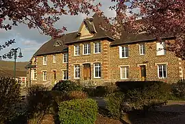 Town hall | |
Location of Saint-Rémy | |
 Saint-Rémy 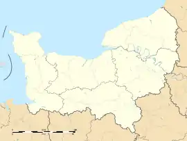 Saint-Rémy | |
| Coordinates: 48°56′27″N 0°30′08″W | |
| Country | France |
| Region | Normandy |
| Department | Calvados |
| Arrondissement | Caen |
| Canton | Le Hom |
| Intercommunality | Cingal-Suisse Normande |
| Government | |
| • Mayor (2020–2026) | Serge Ladan[1] |
| Area 1 | 7.52 km2 (2.90 sq mi) |
| Population (2021)[2] | 982 |
| • Density | 130/km2 (340/sq mi) |
| Time zone | UTC+01:00 (CET) |
| • Summer (DST) | UTC+02:00 (CEST) |
| INSEE/Postal code | 14656 /14570 |
| Elevation | 26–216 m (85–709 ft) (avg. 37 m or 121 ft) |
| 1 French Land Register data, which excludes lakes, ponds, glaciers > 1 km2 (0.386 sq mi or 247 acres) and river estuaries. | |
Geography
The commune is part of the area known as Suisse Normande.[4]
The commune is made up of the following collection of villages and hamlets, Le Pont de la Moussé, Nid de Chien, La Gennière, La Piventière, La Moussé, La Muloisière, L'Église, La Vallée and Saint-Rémy.[5]
The River Orne plus five streams, The Herbion, La Porte, La Vallee des Vaux, La Vignonniere and The Val Fournet are the six watercourses running through the commune.[6]
Neighbouring communes[5] | ||||||||||||||||
|---|---|---|---|---|---|---|---|---|---|---|---|---|---|---|---|---|
| ||||||||||||||||
Population
| Year | Pop. | ±% |
|---|---|---|
| 1962 | 1,075 | — |
| 1968 | 981 | −8.7% |
| 1975 | 1,012 | +3.2% |
| 1982 | 969 | −4.2% |
| 1990 | 993 | +2.5% |
| 1999 | 1,066 | +7.4% |
| 2008 | 1,087 | +2.0% |
Points of interest
National heritage sites
- Saint-Rémy Church is a twelfth centaury church, that was listed as a Monument historique in 1933.[7]
Notable People
- Pierre Surirey de Saint-Remy (1645–1716) a French general was born here.[8]
See also
References
- "Répertoire national des élus: les maires". data.gouv.fr, Plateforme ouverte des données publiques françaises (in French). 9 August 2021.
- "Populations légales 2021". The National Institute of Statistics and Economic Studies. 28 December 2023.
- "Un jeu sur la mine inauguré à Saint-Remy-sur-Orne". Ouest-France.fr. 13 July 2023.
- "Map of Suiss Normande" (PDF).
- "Saint-Rémy · 14570, France". Saint-Rémy · 14570, France.
- Sandre. "Fiche cours d'eau - L'Orne (I2--0200)".
- "Eglise à Saint-Rémy - PA00111720 - Monumentum". monumentum.fr.
- "Pierre Surirey de Saint-Remy (1644-1716)". data.bnf.fr.
Wikimedia Commons has media related to Saint-Rémy (Calvados).
This article is issued from Wikipedia. The text is licensed under Creative Commons - Attribution - Sharealike. Additional terms may apply for the media files.