Cresserons
Cresserons is a commune in the Calvados department in the Normandy region in northwestern France.
Cresserons | |
|---|---|
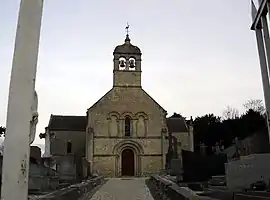 The church in Cresserons | |
Location of Cresserons | |
 Cresserons 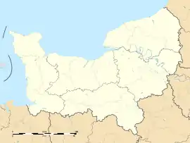 Cresserons | |
| Coordinates: 49°17′19″N 0°21′12″W | |
| Country | France |
| Region | Normandy |
| Department | Calvados |
| Arrondissement | Caen |
| Canton | Courseulles-sur-Mer |
| Intercommunality | Cœur de Nacre |
| Government | |
| • Mayor (2020–2026) | Patrick Lermine[1] |
| Area 1 | 3.59 km2 (1.39 sq mi) |
| Population (2021)[2] | 1,088 |
| • Density | 300/km2 (780/sq mi) |
| Time zone | UTC+01:00 (CET) |
| • Summer (DST) | UTC+02:00 (CEST) |
| INSEE/Postal code | 14197 /14440 |
| Elevation | 17–59 m (56–194 ft) (avg. 30 m or 98 ft) |
| 1 French Land Register data, which excludes lakes, ponds, glaciers > 1 km2 (0.386 sq mi or 247 acres) and river estuaries. | |
Cresserons is located just south of the beaches of Normandy. During the Battle of Normandy in the Second World War, British troops arrived there and a battle was fought on 7 June 1944.
Population
| Year | Pop. | ±% p.a. |
|---|---|---|
| 1968 | 393 | — |
| 1975 | 435 | +1.46% |
| 1982 | 785 | +8.80% |
| 1990 | 953 | +2.45% |
| 1999 | 1,202 | +2.61% |
| 2009 | 1,210 | +0.07% |
| 2014 | 1,184 | −0.43% |
| 2020 | 1,099 | −1.23% |
| Source: INSEE[3] | ||
See also
References
- "Répertoire national des élus: les maires". data.gouv.fr, Plateforme ouverte des données publiques françaises (in French). 2 December 2020.
- "Populations légales 2021". The National Institute of Statistics and Economic Studies. 28 December 2023.
- Population en historique depuis 1968, INSEE
Wikimedia Commons has media related to Cresserons.
This article is issued from Wikipedia. The text is licensed under Creative Commons - Attribution - Sharealike. Additional terms may apply for the media files.