Lanier County, Georgia
Lanier County is a county in the south central portion of the U.S. state of Georgia. As of the 2020 census, the population was 9,877.[2] The county seat and only incorporated municipality is Lakeland.[3] The county is named after the Georgia poet Sidney Lanier.[4]
Lanier County | |
|---|---|
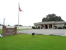
 Lanier County Courthouse in Lakeland | |
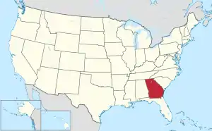
 Location within the U.S. state of Georgia | |
 Georgia's location within the U.S. | |
| Coordinates: 31°02′16″N 83°03′46″W | |
| Country | |
| State | |
| Founded | August 7, 1920 |
| Named for | Sidney Lanier |
| Seat | Lakeland |
| Largest city | Lakeland |
| Area | |
| • Total | 200 sq mi (500 km2) |
| • Land | 185 sq mi (480 km2) |
| • Water | 15 sq mi (40 km2) 7.3% |
| Population (2020) | |
| • Total | 9,877 |
| • Density | 53/sq mi (20/km2) |
| Time zone | UTC−5 (Eastern) |
| • Summer (DST) | UTC−4 (EDT) |
| Congressional district | 8th |
| Website | laniercountyboc |
| [1] | |
Lanier County is part of the Valdosta, GA metropolitan statistical area. Lanier shares Moody Air Force Base with Lowndes County on its western boundary.
Geography
According to the U.S. Census Bureau, the county has an area of 200 square miles (520 km2), of which 185 square miles (480 km2) is land and 15 square miles (39 km2) (7.3%) is water.[5]
The vast majority of Lanier County is in the Alapaha River sub-basin of the Suwannee River basin. Just a narrow section of the western border of the county, northeast and southeast of Ray City, is in the Withlacoochee River sub-basin of the same Suwannee River basin, and a very narrow section of the eastern border of Lanier County is in the Upper Suwannee River sub-basin of the same Suwannee River basin.[6]
Major highways
 U.S. Route 84
 U.S. Route 129
 U.S. Route 221
 State Route 11
 State Route 11 Bypass
 State Route 31
 State Route 31 Connector
 State Route 37
 State Route 38
 State Route 64
 State Route 122
 State Route 122 Connector
 State Route 125
 State Route 135
 State Route 135 Bypass
 State Route 168
Major waterways
Previous
Defunct
- Atlantic and Gulf Railroad
- Atlantic Coast Line Railroad
- Lakeland Railroad (Defunct, it was used from 1929 to 1957. It ran along the same path as the Milltown Air Line Railroad)
- Milltown Air Line Railroad (Defunct, it was used from 1904 to 1928. It ran from Lakeland to Naylor, Georgia)
- Plant System
- Waycross and Western Railroad (Defunct, it was used from 1912 to 1925 from Waycross, Georgia to Lakeland, Georgia. It roughly followed current Georgia State Route 122)
Adjacent counties
- Berrien County - northwest
- Atkinson County - north
- Clinch County - east
- Echols County - south
- Lowndes County - southwest
National protected area

The Banks Lake National Wildlife Refuge, established in 1985, hosts approximately 20,000 visitors annually. It provides hiking, fishing, and boating opportunities on more than 4,000 acres (16 km2) of water, Banks Lake marsh, and swamp. The Robert Simpson III Nature Trail, dedicated in August 2001, is in the Lakeland, Georgia city limits on 75 acres (300,000 m2) of pine and hardwood forests. The county is known for its excellent fishing in the Alapaha River, Banks Lake National Wildlife Refuge as well as in its many small lakes.
Census-designated place
- Stockton
Demographics
| Census | Pop. | Note | %± |
|---|---|---|---|
| 1930 | 5,190 | — | |
| 1940 | 5,632 | 8.5% | |
| 1950 | 5,151 | −8.5% | |
| 1960 | 5,097 | −1.0% | |
| 1970 | 5,031 | −1.3% | |
| 1980 | 5,654 | 12.4% | |
| 1990 | 5,531 | −2.2% | |
| 2000 | 7,847 | 41.9% | |
| 2010 | 10,078 | 28.4% | |
| 2020 | 9,877 | −2.0% | |
| 2023 (est.) | 10,452 | [7] | 5.8% |
| U.S. Decennial Census[8] 1790-1880[9] 1890-1910[10] 1920-1930[11] 1930-1940[12] 1940-1950[13] 1960-1980[14] 1980-2000[15] 2010[16] | |||
| Race | Num. | Perc. |
|---|---|---|
| White (non-Hispanic) | 6,595 | 66.77% |
| Black or African American (non-Hispanic) | 2,138 | 21.65% |
| Native American | 31 | 0.31% |
| Asian | 81 | 0.82% |
| Pacific Islander | 14 | 0.14% |
| Other/Mixed | 446 | 4.52% |
| Hispanic or Latino | 572 | 5.79% |
As of the 2020 United States census, there were 9,877 people, 3,714 households, and 2,536 families residing in the county.
Economy
The county's economy has remained rural in nature, but the educational, health and social service sector was the largest employment category in 2006. Factors contributing to this economy include the presence of Moody Air Force Base (shared by adjoining Lowndes County), the several lakes and nature reserve, the hospital, and a large state correctional facility.
The top ten employers in Lanier County are:
- Moody Air Force Base
- Farmers & Merchants Bank
- Louis Smith Hospital
- Patten Probation Detention Center
- Georgia Department of Corrections
- Patten Seed Company
- City of Lakeland, Georgia
- Wausau Homes, Inc
- J.H. Harvey Co, LLC (parent company of Harveys Supermarkets)
Media
- Lanier County News - Legal organ and hometown newspaper since 1913. The paper was originally named The Milltown Advocate, but changed its name after Lanier County was formed in 1920.
- Lanier County Advocate (newspaper) - Legal organ newspaper as of January 1, 2015.
Historic sites
Historic sites include Governor Eurith D. Rivers' home, which was moved from its original spot on Banks Lake to West Main Street in Lakeland in the early 1980s; Union Baptist Church, located near Georgia Highway 135; and Fender Cemetery, located east of Lakeland at the junction of U.S. 221 and Georgia Highway 37 on land that once belonged to David Fender. The site of the cemetery, in which many of the area's first settlers are buried, was chosen so that mourners would not have to ferry their dead across the river for burial. Also, the "Murals of Milltown," which depict community life in the 1920s, grace the exteriors of buildings in downtown Lakeland.
Education
The Lanier County School District operates four schools: Lanier County Primary School, Lanier County Elementary School, Lanier County Middle School, and Lanier County High School.
Politics
| Year | Republican | Democratic | Third party | |||
|---|---|---|---|---|---|---|
| No. | % | No. | % | No. | % | |
| 2020 | 2,509 | 70.16% | 1,019 | 28.50% | 48 | 1.34% |
| 2016 | 1,984 | 69.10% | 806 | 28.07% | 81 | 2.82% |
| 2012 | 1,820 | 61.11% | 1,114 | 37.41% | 44 | 1.48% |
| 2008 | 1,787 | 62.05% | 1,062 | 36.88% | 31 | 1.08% |
| 2004 | 1,641 | 63.38% | 931 | 35.96% | 17 | 0.66% |
| 2000 | 1,048 | 55.04% | 832 | 43.70% | 24 | 1.26% |
| 1996 | 519 | 34.55% | 818 | 54.46% | 165 | 10.99% |
| 1992 | 600 | 35.03% | 811 | 47.34% | 302 | 17.63% |
| 1988 | 725 | 50.81% | 698 | 48.91% | 4 | 0.28% |
| 1984 | 852 | 53.48% | 741 | 46.52% | 0 | 0.00% |
| 1980 | 470 | 29.30% | 1,116 | 69.58% | 18 | 1.12% |
| 1976 | 207 | 14.02% | 1,269 | 85.98% | 0 | 0.00% |
| 1972 | 850 | 81.50% | 193 | 18.50% | 0 | 0.00% |
| 1968 | 241 | 15.63% | 277 | 17.96% | 1,024 | 66.41% |
| 1964 | 719 | 52.10% | 661 | 47.90% | 0 | 0.00% |
| 1960 | 198 | 15.88% | 1,049 | 84.12% | 0 | 0.00% |
| 1956 | 152 | 14.59% | 890 | 85.41% | 0 | 0.00% |
| 1952 | 170 | 16.75% | 845 | 83.25% | 0 | 0.00% |
| 1948 | 92 | 13.53% | 486 | 71.47% | 102 | 15.00% |
| 1944 | 40 | 6.02% | 625 | 93.98% | 0 | 0.00% |
| 1940 | 16 | 2.56% | 607 | 97.12% | 2 | 0.32% |
| 1936 | 30 | 3.59% | 800 | 95.81% | 5 | 0.60% |
| 1932 | 3 | 1.38% | 211 | 97.24% | 3 | 1.38% |
| 1928 | 138 | 31.29% | 303 | 68.71% | 0 | 0.00% |
| 1924 | 46 | 11.41% | 356 | 88.34% | 1 | 0.25% |
See also
- National Register of Historic Places listings in Lanier County, Georgia
- List of counties in Georgia
Notes
- "Lanier County Act Amended, No. 505". Acts of the General Assembly of the State of Georgia. 1920. pp. 45–48. Retrieved November 13, 2022.
- "Census - Geography Profile: Lanier County, Georgia". United States Census Bureau. Retrieved December 27, 2022.
- "Find a County". National Association of Counties. Retrieved June 7, 2011.
- Krakow, Kenneth K. (1975). Georgia Place-Names: Their History and Origins (PDF). Macon, GA: Winship Press. p. 129. ISBN 0-915430-00-2. Archived (PDF) from the original on April 14, 2004.
- "US Gazetteer files: 2010, 2000, and 1990". United States Census Bureau. February 12, 2011. Retrieved April 23, 2011.
- "Georgia Soil and Water Conservation Commission Interactive Mapping Experience". Georgia Soil and Water Conservation Commission. Retrieved November 27, 2015.
- "Annual Estimates of the Resident Population for Counties: April 1, 2020 to July 1, 2023". United States Census Bureau. Retrieved March 31, 2024.
- "Decennial Census of Population and Housing by Decades". United States Census Bureau.
- "1880 Census Population by Counties 1790-1800" (PDF). United States Census Bureau. 1880.
- "1910 Census of Population - Georgia" (PDF). United States Census Bureau. 1910.
- "1930 Census of Population - Georgia" (PDF). United States Census Bureau. 1930.
- "1940 Census of Population - Georgia" (PDF). United States Census Bureau. 1940.
- "1950 Census of Population - Georgia -" (PDF). United States Census Bureau. 1950.
- "1980 Census of Population - Number of Inhabitants - Georgia" (PDF). United States Census Bureau. 1980.
- "2000 Census of Population - Population and Housing Unit Counts - Georgia" (PDF). United States Census Bureau. 2000.
- "State & County QuickFacts". United States Census Bureau. Archived from the original on June 7, 2011. Retrieved June 23, 2014.
- "Explore Census Data". data.census.gov. Retrieved December 18, 2021.
- Leip, David. "Dave Leip's Atlas of U.S. Presidential Elections". uselectionatlas.org. Retrieved March 20, 2018.
References
External links
Places adjacent to Lanier County, Georgia | ||||||||||||||||
|---|---|---|---|---|---|---|---|---|---|---|---|---|---|---|---|---|
| ||||||||||||||||
Municipalities and communities of Lanier County, Georgia, United States | ||
|---|---|---|
| Cities | Map of Georgia highlighting Lanier County | |
| CDP |
| |
| Footnotes | ‡This populated place also has portions in an adjacent county or counties. | |
| ||