Walton County, Georgia
Walton County is a county located in the Middle Georgia portion of the U.S. - State of Georgia. As of the 2020 census, the population was 96,673.[1] It is located about 30 miles east of the state capital, the city of Atlanta. Monroe is the county seat; Loganville is another major city.[2]
Walton County | |
|---|---|
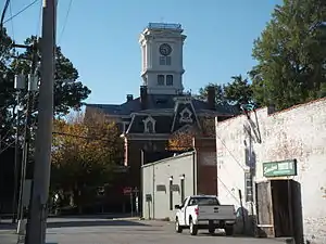 Walton County courthouse in Monroe | |
 Flag  Seal | |
 Location within the U.S. state of Georgia | |
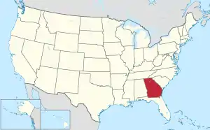 Georgia's location within the U.S. | |
| Coordinates: 33°47′N 83°44′W | |
| Country | |
| State | |
| Founded | December 22, 1818 |
| Named for | George Walton |
| Seat | Monroe |
| Largest city | Monroe |
| Area | |
| • Total | 330 sq mi (900 km2) |
| • Land | 326 sq mi (840 km2) |
| • Water | 4.3 sq mi (11 km2) 1.3% |
| Population (2020) | |
| • Total | 96,673 |
| • Density | 297/sq mi (115/km2) |
| Time zone | UTC−5 (Eastern) |
| • Summer (DST) | UTC−4 (EDT) |
| Congressional district | 10th |
| Website | waltoncountyga.gov |
Walton County is part of the Atlanta-Sandy Springs-Roswell, GA Metropolitan Statistical Area.
History
Walton County was created on December 15, 1818. It is named for George Walton, one of the three men from Georgia who signed the United States Declaration of Independence.[3] The other two were Button Gwinnett and Lyman Hall.
A Supreme Court ruling in April 1946 had ruled that white primaries were unconstitutional, enabling some black citizens in Georgia to cast ballots for the first time during the primary race later that summer.[4] This increased social tensions in many areas, as whites continued to oppose voting by blacks. In addition, many whites resisted black veterans' efforts to gain expanded freedoms following their service during World War II.
Moore's Ford lynchings (1946)
In July 1946, the county was the site of one of the last mass lynchings of the pre-Civil Rights Era, when four African Americans, two young married couples, were murdered here. African American Roger Malcom had had an argument with a local white farmer, "ostensibly over a woman".[4] He and his pregnant wife, and her cousin and her husband, were beaten and lynched on July 25.
A historical highway marker erected by the state in the 21st century reads:
2.4 miles east, at Moore’s Ford Bridge on the Apalachee River, four African-Americans - George and Mae Murray Dorsey and Roger and Dorothy Dorsey Malcom (reportedly 7 months pregnant) - were brutally beaten and shot by an unmasked mob on the afternoon of July 25, 1946. The lynching followed an argument between Roger Malcom and a local white farmer. These unsolved murders played a crucial role in both President Truman’s commitment to civil rights legislation and the ensuing modern civil rights movement.
The sign is at 33° 51.417′ N, 83° 36.733′ W. Marker is near Monroe, Georgia, in Walton County. This is at the intersection of U.S. 78 and Locklin Road, on the right when traveling east on U.S. 78.[5][6]
In 1998, local people arranged a biracial memorial service honoring the victims, which was held at Moore's Ford Bridge.[7][8] Since then a local interracial committee organized to rekindle attention to the case, in hopes of bringing justice to the victims. They also gained state support to erect the historical highway marker noted above to mark the unsolved murders and commemorate the victims.[4]
In the 21st century, commemoration has included an on-site reenactment, held annually since 2005 as part of the education effort.[4][9]
Fire in a Canebrake: The Last Mass Lynching in America (2003), by author Laura Wexler, is among the books to explore the case and social context, and related evidence, including reference to contemporary FBI reports in the investigation ordered under President Truman.[4][10][11]
In the early 21st century, the US Department of Justice reopened an investigation into the cold case, but they were unable to gain sufficient evidence to prosecute any survivors among the more than 50 suspects that FBI files from 1946 had suggested had been involved in the lynching.[4][12] A local multi-ethnic committee continues to press for the case to be reviewed again in hopes of bringing justice to the victims. In February 2014 they presented a video to the Walton Board of Commissioners about the case.[13]
Geography
According to the U.S. Census Bureau, the county has a total area of 330 square miles (850 km2), of which 326 square miles (840 km2) is land and 4.3 square miles (11 km2) (1.3%) is water.[14] The county is located in the Piedmont region of the state.
The western half of Walton County, in a half circle from Social Circle through Monroe to northeast of Loganville, is located in the Upper Ocmulgee River sub-basin of the Altamaha River basin. The eastern part of the county, east of that curve, is located in the Upper Oconee River sub-basin of the same Altamaha River basin.[15]
Adjacent counties
- Barrow County – north
- Oconee County – northeast
- Morgan County – southeast
- Newton County – south
- Rockdale County – southwest
- Gwinnett County – northwest
Communities
Cities
- Good Hope
- Jersey
- Loganville
- Monroe
- Social Circle
- Walnut Grove
Towns
- Between
Unincorporated communities
- Bold Springs
- Campton
- Gratis
- Mt. Vernon
- Pannell
- Windsor
- Youth
- Split Silk
Demographics
There was a noted decline in the African American population from 1900 to 1960 as thousands left rural areas in the South during the Great Migration to the North, Midwest and West Coast to escape social oppression and to gain better jobs and opportunities.
With dramatic new growth related to the rise of Atlanta as a corporate city, the demographics have changed and the county is majority white in the 21st century. The area has been developed for suburban housing and retail.
| Census | Pop. | Note | %± |
|---|---|---|---|
| 1810 | 1,026 | — | |
| 1820 | 4,192 | 308.6% | |
| 1830 | 10,929 | 160.7% | |
| 1840 | 10,209 | −6.6% | |
| 1850 | 10,821 | 6.0% | |
| 1860 | 11,074 | 2.3% | |
| 1870 | 11,038 | −0.3% | |
| 1880 | 15,622 | 41.5% | |
| 1890 | 17,467 | 11.8% | |
| 1900 | 20,942 | 19.9% | |
| 1910 | 25,393 | 21.3% | |
| 1920 | 24,216 | −4.6% | |
| 1930 | 21,118 | −12.8% | |
| 1940 | 20,777 | −1.6% | |
| 1950 | 20,230 | −2.6% | |
| 1960 | 20,481 | 1.2% | |
| 1970 | 23,404 | 14.3% | |
| 1980 | 31,211 | 33.4% | |
| 1990 | 38,586 | 23.6% | |
| 2000 | 60,687 | 57.3% | |
| 2010 | 83,768 | 38.0% | |
| 2020 | 96,673 | 15.4% | |
| 2023 (est.) | 106,702 | [16] | 10.4% |
| U.S. Decennial Census[17] 1790-1880[18] 1890-1910[19] 1920-1930[20] 1930-1940[21] 1940-1950[22] 1960-1980[23] 1980-2000[24] 2010[25] 2020[26] | |||
| Race / Ethnicity | Pop 2000[27] | Pop 2010[25] | Pop 2020[26] | % 2000 | % 2010 | % 2020 |
|---|---|---|---|---|---|---|
| White alone (NH) | 49,731 | 65,677 | 68,499 | 81.95% | 78.40% | 70.86% |
| Black or African American alone (NH) | 8,703 | 12,993 | 17,136 | 14.34% | 15.51% | 17.73% |
| Native American or Alaska Native alone (NH) | 145 | 194 | 188 | 0.24% | 0.23% | 0.19% |
| Asian alone (NH) | 410 | 947 | 1,409 | 0.68% | 1.13% | 1.46% |
| Pacific Islander alone (NH) | 10 | 38 | 44 | 0.02% | 0.05% | 0.05% |
| Other race alone (NH) | 25 | 159 | 552 | 0.04% | 0.19% | 0.57% |
| Mixed race or Multiracial (NH) | 500 | 1,077 | 3,617 | 0.82% | 1.29% | 3.74% |
| Hispanic or Latino (any race) | 1,163 | 2,683 | 5,228 | 1.92% | 3.20% | 5.41% |
| Total | 60,687 | 83,768 | 96,673 | 100.00% | 100.00% | 100.00% |
As of the 2020 United States census, there were 96,673 people, 33,350 households, and 25,736 families residing in the county.
Government
Walton County has a six-member commission elected from single-member districts. This legislative body can pass laws for the county and tax bills. The county chairman is elected at-large to serve as the leader. If a seat becomes vacant during the term, the governor can appoint someone to fill the seat, based on recommendations. In 2015, two of the six positions were filled by appointees.
Politics
| Year | Republican | Democratic | Third party | |||
|---|---|---|---|---|---|---|
| No. | % | No. | % | No. | % | |
| 2020 | 37,839 | 74.05% | 12,683 | 24.82% | 576 | 1.13% |
| 2016 | 31,125 | 76.18% | 8,292 | 20.29% | 1,441 | 3.53% |
| 2012 | 29,036 | 77.07% | 8,148 | 21.63% | 493 | 1.31% |
| 2008 | 27,253 | 75.54% | 8,469 | 23.47% | 357 | 0.99% |
| 2004 | 21,594 | 78.11% | 5,887 | 21.29% | 166 | 0.60% |
| 2000 | 12,966 | 67.95% | 5,484 | 28.74% | 633 | 3.32% |
| 1996 | 7,934 | 52.82% | 5,618 | 37.40% | 1,468 | 9.77% |
| 1992 | 5,619 | 45.35% | 4,821 | 38.91% | 1,951 | 15.75% |
| 1988 | 5,974 | 65.56% | 3,091 | 33.92% | 47 | 0.52% |
| 1984 | 4,995 | 66.81% | 2,481 | 33.19% | 0 | 0.00% |
| 1980 | 2,618 | 35.85% | 4,525 | 61.96% | 160 | 2.19% |
| 1976 | 1,687 | 23.80% | 5,402 | 76.20% | 0 | 0.00% |
| 1972 | 3,994 | 77.80% | 1,140 | 22.20% | 0 | 0.00% |
| 1968 | 1,399 | 19.99% | 1,552 | 22.18% | 4,047 | 57.83% |
| 1964 | 2,874 | 54.99% | 2,350 | 44.97% | 2 | 0.04% |
| 1960 | 403 | 11.52% | 3,095 | 88.48% | 0 | 0.00% |
| 1956 | 470 | 12.56% | 3,271 | 87.44% | 0 | 0.00% |
| 1952 | 324 | 8.11% | 3,672 | 91.89% | 0 | 0.00% |
| 1948 | 164 | 5.71% | 2,440 | 84.99% | 267 | 9.30% |
| 1944 | 172 | 7.75% | 2,046 | 92.25% | 0 | 0.00% |
| 1940 | 104 | 4.55% | 2,179 | 95.24% | 5 | 0.22% |
| 1936 | 132 | 6.33% | 1,952 | 93.58% | 2 | 0.10% |
| 1932 | 36 | 1.66% | 2,136 | 98.34% | 0 | 0.00% |
| 1928 | 424 | 27.20% | 1,135 | 72.80% | 0 | 0.00% |
| 1924 | 90 | 8.78% | 873 | 85.17% | 62 | 6.05% |
| 1920 | 123 | 9.38% | 1,189 | 90.63% | 0 | 0.00% |
| 1916 | 83 | 5.61% | 1,305 | 88.24% | 91 | 6.15% |
| 1912 | 40 | 3.35% | 885 | 74.06% | 270 | 22.59% |
Education
Walton County School District is the local school district for all sections except those in Social Circle. Areas in Social Circle are in the Social Circle City School District.[29]
Transportation
Major highways
 Interstate 20
 U.S. Route 78
 U.S. Route 278
 State Route 10
 State Route 10 Business
 State Route 11
 State Route 12
 State Route 20
 State Route 81
 State Route 83
 State Route 138
 State Route 186
 State Route 402 (unsigned designation for I-20)
Walton County doesn't have any pedestrian trails. However, there are trails in neighboring Gwinnett and Rockdale county such as the Arabia Mountain Path, Conyers Trail and Cedar Creek Trail Loop.
See also
- National Register of Historic Places listings in Walton County, Georgia
- Hard Labor Creek Regional Reservoir
- List of counties in Georgia
References
- Camp, Lynn Robinson, and Jennifer E. Cheek-Collins. Walton County, Georgia (Black America Series; Charleston, S.C., 2003) (ISBN 0-7385-1528-0).
- Sams, Anita B. Wayfarers in Walton: A History of Walton County, Georgia, 1818–1967 (Monroe, Ga., 1967).
- "Census - Geography Profile: Walton County, Georgia". United States Census Bureau. Retrieved December 29, 2022.
- "Find a County". National Association of Counties. Retrieved June 7, 2011.
- Krakow, Kenneth K. (1975). Georgia Place-Names: Their History and Origins (PDF). Macon, GA: Winship Press. p. 245. ISBN 0-915430-00-2. Archived (PDF) from the original on July 27, 2003.
- Chelsea Bailey, "Moore's Ford Massacre: Activists Reenact Racist Lynching as a Call for Justice", 02 August 2017; accessed 11 June 2018
- "Moore's Ford Lynching Historical Marker". www.hmdb.org.
- "Historical Marker Database Map". www.hmdb.org.
- "Lynching in the South; Marking Murder". The Economist. February 21, 2015.
- GeorgiaInfo - Moore's Ford Lynching GHS Historical Marker Archived November 14, 2007, at the Wayback Machine, Carl Vinson Institute of Government, Last accessed July 4, 2008.
- Auslander, Mark. “Touching the Past: Materializing Time in Traumatic ‘Living History” Reenactments.” Signs and Society Vol. 1 (2013): 161-183
- Fire in a Canebrake: The Last Mass Lynching in America. Scribner. 2003. ISBN 0684868164.
- Asim, Jabari (January 2003). "The Moore's Ford Incident". The Washington Post. washingtonpost.com. Retrieved September 3, 2019.
- "New evidence collected in 1946 lynching case - CNN.com". www.cnn.com.
- Joeff Davis, "New information to be presented in unsolved Georgia lynching case", Creative Loafing (Atlanta), March 1, 2014
- "US Gazetteer files: 2010, 2000, and 1990". United States Census Bureau. February 12, 2011. Retrieved April 23, 2011.
- "Georgia Soil and Water Conservation Commission Interactive Mapping Experience". Georgia Soil and Water Conservation Commission. Retrieved November 18, 2015.
- "Annual Estimates of the Resident Population for Counties: April 1, 2020 to July 1, 2023". United States Census Bureau. Retrieved March 31, 2024.
- "Decennial Census of Population and Housing by Decade". United States Census Bureau.
- "1880 Census Population by Counties 1790-1800" (PDF). United States Census Bureau. 1880.
- "1910 Census of Population - Georgia" (PDF). United States Census Bureau. 1910.
- "1930 Census of Population - Georgia" (PDF). United States Census Bureau. 1930.
- "1940 Census of Population - Georgia" (PDF). United States Census Bureau. 1940.
- "1950 Census of Population - Georgia -" (PDF). United States Census Bureau. 1950.
- "1980 Census of Population - Number of Inhabitants - Georgia" (PDF). United States Census Bureau. 1980.
- "2000 Census of Population - Population and Housing Unit Counts - Georgia" (PDF). United States Census Bureau. 2000.
- "P2: Hispanic or Latino, and Not Hispanic or Latino by Race – 2010: DEC Redistricting Data (PL 94-171) – Walton County, Georgia". United States Census Bureau.
- "P2: Hispanic or Latino, and Not Hispanic or Latino by Race – 2020: DEC Redistricting Data (PL 94-171) - Walton County, Georgia". United States Census Bureau.
- "P004 HISPANIC OR LATINO, AND NOT HISPANIC OR LATINO BY RACE – 2000: DEC Summary File 1 – Walton County, Georgia". United States Census Bureau.
- Leip, David. "Dave Leip's Atlas of U.S. Presidential Elections". uselectionatlas.org. Retrieved March 22, 2018.
- "2020 CENSUS - SCHOOL DISTRICT REFERENCE MAP: Walton County, GA" (PDF). U.S. Census Bureau. Retrieved May 7, 2023. - Text list
External links
- Georgia.gov on Walton County
- https://web.archive.org/web/20070704131617/http://www.negrdc.org/counties/walton/default.asp
- "Holding on to Those Who Can't be Held": Reenacting a Lynching at Moore's Ford, Georgia" Southern Spaces, November 8, 2010.
Places adjacent to Walton County, Georgia | ||||||||||||||||
|---|---|---|---|---|---|---|---|---|---|---|---|---|---|---|---|---|
| ||||||||||||||||
Municipalities and communities of Walton County, Georgia, United States | ||
|---|---|---|
| Cities | Map of Georgia highlighting Walton County | |
| Towns |
| |
| Unincorporated communities |
| |
| Footnotes | ‡This populated place also has portions in an adjacent county or counties | |
| ||
|  | |||||
|
| ||||||