Morgan County, Georgia
Morgan County is a county located in the north central Piedmont region and the lake country region of the U.S. state of Georgia. As of the 2020 census, the population was 20,097.[1] The county seat is Madison.[2]
Morgan County | |
|---|---|
 Morgan County Courthouse in Madison | |
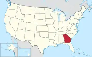
 Location within the U.S. state of Georgia | |
 Georgia's location within the U.S. | |
| Coordinates: 33°35′N 83°29′W | |
| Country | |
| State | |
| Founded | December 10, 1807 |
| Seat | Madison |
| Largest city | Madison |
| Area | |
| • Total | 361 sq mi (930 km2) |
| • Land | 345 sq mi (890 km2) |
| • Water | 16 sq mi (40 km2) 4.4% |
| Population (2020) | |
| • Total | 20,097 |
| • Density | 58/sq mi (22/km2) |
| Time zone | UTC−5 (Eastern) |
| • Summer (DST) | UTC−4 (EDT) |
| Congressional district | 10th |
Since the early 21st century, the county has had a housing boom. It has proximity to Lake Oconee, a recreation site, as well as to major employment centers such as Atlanta, Athens, Augusta and Macon.
History
Morgan County was created on December 10, 1807. It was named for renowned Revolutionary War commander Daniel Morgan. During the American Civil War, the county provided the Panola Guards, which was a part of Cobb's Legion.
Geography
According to the U.S. Census Bureau, the county has a total area of 355 square miles (920 km2), of which 347 square miles (900 km2) is land and 7.3 square miles (19 km2) (2.1%) is water.[3] The entirety of Morgan County is located in the Upper Oconee River sub-basin of the Altamaha River basin.[4]
Major highways
 Interstate 20
 U.S. Route 129
 U.S. Route 129 Bypass
 U.S. Route 278
 U.S. Route 278 Truck
 U.S. Route 441
- U.S. Route 441 Bypass
 State Route 12
- State Route 12 Truck
 State Route 24
 State Route 24 Bypass
 State Route 83
 State Route 186
 State Route 402 (unsigned designation for I-20)
Adjacent counties
- Oconee County (north)
- Greene County (east)
- Putnam County (southeast)
- Jasper County (southwest)
- Newton County (west)
- Walton County (northwest)
National protected area
- Oconee National Forest (part)
Communities
Town
- Buckhead
Unincorporated communities
- Apalachee
- Godfrey (ghost town)
- Pennington
Demographics
| Census | Pop. | Note | %± |
|---|---|---|---|
| 1810 | 8,369 | — | |
| 1820 | 13,520 | 61.5% | |
| 1830 | 12,046 | −10.9% | |
| 1840 | 9,121 | −24.3% | |
| 1850 | 10,744 | 17.8% | |
| 1860 | 9,997 | −7.0% | |
| 1870 | 10,696 | 7.0% | |
| 1880 | 14,032 | 31.2% | |
| 1890 | 16,041 | 14.3% | |
| 1900 | 15,813 | −1.4% | |
| 1910 | 19,717 | 24.7% | |
| 1920 | 20,143 | 2.2% | |
| 1930 | 12,488 | −38.0% | |
| 1940 | 12,713 | 1.8% | |
| 1950 | 11,899 | −6.4% | |
| 1960 | 10,280 | −13.6% | |
| 1970 | 9,904 | −3.7% | |
| 1980 | 11,572 | 16.8% | |
| 1990 | 12,883 | 11.3% | |
| 2000 | 15,457 | 20.0% | |
| 2010 | 17,868 | 15.6% | |
| 2020 | 20,097 | 12.5% | |
| 2023 (est.) | 21,460 | [5] | 6.8% |
| U.S. Decennial Census[6] 1790-1880[7] 1890-1910[8] 1920-1930[9] 1930-1940[10] 1940-1950[11] 1960-1980[12] 1980-2000[13] 2010[14] | |||
| Race | Num. | Perc. |
|---|---|---|
| White | 14,487 | 72.09% |
| Black or African American | 4,105 | 20.43% |
| Native American | 42 | 0.21% |
| Asian | 122 | 0.61% |
| Pacific Islander | 1 | 0.0% |
| Other/Mixed | 628 | 3.12% |
| Hispanic or Latino | 712 | 3.54% |
As of the 2020 United States census, there were 20,097 people, 6,942 households, and 5,250 families residing in the county.
Politics
| Year | Republican | Democratic | Third party | |||
|---|---|---|---|---|---|---|
| No. | % | No. | % | No. | % | |
| 2020 | 8,231 | 70.29% | 3,353 | 28.63% | 126 | 1.08% |
| 2016 | 6,559 | 69.22% | 2,663 | 28.11% | 253 | 2.67% |
| 2012 | 6,186 | 68.42% | 2,753 | 30.45% | 102 | 1.13% |
| 2008 | 5,987 | 65.32% | 3,091 | 33.73% | 87 | 0.95% |
| 2004 | 4,902 | 67.64% | 2,304 | 31.79% | 41 | 0.57% |
| 2000 | 3,524 | 59.71% | 2,238 | 37.92% | 140 | 2.37% |
| 1996 | 2,118 | 45.92% | 2,111 | 45.77% | 383 | 8.30% |
| 1992 | 1,797 | 40.34% | 2,057 | 46.17% | 601 | 13.49% |
| 1988 | 2,108 | 58.10% | 1,508 | 41.57% | 12 | 0.33% |
| 1984 | 2,301 | 57.31% | 1,714 | 42.69% | 0 | 0.00% |
| 1980 | 1,323 | 36.04% | 2,276 | 62.00% | 72 | 1.96% |
| 1976 | 904 | 28.45% | 2,274 | 71.55% | 0 | 0.00% |
| 1972 | 2,007 | 75.03% | 668 | 24.97% | 0 | 0.00% |
| 1968 | 616 | 20.67% | 973 | 32.65% | 1,391 | 46.68% |
| 1964 | 1,485 | 47.31% | 1,654 | 52.69% | 0 | 0.00% |
| 1960 | 373 | 20.04% | 1,488 | 79.96% | 0 | 0.00% |
| 1956 | 246 | 14.15% | 1,492 | 85.85% | 0 | 0.00% |
| 1952 | 247 | 13.03% | 1,649 | 86.97% | 0 | 0.00% |
| 1948 | 115 | 8.18% | 1,147 | 81.58% | 144 | 10.24% |
| 1944 | 51 | 4.18% | 1,166 | 95.50% | 4 | 0.33% |
| 1940 | 24 | 4.72% | 484 | 95.28% | 0 | 0.00% |
| 1936 | 37 | 3.17% | 1,130 | 96.66% | 2 | 0.17% |
| 1932 | 74 | 7.36% | 923 | 91.75% | 9 | 0.89% |
| 1928 | 208 | 20.57% | 803 | 79.43% | 0 | 0.00% |
| 1924 | 126 | 16.41% | 598 | 77.86% | 44 | 5.73% |
| 1920 | 176 | 28.12% | 450 | 71.88% | 0 | 0.00% |
| 1916 | 58 | 7.63% | 643 | 84.61% | 59 | 7.76% |
| 1912 | 37 | 6.19% | 537 | 89.80% | 24 | 4.01% |
See also
- National Register of Historic Places listings in Morgan County, Georgia
- List of counties in Georgia
References
- "Census - Geography Profile: Morgan County, Georgia". United States Census Bureau. Retrieved December 27, 2022.
- "Find a County". National Association of Counties. Retrieved June 7, 2011.
- "US Gazetteer files: 2010, 2000, and 1990". United States Census Bureau. February 12, 2011. Retrieved April 23, 2011.
- "Georgia Soil and Water Conservation Commission Interactive Mapping Experience". Georgia Soil and Water Conservation Commission. Retrieved November 19, 2015.
- "Annual Estimates of the Resident Population for Counties: April 1, 2020 to July 1, 2023". United States Census Bureau. Retrieved March 31, 2024.
- "Decennial Census of Population and Housing by Decades". United States Census Bureau.
- "1880 Census Population by Counties 1790-1800" (PDF). United States Census Bureau. 1880.
- "1910 Census of Population - Georgia" (PDF). United States Census Bureau. 1910.
- "1930 Census of Population - Georgia" (PDF). United States Census Bureau. 1930.
- "1940 Census of Population - Georgia" (PDF). United States Census Bureau. 1940.
- "1950 Census of Population - Georgia -" (PDF). United States Census Bureau. 1950.
- "1980 Census of Population - Number of Inhabitants - Georgia" (PDF). United States Census Bureau. 1980.
- "2000 Census of Population - Population and Housing Unit Counts - Georgia" (PDF). United States Census Bureau. 2000.
- "State & County QuickFacts". United States Census Bureau. Retrieved September 9, 2021.
- "Explore Census Data". data.census.gov. Retrieved December 9, 2021.
- Leip, David. "Dave Leip's Atlas of U.S. Presidential Elections". uselectionatlas.org. Retrieved March 22, 2018.
Places adjacent to Morgan County, Georgia | ||||||||||||||||
|---|---|---|---|---|---|---|---|---|---|---|---|---|---|---|---|---|
| ||||||||||||||||
Municipalities and communities of Morgan County, Georgia, United States | ||
|---|---|---|
| Cities | Map of Georgia highlighting Morgan County | |
| Towns |
| |
| CDP |
| |
| Other unincorporated communities |
| |
| ||