Coventry, Connecticut
Coventry is a town in Connecticut. It is in Tolland County. There were 11,504 people living in Coventry in 2000. Coventry became a town in May 1712. According to the United States Census Bureau, the town has a total area of 38.4 square miles (99 km2) of which 37.7 square miles (98 km2) is land and 0.6 square miles (1.6 km2) (1.67%) is water.
Coventry, Connecticut | |
|---|---|
 House at the corner of US Route 44 and North River Road | |
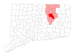 Location in Tolland County, Connecticut | |
| Coordinates: 41°47′04″N 72°20′20″W | |
| Country | |
| U.S. state | |
| County | Tolland |
| NECTA | Hartford |
| Region | Capitol Region |
| Incorporated | 1712 |
| Government | |
| • Type | Council-manager |
| • Town manager | John A. Elsesser |
| • Town council | Julie A. Blanchard (R), Council Chair Matthew D. O'Brien (R), Vice-Chair Richard Williams Jr (R), Secretary Andrew Brodersen (R) Hannah Pietrantonio (D) Lisa Thomas (D) Thomas Pope (R) |
| Area | |
| • Total | 38.4 sq mi (99.5 km2) |
| • Land | 37.7 sq mi (97.7 km2) |
| • Water | 0.6 sq mi (1.7 km2) |
| Elevation | 656 ft (200 m) |
| Population (2010) | |
| • Total | 12,445 |
| • Density | 330.0/sq mi (127.3/km2) |
| Time zone | UTC-5 (EST) |
| • Summer (DST) | UTC-4 (EDT) |
| ZIP code | 06238 |
| Area code(s) | 860 |
| FIPS code | 09-17800 |
| GNIS feature ID | 0213413 |
| Website | www |
Other websites
Wikimedia Commons has media related to Coventry, Connecticut.
Municipalities and communities of Tolland County, Connecticut, United States | ||
|---|---|---|
| Towns |  | |
| CDPs | ||
| Other communities |
| |

This article is issued from Wikipedia. The text is licensed under Creative Commons - Attribution - Sharealike. Additional terms may apply for the media files.