Calhoun County, Alabama
Calhoun County is a county in the U.S. state of Alabama. As of 2010 the population was 118,572. It is included in the Anniston-Oxford Metropolitan Statistical Area. Its county seat is Anniston.
Calhoun County | |
|---|---|
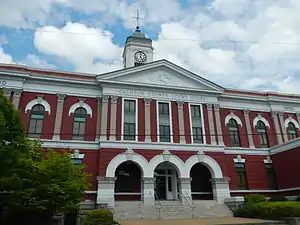 Calhoun County courthouse in Anniston | |
 Location within the U.S. state of Alabama | |
 Alabama's location within the U.S. | |
| Coordinates: 33°46′10″N 85°49′15″W | |
| Country | |
| State | |
| Founded | December 18, 1832 as Benton County |
| Named for | John C. Calhoun |
| Seat | Anniston |
| Largest city | Anniston |
| Area | |
| • Total | 612 sq mi (1,590 km2) |
| • Land | 606 sq mi (1,570 km2) |
| • Water | 6.4 sq mi (17 km2) 1.0%% |
| Population | |
| • Estimate (2017) | 114,728 |
| • Density | 191/sq mi (74/km2) |
| Time zone | UTC−6 (Central) |
| • Summer (DST) | UTC−5 (CDT) |
| Congressional district | 3rd |
| Website | www |
| |
History
Benton County was formed on December 18, 1832. It was named for Thomas Hart Benton, a member of the United States Senate from Missouri. The first county seat was at Jacksonville.
An F4 tornado struck here on Palm Sunday March 27, 1994. It destroyed Piedmont's Goshen United Methodist Church twelve minutes after the National Weather Service of Birmingham issued a tornado warning for northern Calhoun, southeastern Etowah, and southern Cherokee.
Geography
According to the 2000 census, the county has a total area of 612.32 square miles (1,585.9 km2). 608.46 square miles (1,575.9 km2) (or 99.37%) is land and 3.86 square miles (10.0 km2) (or 0.63%) is water.[1]
Major highways
|
|
Rail
- Alabama and Tennessee River Railway
- Norfolk Southern Railway
- Amtrak
Adjacent counties
- Cherokee County, Alabama - northeast
- Cleburne County, Alabama - east
- Talladega County, Alabama - south
- St. Clair County, Alabama - west
- Etowah County, Alabama - northwest
National protected areas
- Mountain Longleaf National Wildlife Refuge
- Talladega National Forest (part)
Cities and towns
- Alexandria
- Anniston
- Blue Mountain
- Bynum
- Choccolocco
- Eastaboga
- Hobson City
- Jacksonville
- Pleasant Valley
- Minden
- Ohatchee
- Oxford (part - part of Oxford is in Talladega County)
- Piedmont (part - part of Piedmont is in Cherokee County)
- Saks
- Weaver
- Webster's Chapel
- Wellington
- West End-Cobb Town
Places of interest
Calhoun County is home to the Anniston Museum of Natural History and the Berman Museum of World History. It also contains a part of the Talladega National Forest.
References
- "Census 2000 U.S. Gazetteer Files: Counties". United States Census. Retrieved 2011-02-13.
Municipalities and communities of Calhoun County, Alabama, United States | ||
|---|---|---|
| Cities | Map of Alabama highlighting Calhoun County | |
| Towns | ||
| CDPs |
| |
| Unincorporated communities |
| |
| Ghost town |
| |
| Footnotes | ‡This populated place also has portions in an adjacent county or counties | |