Colbert County, Alabama
Colbert County is a county of the U.S. state of Alabama. Its name is in honor of brothers George and Levi Colbert, Chickasaw Indian chiefs. George Colbert operated a ferry across the Tennessee River in 1790 near present-day Cherokee.[1]
Colbert County | |
|---|---|
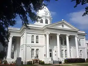 Colbert County Courthouse in Tuscumbia, Alabama | |
 Location within the U.S. state of Alabama | |
 Alabama's location within the U.S. | |
| Coordinates: 34°40′36″N 87°49′02″W | |
| Country | |
| State | |
| Founded | February 6, 1867 |
| Seat | Tuscumbia |
| Largest city | Muscle Shoals |
| Area | |
| • Total | 623.61 sq mi (1,615.1 km2) |
| • Land | 594.53 sq mi (1,539.8 km2) |
| • Water | 29.08 sq mi (75.3 km2) 4.66%% |
| Population (2010) | |
| • Total | 54,428 |
| • Density | 91/sq mi (35/km2) |
| Website | www |

The county seat of Colbert County is Tuscumbia. It is part of the Florence - Muscle Shoals Metropolitan Statistical Area known as "The Shoals". As of 2010, 54,428 people lived there.
History
Colbert County was first formed on February 6, 1867. It split from Franklin County over political issues after the American Civil War. It was ended but was reestablished on February 24, 1870.[1] It is also the location of Ivy Green, the birthplace of noted author Helen Keller.[1] Colbert County is also home of the towns Sheffield and Muscle Shoals where many popular musicians such as Aretha Franklin and the Rolling Stones recorded music.
Geography
According to the 2000 census, the county has a total area of 623.61 square miles (1,615.1 km2). 594.53 square miles (1,539.8 km2) (or 95.34%) is land and 29.08 square miles (75.3 km2) (or 4.66%) is water.[2]
Major Highways
 U.S. Highway 43
 U.S. Highway 72
 State Route 20
 State Route 157
 State Route 247
- Natchez Trace Parkway
National protected area
- Natchez Trace Parkway (part)
Rail
- Norfolk Southern Railway - freight lines going South, East, and West.[3]
River
Border Counties
- Lauderdale County, Alabama - north across the Tennessee River
- Lawrence County, Alabama - southeast
- Franklin County, Alabama - south
- Tishomingo County, Mississippi - west
Settlements
Cities
Unincorporated communities
- Allsboro
- Barton
- Buzzard Roost
- Colbert Heights
- Ford City
- White Oak
References
- "Colbert County Website". Retrieved 2007-05-16.
- "Census 2000 U.S. Gazetteer Files: Counties". United States Census. Retrieved 2011-02-13.
- Alabama Railway Map Archived 2012-03-12 at the Wayback Machine. 2008. Alabama Department of Transportation. Accessed 2012-03-15.
Municipalities and communities of Colbert County, Alabama, United States | ||
|---|---|---|
| Cities | Map of Alabama highlighting Colbert County | |
| Towns | ||
| Unincorporated communities |
| |