Chanute, Kansas
Chanute (/ʃəˈnuːt/) is a city in Neosho County, Kansas, United States. It was created on January 1, 1873. It was named after railroad engineer and aviation pioneer Octave Chanute.[5][6] In 2010, 9,119 people lived there.[7] The Neosho County Community College is in Chanute.
Chanute, Kansas | |
|---|---|
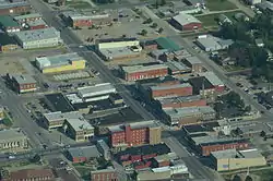 Aerial view of Chanute (2013) | |
 Location within Neosho County and Kansas | |
 KDOT map of Neosho County (legend) | |
| Coordinates: 37°40′37″N 95°27′23″W | |
| Country | United States |
| State | Kansas |
| County | Neosho |
| Founded | 1872 |
| Incorporated | 1873 |
| Named for | Octave Chanute |
| Area | |
| • Total | 7.15 sq mi (18.52 km2) |
| • Land | 7.03 sq mi (18.21 km2) |
| • Water | 0.12 sq mi (0.31 km2) |
| Elevation | 958 ft (292 m) |
| Population | |
| • Total | 9,119 |
| • Estimate (2016)[3] | 9,139 |
| • Density | 1,300/sq mi (490/km2) |
| Time zone | UTC-6 (CST) |
| • Summer (DST) | UTC-5 (CDT) |
| ZIP code | 66720 |
| Area code | 620 |
| FIPS code | 20-12500 |
| GNIS ID | 0484936[4] |
| Website | Chanute.org |
Geography
The United States Census Bureau says that the city has a total area of 7.15 square miles (18.52 km2). Of that, 7.03 square miles (18.21 km2) is land and 0.12 square miles (0.31 km2) is water.[1]
Climate
| Month | Jan | Feb | Mar | Apr | May | Jun | Jul | Aug | Sep | Oct | Nov | Dec | Year |
|---|---|---|---|---|---|---|---|---|---|---|---|---|---|
| Record high °F (°C) | 75 (24) |
83 (28) |
95 (35) |
96 (36) |
99 (37) |
108 (42) |
116 (47) |
113 (45) |
107 (42) |
98 (37) |
89 (32) |
77 (25) |
116 (47) |
| Mean maximum °F (°C) | 64.2 (17.9) |
71.0 (21.7) |
79.3 (26.3) |
83.9 (28.8) |
87.7 (30.9) |
93.1 (33.9) |
99.3 (37.4) |
99.6 (37.6) |
94.3 (34.6) |
85.0 (29.4) |
74.9 (23.8) |
65.3 (18.5) |
101.3 (38.5) |
| Average high °F (°C) | 42.2 (5.7) |
47.9 (8.8) |
58.1 (14.5) |
67.9 (19.9) |
75.9 (24.4) |
84.4 (29.1) |
89.8 (32.1) |
89.8 (32.1) |
81.1 (27.3) |
69.3 (20.7) |
56.7 (13.7) |
44.0 (6.7) |
67.3 (19.6) |
| Average low °F (°C) | 22.9 (−5.1) |
26.9 (−2.8) |
36.1 (2.3) |
45.8 (7.7) |
55.8 (13.2) |
64.7 (18.2) |
69.2 (20.7) |
67.9 (19.9) |
58.7 (14.8) |
47.2 (8.4) |
35.9 (2.2) |
25.3 (−3.7) |
46.5 (8.1) |
| Mean minimum °F (°C) | 2.9 (−16.2) |
6.3 (−14.3) |
17.0 (−8.3) |
28.1 (−2.2) |
39.6 (4.2) |
51.6 (10.9) |
58.2 (14.6) |
55.6 (13.1) |
40.7 (4.8) |
29.4 (−1.4) |
18.5 (−7.5) |
5.2 (−14.9) |
−3.3 (−19.6) |
| Record low °F (°C) | −23 (−31) |
−16 (−27) |
−4 (−20) |
14 (−10) |
28 (−2) |
44 (7) |
48 (9) |
45 (7) |
30 (−1) |
17 (−8) |
1 (−17) |
−17 (−27) |
−23 (−31) |
| Average precipitation inches (mm) | 1.26 (32) |
1.90 (48) |
3.04 (77) |
4.40 (112) |
5.80 (147) |
6.03 (153) |
4.37 (111) |
3.69 (94) |
3.67 (93) |
3.66 (93) |
2.50 (64) |
1.75 (44) |
42.07 (1,069) |
| Average precipitation days (≥ 0.01 in) | 5.9 | 6.3 | 8.7 | 9.8 | 11.7 | 11.6 | 7.8 | 7.2 | 7.5 | 8.5 | 7.0 | 6.9 | 98.9 |
| Source: NOAA[8][9] | |||||||||||||
People
| Historical population | |||
|---|---|---|---|
| Census | Pop. | %± | |
| 1880 | 887 | — | |
| 1890 | 2,826 | 218.6% | |
| 1900 | 4,208 | 48.9% | |
| 1910 | 9,272 | 120.3% | |
| 1920 | 10,286 | 10.9% | |
| 1930 | 10,277 | −0.1% | |
| 1940 | 10,142 | −1.3% | |
| 1950 | 10,109 | −0.3% | |
| 1960 | 10,849 | 7.3% | |
| 1970 | 10,341 | −4.7% | |
| 1980 | 10,506 | 1.6% | |
| 1990 | 9,488 | −9.7% | |
| 2000 | 9,411 | −0.8% | |
| 2010 | 9,119 | −3.1% | |
| 2016 (est.) | 9,139 | [3] | 0.2% |
| U.S. Decennial Census[10] 2012 Estimate[11] | |||
Transportation
Bus
Bus service goes north towards Kansas City, Missouri. It also goes south towards Tulsa, Oklahoma. Buses are by Jefferson Lines (subcontractor of Greyhound Lines).[12][13]
References
- Mean monthly maxima and minima (i.e. the highest and lowest temperature readings during an entire month or year) calculated based on data at said location from 1981 to 2010.
- "US Gazetteer files 2010". United States Census Bureau. Archived from the original on 2012-01-25. Retrieved 2012-07-06.
- "American FactFinder". United States Census Bureau. Retrieved 2012-07-06.
- "Population and Housing Unit Estimates". Retrieved June 9, 2017.
- "US Board on Geographic Names". United States Geological Survey. 2007-10-25. Retrieved 2008-01-31.
- Brackman, Barbara (1997). Kansas Trivia. Thomas Nelson Inc. p. 12. ISBN 9781418553814.
- Chisholm, Hugh, ed. (1911). . Encyclopædia Britannica. Vol. 5 (11th ed.). Cambridge University Press. p. 849.
- "2010 City Population and Housing Occupancy Status". U.S. Census Bureau. Archived from the original on July 21, 2011. Retrieved December 1, 2011.
- "NowData – NOAA Online Weather Data". National Oceanic and Atmospheric Administration. Retrieved 2018-03-02.
- "KS CHANUTE MARTIN JOHNSON AP". National Oceanic and Atmospheric Administration. Retrieved 2018-03-02.
- United States Census Bureau. "Census of Population and Housing". Archived from the original on April 26, 2015. Retrieved January 3, 2014.
- "Annual Estimates of the Resident Population: April 1, 2010 to July 1, 2012". Archived from the original on October 19, 2013. Retrieved January 3, 2014.
- Jefferson Lines
- Greyhound Lines - Bus stops in Kansas Archived 2010-08-28 at the Wayback Machine
Other websites
Wikimedia Commons has media related to Chanute, Kansas.
- City
- Schools
- USD 413, local school district
- Maps

This article is issued from Wikipedia. The text is licensed under Creative Commons - Attribution - Sharealike. Additional terms may apply for the media files.