Rooks County, Kansas
Rooks County (standard abbreviation: RO) is a county of the U.S. state of Kansas. As of the 2010 census, 5,181 people lived there.[1] The county seat is Stockton,[2] and the largest city is Plainville.
Rooks County | |
|---|---|
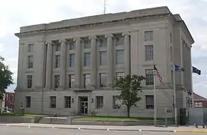 Rooks County courthouse in Stockton | |
 Location within the U.S. state of Kansas | |
 Kansas's location within the U.S. | |
| Coordinates: 39°27′05″N 99°06′07″W | |
| Country | |
| State | |
| Founded | February 26, 1867 |
| Named for | John C. Rooks |
| Seat | Stockton |
| Largest city | Plainville |
| Area | |
| • Total | 895 sq mi (2,320 km2) |
| • Land | 891 sq mi (2,310 km2) |
| • Water | 4.6 sq mi (12 km2) 0.5%% |
| Population | |
| • Estimate (2016) | 5,076 |
| • Density | 5.8/sq mi (2.2/km2) |
| Time zone | UTC−6 (Central) |
| • Summer (DST) | UTC−5 (CDT) |
| Congressional district | 1st |
| Website | RooksCounty.net |
History
Rooks County was founded on February 26, 1867 and named for Private John C. Rooks of the 11th Kansas Infantry who died at the Battle of Prairie Grove near Fayetteville, Arkansas, during the Civil War.[3]
Geography
The U.S. Census Bureau says that the county has a total area of 895 square miles (2,320 km2). Of that 891 square miles (2,310 km2) is land and 4.6 square miles (12 km2) (0.5%) is water.[4]
Bordering counties
- Phillips County (north)
- Smith County (northeast)
- Osborne County (east)
- Ellis County (south)
- Trego County (southwest)
- Graham County (west)
People
| Historical population | |||
|---|---|---|---|
| Census | Pop. | %± | |
| 1880 | 8,112 | — | |
| 1890 | 8,018 | −1.2% | |
| 1900 | 7,960 | −0.7% | |
| 1910 | 11,282 | 41.7% | |
| 1920 | 9,966 | −11.7% | |
| 1930 | 9,534 | −4.3% | |
| 1940 | 8,497 | −10.9% | |
| 1950 | 9,043 | 6.4% | |
| 1960 | 9,734 | 7.6% | |
| 1970 | 7,628 | −21.6% | |
| 1980 | 7,006 | −8.2% | |
| 1990 | 6,039 | −13.8% | |
| 2000 | 5,685 | −5.9% | |
| 2010 | 5,181 | −8.9% | |
| 2016 (est.) | 5,076 | [5] | −2.0% |
| U.S. Decennial Census[6] 1790-1960[7] 1900-1990[8] 1990-2000[9] 2010-2016[1] | |||

Government
Presidential elections
| Year | Republican | Democratic | Third Parties |
|---|---|---|---|
| 2016 | 84.0% 2,031 | 11.4% 275 | 4.7% 113 |
| 2012 | 82.9% 2,038 | 14.7% 361 | 2.5% 61 |
| 2008 | 79.9% 2,068 | 18.1% 468 | 2.0% 52 |
| 2004 | 78.3% 2,121 | 19.7% 534 | 2.0% 55 |
| 2000 | 72.7% 2,016 | 21.5% 597 | 5.8% 162 |
| 1996 | 66.9% 1,864 | 23.3% 650 | 9.8% 273 |
| 1992 | 40.4% 1,249 | 25.0% 771 | 34.6% 1,070 |
| 1988 | 64.5% 1,938 | 33.7% 1,012 | 1.9% 57 |
| 1984 | 77.8% 2,604 | 20.9% 699 | 1.4% 46 |
| 1980 | 71.4% 2,275 | 22.8% 725 | 5.9% 187 |
| 1976 | 53.0% 1,664 | 45.0% 1,412 | 1.9% 61 |
| 1972 | 71.7% 2,457 | 26.4% 904 | 1.9% 64 |
| 1968 | 63.0% 2,252 | 28.3% 1,012 | 8.7% 310 |
| 1964 | 50.6% 1,985 | 49.0% 1,923 | 0.4% 16 |
| 1960 | 63.3% 2,840 | 36.5% 1,639 | 0.2% 11 |
| 1956 | 70.9% 3,059 | 28.7% 1,238 | 0.4% 19 |
| 1952 | 74.3% 3,331 | 24.7% 1,105 | 1.0% 46 |
| 1948 | 56.6% 2,197 | 42.1% 1,636 | 1.3% 49 |
| 1944 | 66.5% 2,361 | 32.9% 1,166 | 0.6% 22 |
| 1940 | 60.6% 2,590 | 38.6% 1,650 | 0.8% 33 |
| 1936 | 49.0% 2,150 | 51.0% 2,235 | 0.0% 0 |
| 1932 | 46.4% 2,005 | 51.6% 2,229 | 2.0% 88 |
| 1928 | 70.7% 2,583 | 28.6% 1,044 | 0.7% 25 |
| 1924 | 66.0% 2,442 | 25.1% 930 | 8.8% 327 |
| 1920 | 69.9% 2,143 | 27.5% 843 | 2.6% 78 |
| 1916 | 38.3% 1,621 | 56.5% 2,394 | 5.2% 219 |
| 1912 | 24.1% 545 | 38.3% 865 | 37.6% 848 |
| 1908 | 53.1% 1,280 | 41.6% 1,003 | 5.2% 126 |
| 1904 | 64.5% 1,266 | 25.2% 495 | 10.3% 203 |
| 1900 | 49.3% 927 | 49.2% 925 | 1.5% 29 |
| 1896 | 45.1% 817 | 53.6% 971 | 1.3% 24 |
| 1892 | 47.9% 811 | 52.1% 881 | |
| 1888 | 58.3% 1,112 | 21.6% 412 | 20.1% 383 |
Education
Unified school districts
- Palco USD 269
- limited to western edge of county; includes Palco, Damar and Zurich
- Plainville USD 270 Archived 2012-02-02 at the Wayback Machine
- southern half of county, except western edge zoned to Palco
- Stockton USD 271 Archived 2016-04-07 at the Wayback Machine
- northern half of county
Communities

Cities
- Damar
- Palco
- Plainville
- Stockton
- Woodston
- Zurich
Unincorporated communities
- Codell
- Webster
Townships
Rooks County is divided into twelve townships. None of the cities within the county are considered governmentally independent, and all figures for the townships include those of the cities. In the following table, the population center is the largest city (or cities) included in that township's population total, if it is of a significant size.
| Township | FIPS | Population center |
Population | Population density /km² (/sq mi) |
Land area km² (sq mi) | Water area km² (sq mi) | Water % | Geographic coordinates |
|---|---|---|---|---|---|---|---|---|
| Township 1 | 71203 | 280 | 1 (3) | 276 (107) | 1 (0) | 0.23% | 39°27′6″N 99°6′8″W | |
| Township 2 | 71207 | 382 | 1 (4) | 278 (107) | 1 (0) | 0.25% | 39°26′33″N 99°13′22″W | |
| Township 3 | 71211 | Stockton | 1,489 | 8 (21) | 184 (71) | 0 (0) | 0.14% | 39°27′13″N 99°17′35″W |
| Township 4 | 71215 | 27 | 0 (1) | 93 (36) | 0 (0) | 0.12% | 39°21′11″N 99°18′36″W | |
| Township 5 | 71219 | 74 | 0 (1) | 276 (107) | 0 (0) | 0.05% | 39°30′10″N 99°30′0″W | |
| Township 6 | 71224 | 60 | 0 (1) | 173 (67) | 13 (5) | 7.13% | 39°24′44″N 99°26′24″W | |
| Township 7 | 71229 | 218 | 2 (6) | 91 (35) | 1 (0) | 0.93% | 39°20′37″N 99°33′24″W | |
| Township 8 | 71234 | 344 | 4 (10) | 94 (36) | 0 (0) | 0.09% | 39°15′20″N 99°33′33″W | |
| Township 9 | 71239 | 51 | 1 (1) | 94 (36) | 0 (0) | 0.05% | 39°10′31″N 99°32′20″W | |
| Township 10 | 71243 | 197 | 1 (3) | 187 (72) | 0 (0) | 0.08% | 39°14′5″N 99°26′0″W | |
| Township 11 | 71246 | Plainville | 2,380 | 9 (22) | 279 (108) | 1 (0) | 0.44% | 39°14′13″N 99°17′39″W |
| Township 12 | 71249 | 183 | 1 (2) | 277 (107) | 1 (0) | 0.24% | 39°12′56″N 99°9′10″W |
References
- "State & County QuickFacts". United States Census Bureau. Archived from the original on July 17, 2011. Retrieved July 28, 2014.
- "Find a County". National Association of Counties. Retrieved 2011-06-07.
- Kansas Place-Names,John Rydjord, University of Oklahoma Press, 1972, ISBN 0-8061-0994-7
- "US Gazetteer files: 2010, 2000, and 1990". United States Census Bureau. 2011-02-12. Retrieved 2011-04-23.
- "Population and Housing Unit Estimates". Retrieved June 9, 2017.
- "U.S. Decennial Census". United States Census Bureau. Retrieved July 28, 2014.
- "Historical Census Browser". University of Virginia Library. Retrieved July 28, 2014.
- "Population of Counties by Decennial Census: 1900 to 1990". United States Census Bureau. Retrieved July 28, 2014.
- "Census 2000 PHC-T-4. Ranking Tables for Counties: 1990 and 2000" (PDF). United States Census Bureau. Retrieved July 28, 2014.
- "Dave Leip's Atlas of U.S. Presidential Elections".
Other websites
- County
- Maps
- Rooks County Maps: Current, Historic, KDOT
- Kansas Highway Maps: Current, Historic, KDOT
- Kansas Railroad Maps: Current, 1996, 1915, KDOT and Kansas Historical Society
Places next to Rooks County, Kansas | ||||||||||
|---|---|---|---|---|---|---|---|---|---|---|
| ||||||||||
